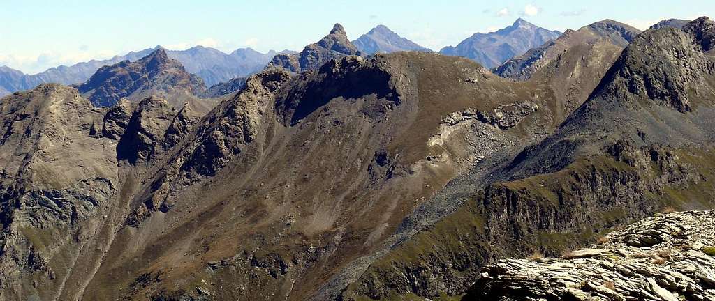
Punta di Plan Rué-Devil's Great Crest-Great Avert from North to South
Punta di Plan Rué or Tita de la Rossa (2883m)
Western Side
&
from left: the Devil's Great Crest to Great Avert, in the watershed ridge between Saint Marcel (under) and Fénis-Clavalité Valleys.
In the background: Appendixes of Pennine Als, with (to right) Mount Nery, Becca of Vlou and Becca Torché.
In the second plan: the ridge from Mount Rouvic or Revic to Varotta Pass, Mount Avic, Raye Chevrères Hill and Mount Iverta, up Ponton's/Champdepraz's Walloons.


