
-
 3147 Hits
-
 74.01% Score
-
 4 Votes
|
|
Route |
|---|---|
|
|
40.33440°N / 124.1104°W |
|
|
Hiking |
|
|
Spring, Summer, Fall, Winter |
|
|
Half a day |
|
|
Day Hike |
|
|
Getting There

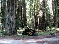
Head west on the little road into the Rockefeller Forest and to Honeydew. This road is paved but it soon becomes very narrow and crooked as it winds its way through the redwoods. Drive slowly and enjoy the view. 5.0 miles from Hwy 101 you will pass Albee Campground on your right and in another .3 mile you will emerge from the redwoods and the road gets better. Stay on the main road and pass the Bull Creek Pioneer Memorial Cemetery at 8.4 miles from Hwy 101. At this point the road starts climbing with several sharp switchbacks. Watch your speed and climb up to a ridgeline saddle at 11.9 miles from Hwy 101. Stop here and notice the gravel road going north with a brown gate. This is the trailhead and the elevation here is about 2,290 ft.
Route Description

Keep going north on this road. There are milepost markers along this road that didn’t exactly agree with my GPS. At about milepost 2.3 there a fork in the road with the right fork going down into the Humboldt Redwoods State Park. Take the left fork and leave the State Park at this point. Stay on the main road as it bends to the west and heads directly towards Rainbow Ridge. At about the 4.0 milepost you can see the communication antenna on the summit, but the road turns more southwest and seems to be bypassing the peak.

Stay on the road until the 5.0 milepost where there is a bit of a clearing and another fork in the road. Take the right fork as it turns to the north and follow it up towards the summit. The area here is very open and you shouldn’t have any problem following the road and the smaller branch road up to the communication tower on the summit. On a clear day, you should be able to see the Pacific Ocean from the summit. My GPS said it was 6.0 miles to the summit from the trailhead. With the small ups and downs along the road the overall elevation gain is about 2,000 ft and the whole hike took me just under 4 hours.
Mountain Bikes should be ok on this route.