
-
 8225 Hits
-
 88.61% Score
-
 27 Votes
|
|
Canyon |
|---|---|
|
|
34.46410°N / 119.69257°W |
|
|
Hiking |
|
|
Spring, Summer, Fall, Winter |
|
|
Overview


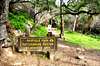
 stone bridge built in 1919
Not to be confused with over a dozen other Rattlesnake Canyons/mountains all over the USA, this Rattlesnake Canyon is located in the Santa Ynez Mountains to the north of the city of Santa Barbara, California.
Rattlesnake Canyon is the next major canyon to the west of San Ysidro Canyon and Cold Springs Canyon. Unlike the other two canyons to its east, Rattlesanke Canyon trail does not extend all the way to East Camino Cielo Road which runs along the ridge separating the Santa Barbara’s front range mountains from its back country. The elevation of the road fluctuates between 3000 feet to 3800 feet. The rocky and steep nature of Rattlesnake Canyon forced the trail makers to take a short cut to Gibraltar Road at a point some 1300 feet lower than Camino Cielo Road. The canyon itself, however, extends all the way to the top of Camino Cielo where it melds with Mission Canyon.
The trail up Rattlesnake Canyon is one of the most popular ones in all of Santa Barbara. Most of the hike is near a creek that flows all year round. There are a number of creek crossings and there are countless swimming holes and mini waterfalls along the trail. The total round trip distance of the hike is about five mile with 1650 feet of elevation gain.
The trail up Rattlesnake Canyon is lined by rock formations on both sides and stays in the shade of California Bay Trees, oak trees and sycamore trees. The highlight of the trip is reaching a meadow with breathtaking views of the upper Rattlesnake Canyon. From here you can view Gibraltar Rock and many of the neighboring formations. There are several boulders providing dry spots for your lunch break.
Getting There

The trailhead is just across from Skofield Park, a beautiful park with a number of famous boulders. If you are here for the canyon, take a few minutes to visit Skofield Park as well.
From US Highway 101 in Santa Barbara take the Mission Street off ramp and turn right at the light. Continue on Mission street passing in front of the mission building to a stop sign at the intersection with Foothill Road. Turn right onto Foothill Road and left onto Tunnel Road. You will come to a fork. Take the right fork toward Botanic Garden. Before reaching Botanic Garden, turn right onto Las Canolas that will take you to Skofield Park and Rattlesnake Canyon Trailhead.
The Hike

 Gibraltar Rock
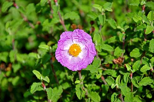
Your hike starts from a beautiful stone bridge that was built in 1919. Soon after the start you need to cross the creek on stones. After about tenth of a mile the trail intersects a fire road. Go left onto the fire road. The photo of a Rock Rose on this page was taken along this road. At one point (34.46374 N, 119.68948 W) you will come to a fork on the trail. The right fork is a horse trail. Take the left one. The trail continues next to the creek where there are moss covered rocks to your right. Cross the creek and continue past pine trees covering the hillside. You will cross the creek at least two more times. These are good places to stop and check out mini waterfalls and swimming holes. Continue on the trail to a beautiful green meadow, Tin Can Meadow, some 1.75 miles from the trailhead. This is the best place to catch a view of the upper Rattlesnake Canyon an Gibraltar Rock area rock formations.
From Tin Can Meadow where you come across a rusty old trail sign, the trail may become a bit confusing, especially after a hard rain. The rain tends to wash out a short section of the trail, but after crossing a drainage from west to east you will pick up the trail again. The next three quarters of a mile is hiking up steep switchbacks with views of Rattlesnake Canyon that get more and more majestic. The trail end on Gibraltar Road and the end of your hike. As a short well-worth doing side trip, you can hike up the road a few hundred yards to Gibraltar Rock and hike up to its top. The view of California coastline and the Pacific Ocean from up there are great.
Trail facts chart
| Benchmark | Rattlesnake Canyon Trail coordinates | elevation | Distance from trailhead |
 Trailhead Trailhead | N 34.46410--------W 119.69257 | 826 ft | 0 |
| Fork on the trail | N 34.46374-------- W 119.68948 | 1074 ft | .12 mile |
 | N 34.47468--------W119.68825 | 1734 ft | 1.65 miles |
| Gibraltar Rock visible at the end of the hike. | N 34.47427--------W119.68117 | 2474 ft | just over 2.4 miles |