
|
|
Mountain/Rock |
|---|---|
|
|
40.17415°N / 105.28336°W |
|
|
Boulder |
|
|
Hiking |
|
|
Spring, Summer, Fall, Winter |
|
|
6570 ft / 2003 m |
|
|
Overview
Red Hill is a modest mountain in the phalanx of foothills that separates the city of Longmont, Colo., from the taller mountains of the west. Easily seen from Hwy 36, Red Hill is the tallest named peak in the Heil Valley Ranch recreation area, a Boulder County Mountain Parks and Open Space property. It is not a strenuous climb by any means, but a bushwhack to its summit offers solitude on an obscure peak and excellent views of Longmont to the east, Boulder and the Boulder Group to the south, and Mount Meeker to the west.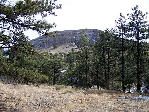
Why Go?
From the top of Red Hill, one can catch his breath amongst the cactus and thick brush and watch the hurly-burly world below. On a busy weekend, mountain bikers streak through the pines across the valley like ghosts, the rattle of their chains muffled by distance. Cars creep noiselessly below to the east, forming caravans along the straight stretch of highway like nomads. The closest sound is the wind, plying the undersides of a raptor’s wings just above like the shivering of a child’s kite aloft, and the crunch of the stiff grass below your own feet. With the summit to yourself, this is a lonely hill a man can climb and forget about his own place in the world, become removed from it, if for only a moment, and relish the solitude of high places: there is no one coming up the mountain behind you; you may take your time.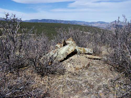
Getting There & Approach
The approach to Red Hill is fairly simple and uses well-traveled trails in the Heil Valley system. From Hwy 36, turn west onto Left Hand Canyon Road, roughly five miles north of Boulder (depending on your definition of where Boulder ends). Shortly, you will see a sign for Heil Valley Ranch on your right. Turn north, following the directions on the sign. Drive one and a half miles to the trailhead. Begin hiking on the Wapiti Trail, a modest affair with very little incline. The entire trail system at Heil Valley is like this: plenty of distance to go around, but little elevation gain.When you intersect the Ponderosa Loop, veer right. Shortly, you will come to another intersection, this time with the Wild Turkey Trail. Take this trail and wind your way downhill on long, moderate switchbacks. You will enter a semi-clearing soon, and will be able to see Red Hill to the east between the trees. Continue on the Wild Turkey Trail until the trail intersects a fire road at a diagonal. Here, the fire road will be gated to the south and posted with a sign that says the fire road is not a trail. From here, Red Hill is still visible and its summit is a 110 degree bushwhack away.

Make your way downhill to get to the tallgrass saddle between the Ponderosa Loop ridge and Red Hill. Do not stray too far to the north (left) or you will come across the deep ravine Red Hill Gulch and a picket of Boulder County “area closed” signs. From the length and placement of the picket, it appears it is intended to keep people out of the gulch. While bushwhacking, use game trails to cut through the grass.
The Hill
When you reach the foot of Red Hill, you will be able to choose any number of steep, bushy game trails to aide your progress.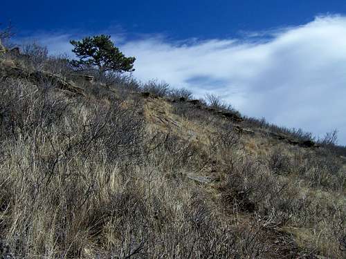
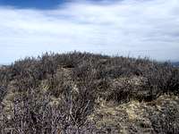
The southwest slope makes a nice direct shot at the top of the hill and is thick with intersecting game trails, though if you want a circuitous route, the western and northern slopes are marked with deep, long-used game trails, visible from more than a mile away. The summit is a brief, steep hike away through the thick brush. At the top, brush and cactus patches sit as a crown.
You will also see what is obviously a man-assembled small cairn. Enjoy the view and see for yourself why this hill would have made a great lookout 100 or 150 years ago.