Reservation Boundary

Reservation Boundary

These are the two most recent maps for Mt. Baldy. The map on the left is from a mapping website, the one on the right is from TOPO. The TOPO map is more recent and presumably more accurate. The small but important difference to note here is that the TOPO map shows the reservation perimeter shifted slightly to the east such that the entire 11400+ summit contour is on the reservation. The older topozone map differs in that it shows the 11400+ contour on the NF land. The location of the little yellow metal sign is or was consist with the TOPO boundary location, at least at the time of my hike in winter 2005. This is especially noteworthy for those people like myself who feel the 11400+ summit is higher than the 11403 spot elevation. Many sources will tell you that the south summit is off limits but just be aware that technically you are probably not supposed to be on the north summit either. Although for practical purposes...
ericnoel
on Aug 20, 2007 9:39 pm
Image Type(s): Informational
Image ID: 326496

Comments

Post a Comment
Viewing: 1-3 of 3
Andinistaloco

Andinistaloco - Oct 19, 2009 12:34 pm - Voted 10/10
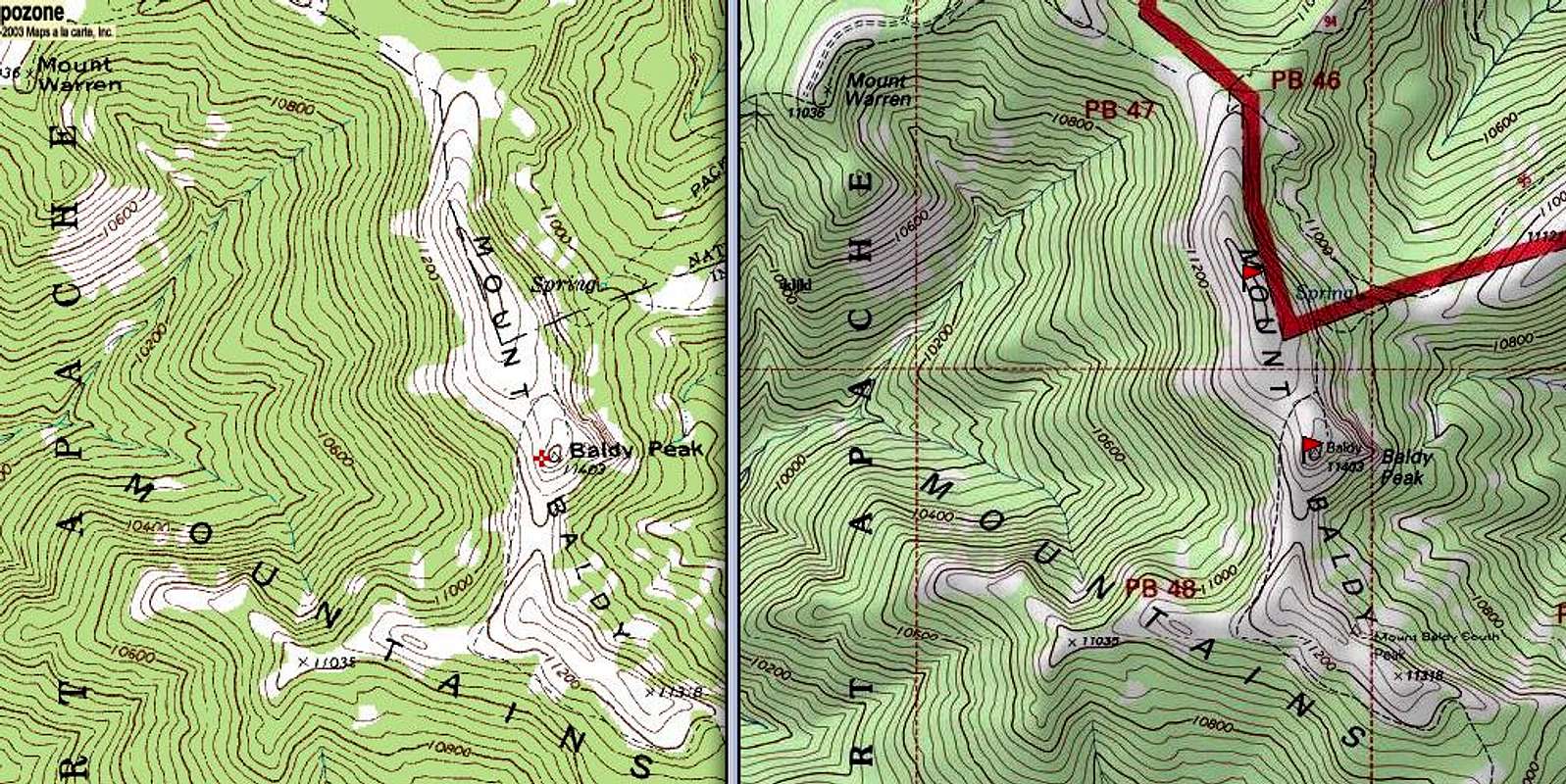
Hmmm

interesting, thanks! I had the old map - wonder if the res boundary has changed or if the old one was just wrong.

ericnoel

ericnoel - Oct 21, 2009 1:11 pm - Hasn't voted

Re: Hmmm

Hard to say. A lot of Indian boundaries were based on 19th century treaties and old surveys can be inexact or the language defining the boundary may be imprecise. However, I did note a very old yellow boundary sign off the trail which was consistent with the new map. So I would guess that the old map was just wrong.

Andinistaloco

Andinistaloco - Oct 25, 2009 12:36 am - Voted 10/10

Re: Hmmm

That would seem to be most likely - maps generally become more accurate rather than less so. Didn't see any signs myself - they all seemed to have been taken or something - but no doubt there are some out there.

Viewing: 1-3 of 3