
-
 2280 Hits
-
 76.66% Score
-
 7 Votes
|
|
Route |
|---|---|
|
|
46.59325°N / 12.89664°E |
|
|
Download GPX » View Route on Map |
|
|
Hiking |
|
|
Spring, Summer, Fall |
|
|
Half a day |
|
|
Medium hard hike (T3) |
|
|
Overview
 Rif. Marinelli
If the very popular and important Marinelli hut once gets on SummitPost its own page, this text can be moved there. Rif. Marinelli can be quickest reached from the west, from the parking place near Rif. Tolazzi. From the east two general approach routes are available. The lower one uses a mountain road, which starts on the main road, then connects alpine pastures and ultimately reaches almost Rif. Marinelli itself. This is the route for mountain bikers and for tour skiing. The upper variant will be described here. It is the main Carnic hiking trail (Traversata Carnica), connecting Ploecken Pass / Passo di Monte Croce Carnico and Rif. Marinelli. This section is numbered No. 146. The trail No. 146 goes from the very road pass over nice alpine meadows, on an exposed, but picturesque passage crosses the side ridge of Creta di Collina / Kollinspitze, where it loses some 100 m of altitude, and then continues over nice meadows until the narrow mountain road, which it finally follows to the hut.
General Information
 Hiking towards Rif. Marinelli
Difficulty: It's all the time an easy hiking tour, which however has one a bit exposed, with steel ropes secured passage, called La Scaletta. On the Swiss Hiking Scale its difficulty would be graded T3 (the rest is T2/T1). If there is snow on La Scaletta, the passage may even be unpassable, because the route goes through a natural window, which may be filled with snow.
Orientation: The path is all the time well marked. From this path many other marked paths deter (mostly up, towards the summits of the main crest, but also down, on alpine pastures), so be careful to stay on the main route. See the GPX track in the header!
Exposition: La Scaletta passage is exposed. But the path there is well beaten and on the narrow ledge there is also a cable for protection.
Objective dangers: There are virtually none.
Best season: Summer and autumn months, normally from June till November (or first snow).
Gear: Good shoes and poles are sufficient.
Tour start: The big (free) parking place on Ploecken Pass / Passo di Monte Croce Carnico, 1360 m.
Highest point: 2122 m.
Altitude to overcome: On the ascent some 860 m. After La Scaletta passage you lose some 100 m of gained altitude.
Time for ascent: 2 h 30 min.
Route Description
| From the parking place you follow the signposted path towards the west. It soon branches, you take the marked upper, right branch. Then the path gains some altitude and on some 1500 m you reach the nice alpine pasture of Colinetta di sopra. It lies in a valley between the main ridge and the parallel, much lower ridge on the south. The latter you need to cross. |
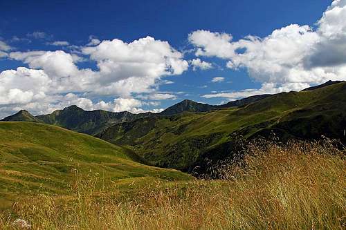
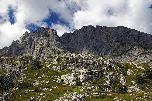
 Looking back on Kleiner Pal / Pal Piccolo Looking back on Kleiner Pal / Pal Piccolo |
 Colinetta di Sopra pasture Colinetta di Sopra pasture |
 On Colinetta di Sopra pasture
| So, the path goes almost till the valley end, there turns left and in a few turns ascends southwards, on the grassy ridge, gaining it on 1801 m. |
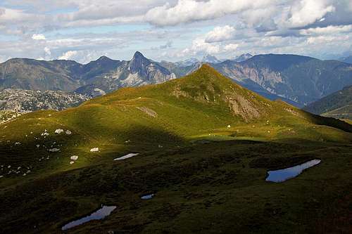
 Towards Rif. Marinelli Towards Rif. Marinelli |
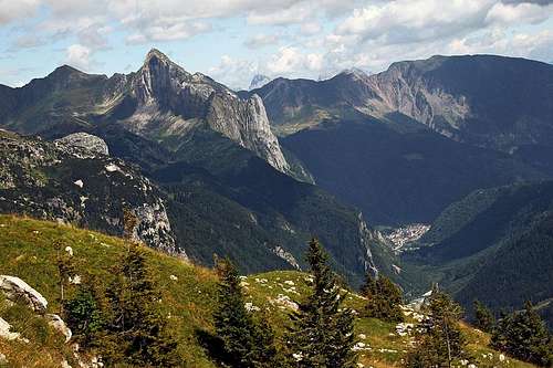 The view from the ridge 1801 towards the east
Then it continues westwards, at first ascending a bit more, then going down and around a steep rock wall. Finally steel ropes help you down into a chimney. From the bottom of it you exit a cave, having an opening on top, then you continue descending by a narrow ledge. After losing some 50 m of altitude, La Scaletta passage is behind you and you continue slightly descending towards the south-west.
 Approaching La Scaletta Approaching La Scaletta |
 La Scaletta La Scaletta |
 La Scaletta chimney La Scaletta chimney |
 La Scaletta ledge La Scaletta ledge |
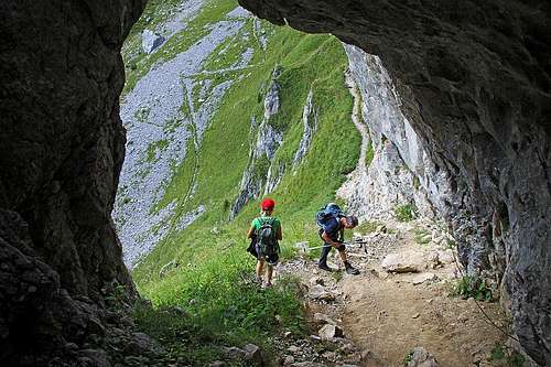 La Scaletta
On the pasture there once stood Casera Monumenz, 1769 m. By an interesting, karstic valley you continue westwards, but towards the valley end the main path deters sharply left and in a few minutes reaches a narrow mountain road. You are just above Casera Plotta (where a shelter stands).
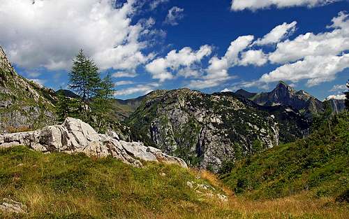
 Creta della Chianevate / Kellerspitzen from Monumenz meadows
The rest of the hike is simply continuing westwards by the narrow road. It gains much altitude with some turns, goes over the plateau west of Cima Plotta, 2017 m, and then below Rif. Marinelly converts into a usual hiking trail, still suitable for mountain bikers.
 From below Rif. Marinelli, looking eastwards