
|
|
Mountain/Rock |
|---|---|
|
|
34.29190°N / 118.63556°W |
|
|
Ventura |
|
|
Hiking, Toprope, Bouldering, Aid Climbing, Scrambling |
|
|
Spring, Summer, Fall, Winter |
|
|
2714 ft / 827 m |
|
|
Overview

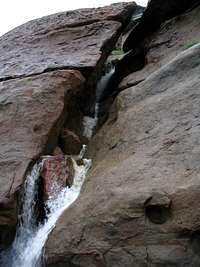
About 30 miles northwest of downtown Los Angeles, in the Santa Susana Mountains, is Rocky Peak Park. This 4,800 acre park, situated between the San Fernando and Simi valleys, consists of grassy slopes and craggy peaks dotted with sandstone boulders. Managed by the Santa Monica Mountains conservancy, the area provides critical wildlife habitat as well as great hiking and mountainbiking opportunities, with views of the surrounding valleys, the San Gabriel Mountains and the Pacific Ocean.
From the trailhead at the 118 freeway the Rocky Peak Trail is the park's main artery for access. It follows a fire road along the crest of the mountains, climbing and winding for 5 miles, terminating north of Blind Canyon in Las Llajas Canyon.
Getting There

Rocky peak trail
From the San Fernando Valley:
Take the 118 freeway west and exit at Rocky Peak. Turn right, the trailhead is right there on the right. There is overflow parking across the overpass on Santa Susana Pass Road.
From Simi Valley:
Exit the 118 freeway at Kuehner Drive and go south to Santa Susana Pass road and follow it a few miles to the 118 overpass, turn left and cross the bridge, park at the end of the road.
~~~~~~~~~~~~~~~~~~~~~~~~~~~~~~~~~~~~~~~~~~~~~~~~~~~~~~~~~~~~~~~~~~~~~~~~~~~

Hummingbird Trail
Exit the 118 freeway at Kuehner Drive and go north 1/4 mile, there is parking on the right. The trail intersects the Main Rocky Peak Trail after about 2.3 miles.
~~~~~~~~~~~~~~~~~~~~~~~~~~~~~~~~~~~~~~~~~~~~~~~~~~~~~~~~~~~~~~~~~~~~~~~~~~~

Chumash Trail
Exit the 118 Freeway at Yosemite Avenue, go north on Yosemite. Turn right on Flanagan and follow to the end. Park along the street. The trail goes for 3 miles then intersects the Main Rocky Peak Trail. About 1100 feet elevation gain.
~~~~~~~~~~~~~~~~~~~~~~~~~~~~~~~~~~~~~~~~~~~~~~~~~~~~~~~~~~~~~~~~~~~~~~~~~~~
Red Tape

Call 911 in case of emergency.
The Ranger emergency number is 310-456-7049
The park is closed from sunset to sunrise
No camping
No smoking or fires
No alcoholic beverages
More information
~~~~~~~~~~~~~~~~~~~~~~~~~~~~~~~~~~~~~~~~~~~~~~~~~~~~~~~~~~~~~~~~~~~~~~~~~~~
External Links

Santa Monica Mountains Conservancy
"Trekking the stony highlands", latimes.com
Bigwall.com
When to go...
Year round. Spring, Winter and Fall are best. In the summer it gets very hot, but you can hike in the morning or late afternoon when it's cooler.
Click for weather report....
Rockclimbing

The majority of the rock at Rocky Peak park is not worth climbing, due to the lack of quality. But some exceptions do exist, the Bolt ladder wall is one. Less than a mile from the 118 trailhead is a small peak with a sheer south face, topping the face is a 10 foot roof. A bolt ladder climbs the face and over the spectacular roof.
There are some other climbs also. Just to the left of the bolt ladder is a 5.11b top rope climb of excellent quality.
Check out Bigwall.com for more info and topos. .