Toggle navigation
Mountains
Routes
Images
Trip Reports
Forum
What's New
People
Areas & Ranges
Articles
Trailheads
Canyons
Huts & Campgrounds
Albums
Logistical Centers
Fact Sheets
Lists
Custom Objects
Gear
Plans & Partners
WELCOME TO SUMMITPOST
SIGN IN
REGISTER
Route 3 Variation
Additional Parents
Image
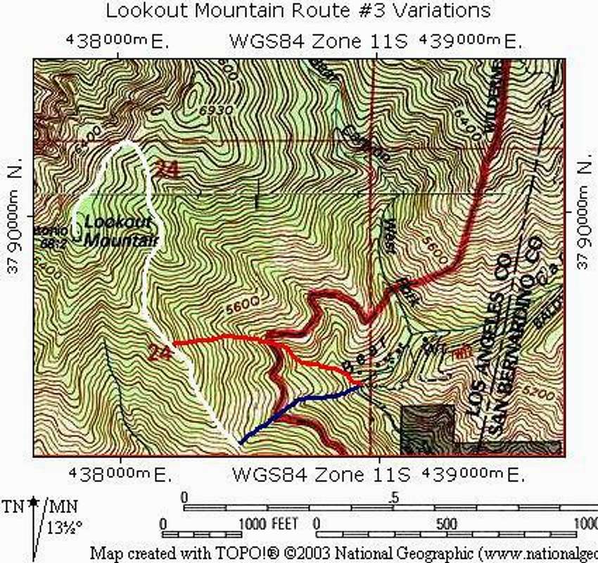
Route #3 Variations Map
View High-Resolution Image
Route #3 Variations Map
Map shows the two different variations of Route 3 to Lookout's south ridge. Blue shows the traditional HPS route, red shows the variation described on this page, and white shows the approximate location of the trail to the top of Lookout.
« PREV
NEXT »
bechtt
on
Feb 21, 2007 8:51 pm
Comments & voting
Other parents
Lat/Lon:
34.24870°N / 117.6752°W
Image ID:
271986
1646 Hits
71.06
% Score
1
Votes
Log in to vote
Comments
No comments posted yet.
to post!
Don't have an account?
Route 3 Variation
(Route)
« PREV
Viewing
#2 of 2
GALLERY
You are at
the Last
Image
bechtt's Image Gallery
« PREV
Viewing
#238 of 274
GALLERY
NEXT »
×
You need to login in order to vote!
User Name
Password
Remember me
Forgot your password?
Log me out when I close my browser.
Keep me logged in all the time.
sign in as a user
Don't have an account?
Register now for FREE
Rating available
Suggested routes for you
People who climb the same things as you
Comments Available
Create Albums
Register Here


