Toggle navigation
Mountains
Routes
Images
Trip Reports
Forum
What's New
People
Areas & Ranges
Articles
Trailheads
Canyons
Huts & Campgrounds
Albums
Logistical Centers
Fact Sheets
Lists
Custom Objects
Gear
Plans & Partners
WELCOME TO SUMMITPOST
SIGN IN
REGISTER
Svartisen Traverse
Additional Parents
Image
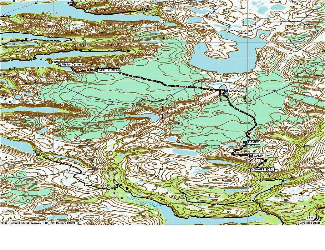
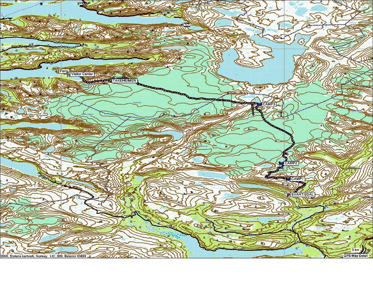
Route Map
View High-Resolution Image
Route Map
Route recorded by Garmin GPS (I can provide gdb file to those interested).
« PREV
NEXT »
mishab
on
Oct 2, 2009 8:41 pm
Comments & voting
Other parents
Lat/Lon:
66.57012°N / 13.91968°E
Image ID:
559431
836 Hits
0
% Score
0
Votes
Log in to vote
Comments
No comments posted yet.
to post!
Don't have an account?
Svartisen Traverse
(Route)
You are at
the First
Image
Viewing
#1 of 1
GALLERY
You are at
the Last
Image
mishab's Image Gallery
You are at
the First
Image
Viewing
#1 of 1
GALLERY
You are at
the Last
Image
×
You need to login in order to vote!
User Name
Password
Remember me
Forgot your password?
Log me out when I close my browser.
Keep me logged in all the time.
sign in as a user
Don't have an account?
Register now for FREE
Rating available
Suggested routes for you
People who climb the same things as you
Comments Available
Create Albums
Register Here