Toggle navigation
Mountains
Routes
Images
Trip Reports
Forum
What's New
People
Areas & Ranges
Articles
Trailheads
Canyons
Huts & Campgrounds
Albums
Logistical Centers
Fact Sheets
Lists
Custom Objects
Gear
Plans & Partners
WELCOME TO SUMMITPOST
SIGN IN
REGISTER
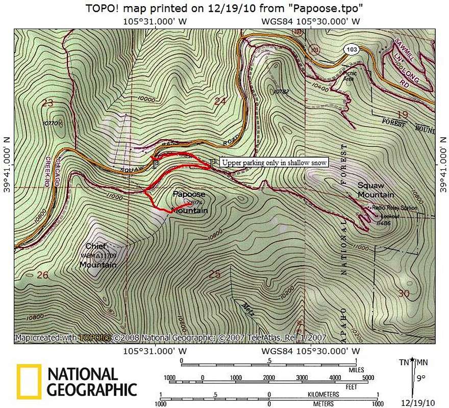
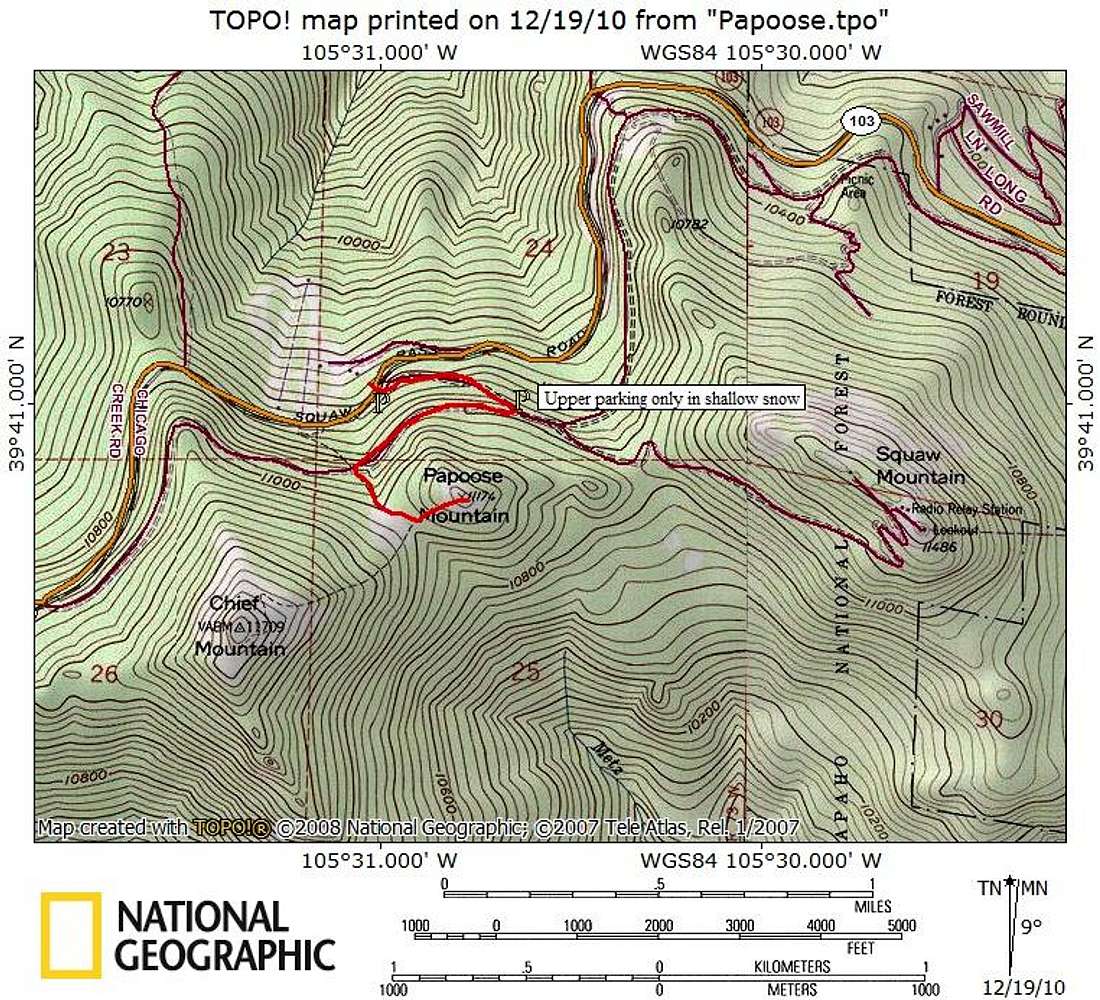
Sqaw Pass Road - North Slopes Traverse - Western Slopes
Additional Parents
Image
Route Map
View High-Resolution Image
Route Map
There are several options for ascending Papoose Mountain, the little peak sitting between Squaw Mountain and Chief Mountain. This short but sweet stroll is a good winter route option with several advantages.
Map designed December 2010
« PREV
NEXT »
Sarah Simon
on
Dec 28, 2010 6:49 pm
Comments & voting
Other parents
Lat/Lon:
39.68020°N / 105.5132°W
Image Type(s):
Topo/Diagram
Image ID:
687890
914 Hits
72.08
% Score
2
Votes
Log in to vote
Comments
No comments posted yet.
to post!
Don't have an account?
Sqaw Pass Road - North Slopes Traverse - Western Slopes
(Route)
« PREV
Viewing
#3 of 10
GALLERY
NEXT »
Sarah Simon's Image Gallery
« PREV
Viewing
#3476 of 5480
GALLERY
NEXT »
×
You need to login in order to vote!
User Name
Password
Remember me
Forgot your password?
Log me out when I close my browser.
Keep me logged in all the time.
sign in as a user
Don't have an account?
Register now for FREE
Rating available
Suggested routes for you
People who climb the same things as you
Comments Available
Create Albums
Register Here


