
-
 1271 Hits
-
 76.66% Score
-
 7 Votes
|
|
Route |
|---|---|
|
|
45.50840°N / 7.06041°E |
|
|
Hiking |
|
|
Summer, Fall |
|
|
E |
|
|
Overview
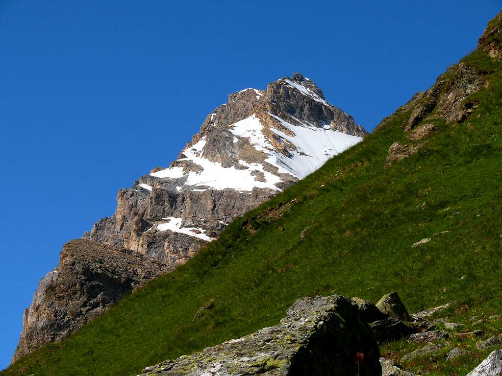
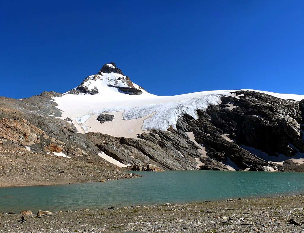
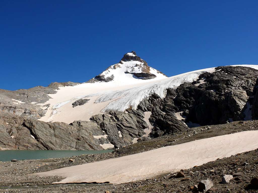
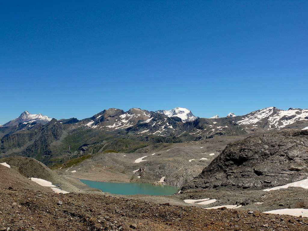
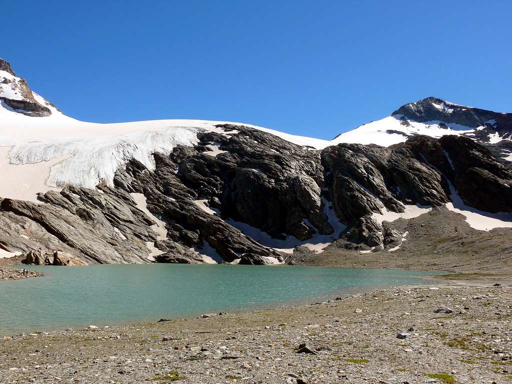
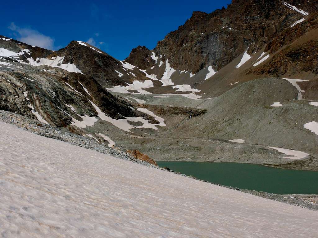
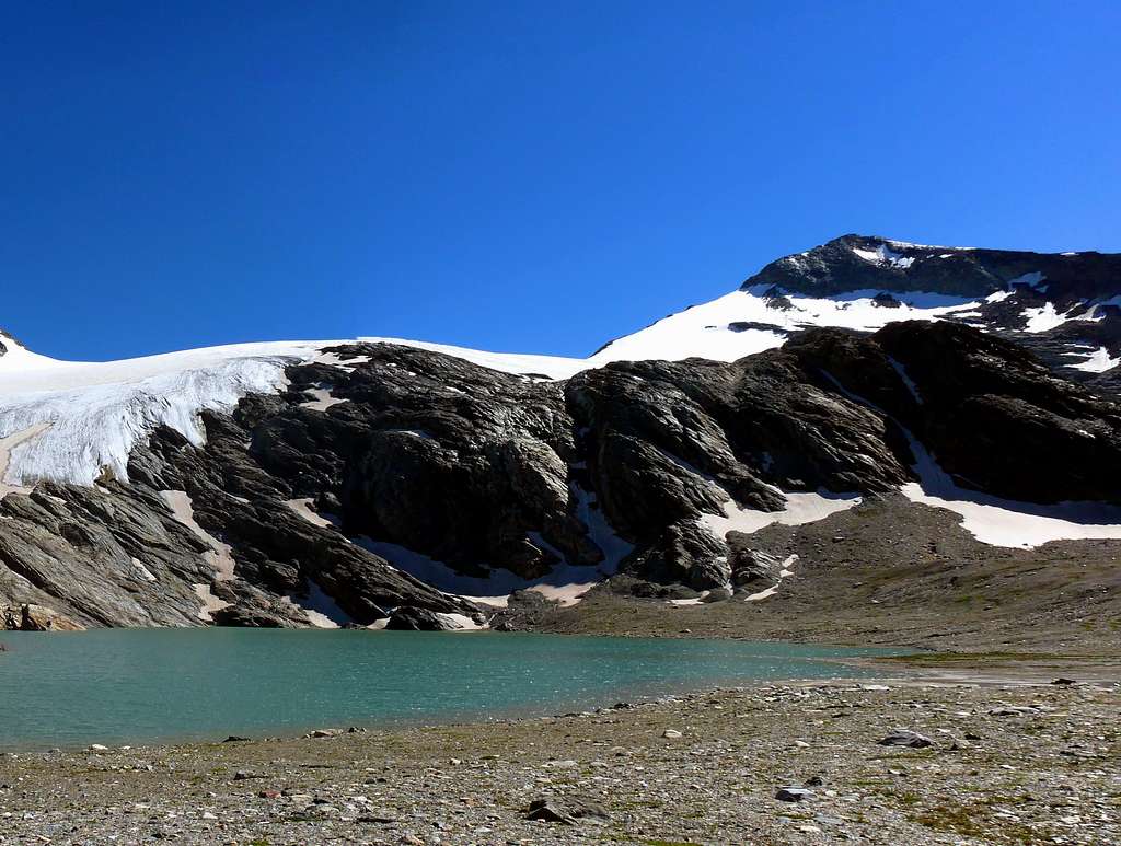
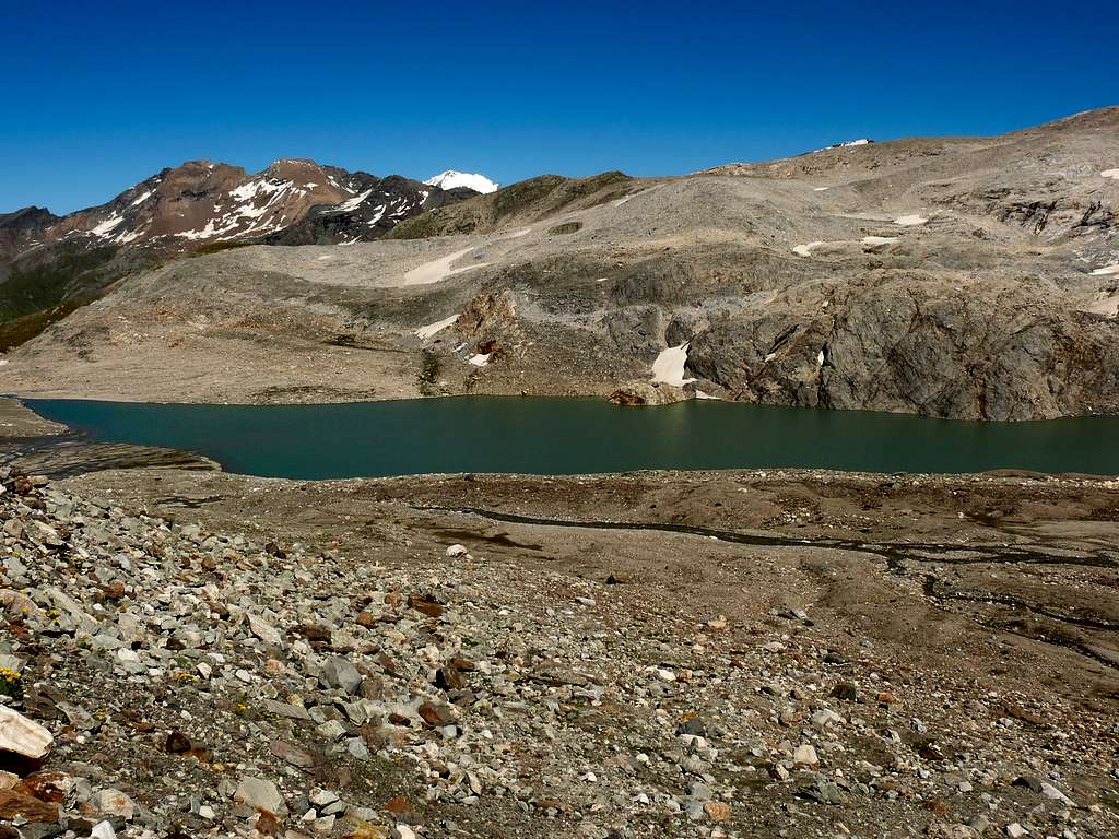
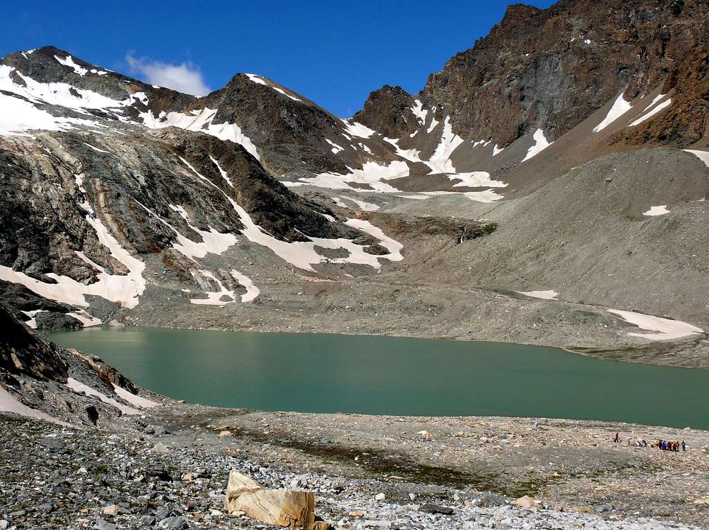
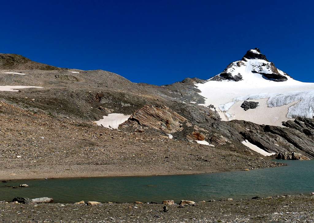
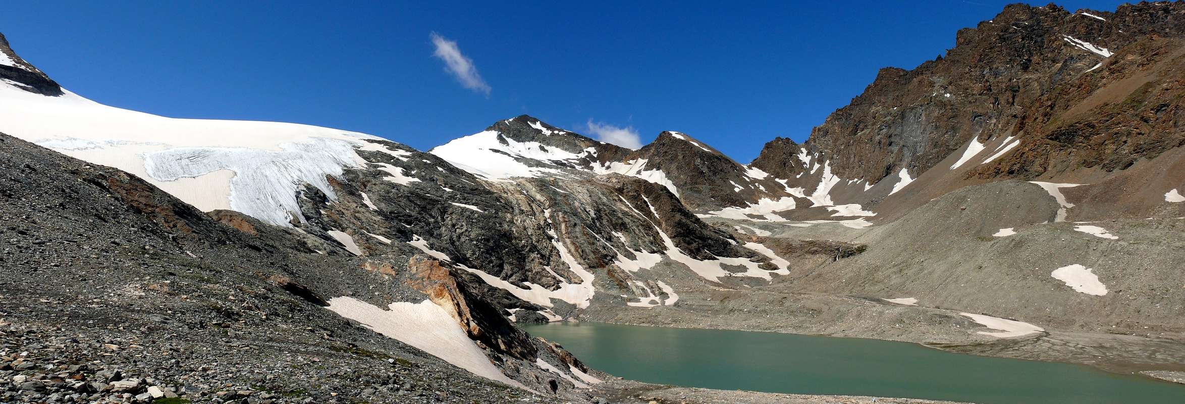
The Lake Goletta (2.728m) at the foot of the homonymous glacier, located between Granta Parei (3.387m) and Becca della Traversiere (3.337m), offers a magnificent panorama from the Grand Combin to the Gran Paradiso Group (if you climb slightly from lake), its waters have a color ranging from greyish to pale blue due to the melting of the glacier which is now in considerable retreat. The place, very popular in summer, is certainly worth a visit given the relative distance from the Gian Federico Benevolo refuge (2.285m).
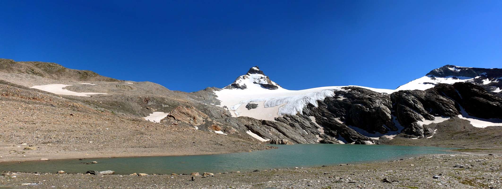 |
Il Lago di Goletta (2.728 m) ai piedi dell’omonimo ghiacciaio, posto tra la Granta Parei (3.387 m) e la Becca della Traversiere (3.337 m), offre un grandioso panorama dal Grand Combin al Gruppo del Gran Paradiso (se si sale un pò di livello), le sue acque hanno un colore che dal grigiastro vanno a un azzurro tenue dovuto alla fusione del ghiacciaio oramai in notevole ritirata. Il luogo, molto frequentato nella bella stagione, merita sicuramente una visita visto la relativa distanza dal rifugio Gian Federico Benevolo (2.285 m).
Getting There
- From France: through the Mont Blanc Tunnel or the Col du Petit Saint Bernard: you can drive on SS.26, following directions for Aosta and, before arriving in Villeneuve, turn right towards Introd. Alternatively, you can take Motorway A5 (at Courmayeur or Morgex) and exit at Aosta Ovest.
- From all the other directions: get to the Aosta Ovest exit of Motorway A5. Then drive on SS.26 Aosta, in the direction of Courmayeur; just after Villeneuve turn left towards Introd. Enter the valley and, at the fork between Valsavarenche and Val di Rhêmes turn to the right (Rhêmes).
 |
 |
 |
 |
 |
Specific Road
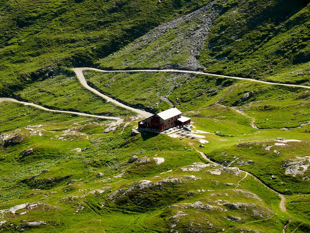
After passing all the towns in the Valley and reaching Rhêmes Notre Dame (1.725m), continue along the road until you reach Thumel (1.853 meters about, large car park), from here, following the dirt road on the right side (uphill) of the valley, or a path on the left that crosses some magnificent woods, continue until you reach the Gian Federico Benevolo Refuge (2.285m).
Dopo aver superato tutte le località della Valle e aver raggiunto Rhêmes Notre Dame (1.725 m) si continua lungo la strada sino a raggiungere Thumel (1.853 metri circa, grande parcheggio per le auto), da qui, seguendo la strada sterrata sul lato destro (in salita) della valle, o un sentiero sulla sinistra che attraversa alcuni magnifici boschi si prosegue fino a raggiungere il Rifugio Gian Federico Benevolo (2.285 m).
Route
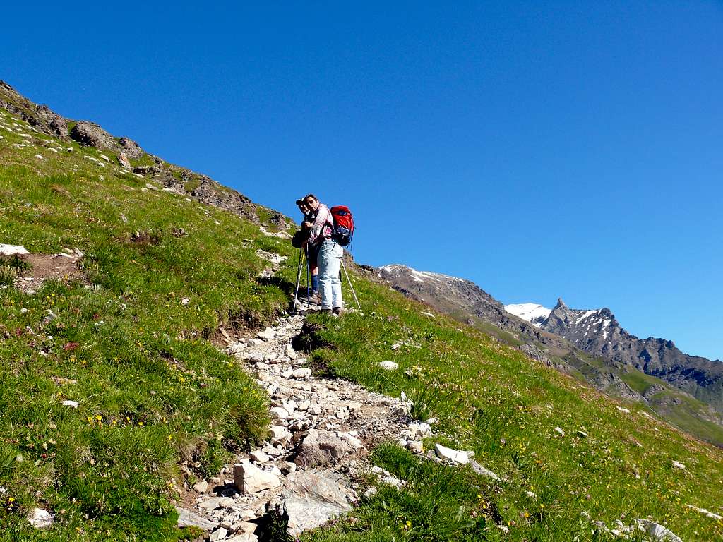
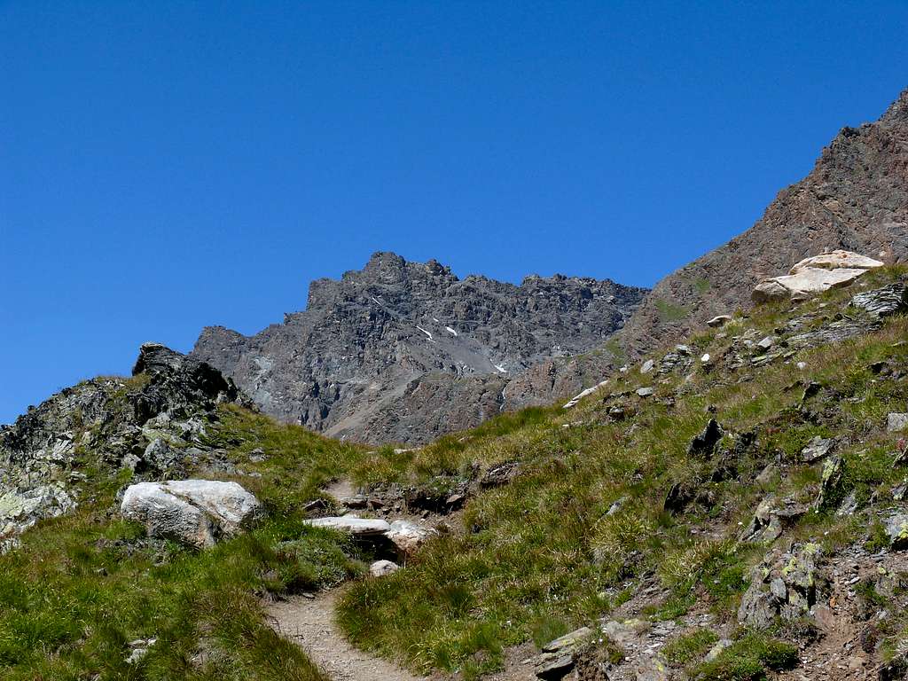
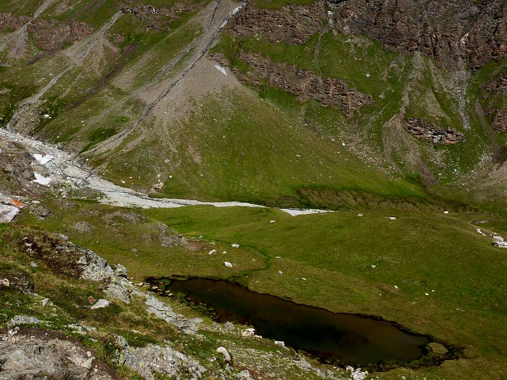
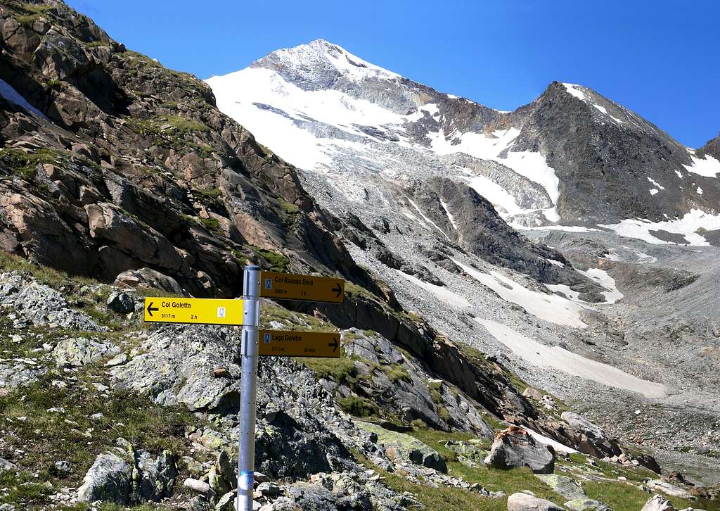
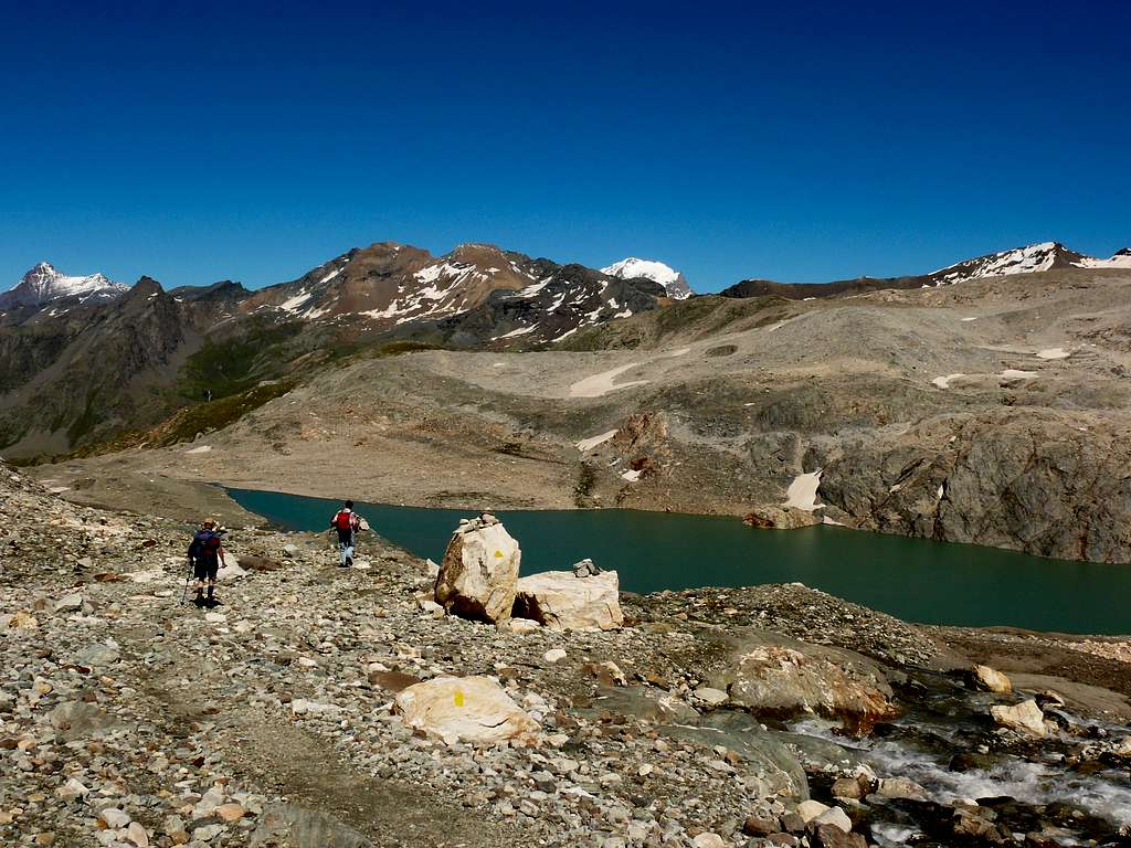
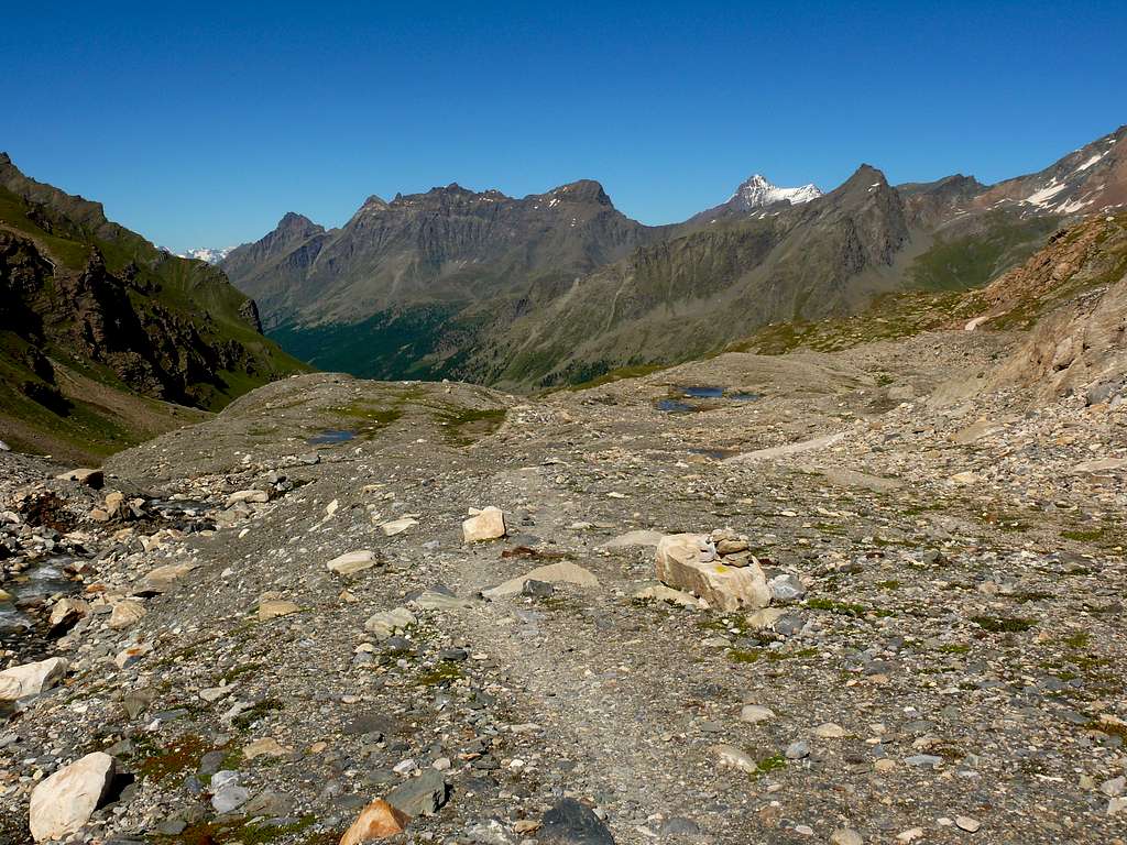
From the Gian Federico Benevolo Refuge (2.285m) descend southwest to the small bridge below (2.269m) on the Dora di Rhêmes; go up to the Northwest with the path n° 13d/HRG (Alta Via Glaciale), after the Sauches pasture (2.315m) continue up to the crossroads about 2.420 meters, (little man). Continue on the steep path to the right until you reach the plateau where there is a signpost for Lake Goletta and Colle di Bassac on the right and Colle della Goletta on the left, obviously continue uphill to Lake Goletta and after passing a small lake on the right (about 2.610 meters), and another 0h'20/0h'25 walk you will be at lake Goletta (2.728m). 2h'30/3h'00 from the Thumel car park, 1h'30/1h'50 from the Benevolo Refuge.
 |
 |
 |
 |
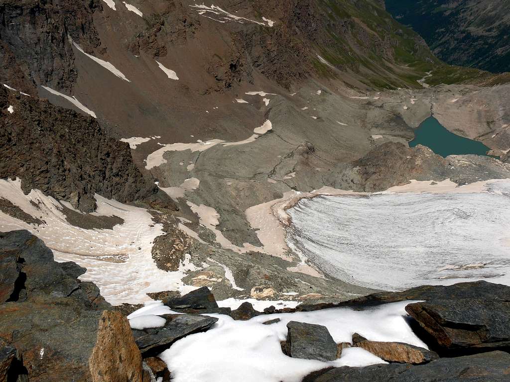 |
Dal Rifugio Gian Federico Benevolo (2.285 m) scendere a Sudovest al sottostante ponticello (2.269 m) sulla Dora di Rhêmes; risalire a Nordovest con il sentiero n° 13d/HRG (Alta Via Glaciale), superato l'Alpeggio Sauches (2.315 m) proseguire fino al bivio 2.420 metri circa, (ometto). Continuare sul ripido sentiero di destra sino a raggiungere il pianoro dove e posto un cartello di segnalazione per il lago Goletta e il Colle di Bassac a destra e il colle della Goletta a sinistra, continuare ovviamente in leggera salita per il Lago Goletta e dopo aver superato un piccolo lago sulla destra (2.610 metri circa), e altri 0h'20/0h'25 di cammino sarete al lago Goletta (2.728 m). 2h'30/3h'00 dal parcheggio di Thumel, 1h'30/1h'50 dal Rifugio Benevolo.
Difficulty
The route can be classified as E.
L'itinerario è classificato E.
 |
 |
 |
 |
 |
Equipment
For Hikings.
Da Escursionismo.
External Links
- REGIONE AUTONOMA VALLE D'AOSTA the official site.
- FONDAZIONE MONTAGNA SICURA Villa Cameron, località Villard de la Palud n° 1 Courmayeur (AO) Tel: 39 0165 897602 - Fax: 39 0165 897647.
- SOCIETA' GUIDE ALPINE DEL GRAN PARADISO Comune di Valsavarenche.
- A.I.NE.VA. (Associazione Interregionale Neve e Valanghe).
 |
 |
 |
 |
 |
Useful numbers
- Protezione Civile Valdostana località Aeroporto n° 7/A Saint Christophe (Ao) Tel. 0165-238222.
- Bollettino Meteo (weather info) Tel. 0165-44113.
- Unità Operativa di Soccorso Sanitario Tel. 118.
 |