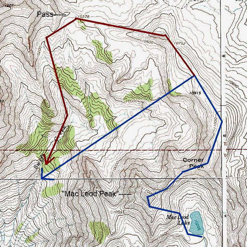
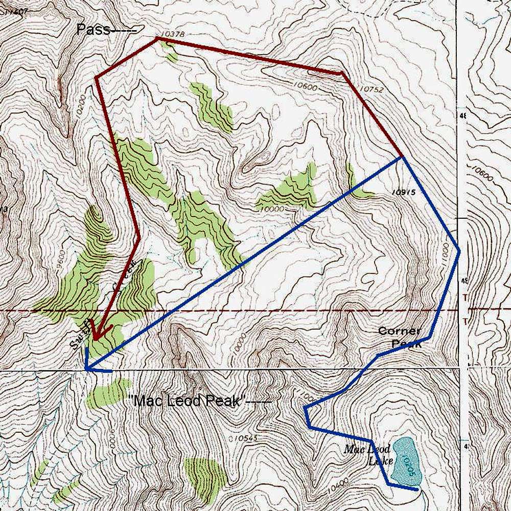
The blue shows our route from Mac Leod Lake all the way to the Swift Creek Trail. This includes the variation we took on the descent. The red indicates the part of the hiking route that our variation eliminated.
This image was downloaded from Topoquest.com, and I added the diagrams and notes.


