
|
|
Route |
|---|---|
|
|
36.05720°N / 112.1375°W |
|
|
Hiking |
|
|
Most of a day |
|
|
Strenuous |
|
|
Approach
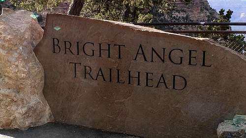
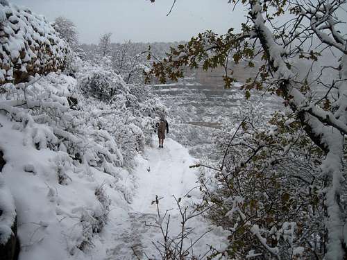
Grand Canyon is in the northwest corner of Arizona, close to the borders of Utah and Nevada. Grand Canyon lies entirely within the state of Arizona. Grand Canyon National Park's South Rim (open all year) is located 60 miles north of Williams, Arizona (via route 64 from Interstate 40) and 80 miles northwest of Flagstaff (via route 180). Bright Angel Trail Head is located just left (West)of Kolb Studio and Bright Angel Lodge. It is within easy walking distance from Maswik Lodge, Bright Angel Lodge, rim lodge parking areas and from Parking Lots E and D. The trail starts by the mule corral.
There is day parking right next to the trailhead. Out of consideration for daytime park visitors, it is recommended that overnight hikers park at Parking Lots E and D (the Backcountry Information Center parking lot). This it is the most secure and is also where the largest number of parking spaces are located. To drive directly to the trail head, from the entrance in the National Park follow signs for the "Village."
Route Description
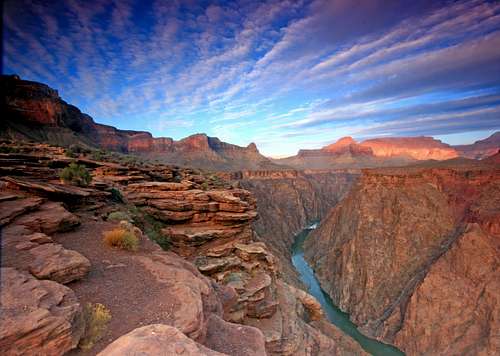
Elevation at trailhead is 6,850 feet. The Colorado River is at 2,400 feet. The trail runs 7.9 miles from rim to the river. If one chooses to go to Phantom Ranch, it is 1.7 additional miles.
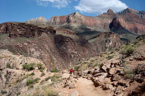
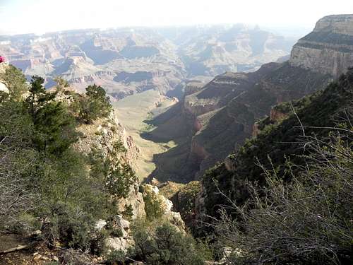
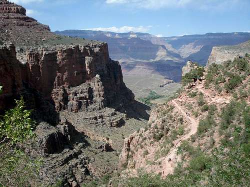
Following a natural break in the cliffs formed by the massive Bright Angel Fault, today’s Bright Angel Trail approximates a route used for millennia by the many Native American groups that have called the Grand Canyon home. Bright Angel Trail follows the head of a side canyon.Views on the Bright Angel Trail are framed by massive cliffs, and by virtue of having natural water sources, there is more plant life and animal life along the Bright Angel Trail than on the South Kaibab Trail. These features make the Bright Angel Trail appealing to those interested in geology and in viewing wildlife.
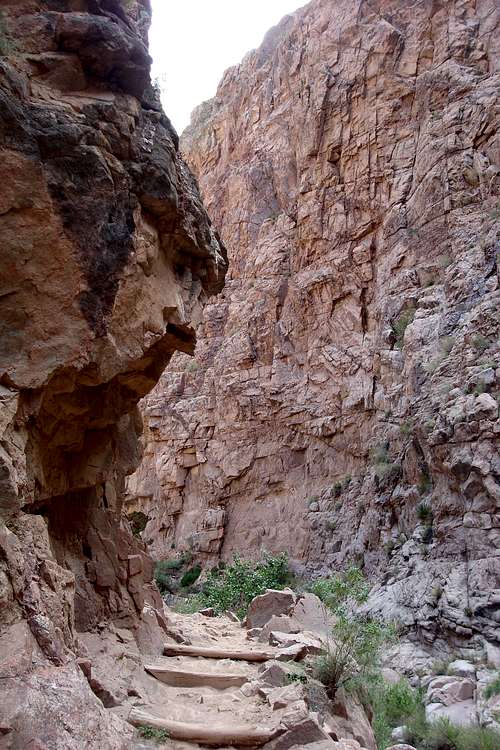
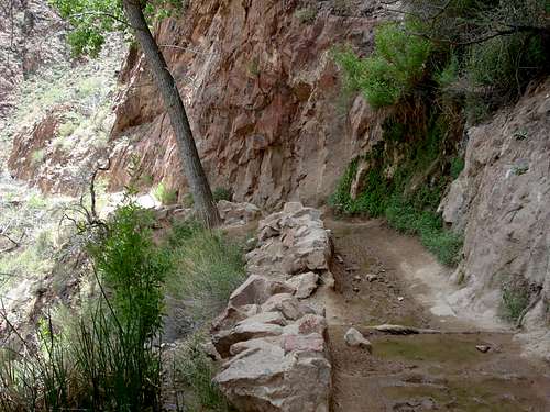
This trail is more scenic than South Kaibab trail. The majority of Bright Angel trail’s elevation change takes place in the upper four miles of trail via a series of switchbacks that can seem endless. There are water stations every 1.5 miles between the rim and Indian Garden (halfway between top and bottom). There are no water stations after Indian Garden until Phantom Ranch/ Bright Angel Campground. There are no potable water sources between Indian Garden and Bright Angel Campground. Below Indian Garden, the trail follows a creek through a meandering gully of water-sculpted stone and shimmering cottonwood trees. The trail becomes steep once again where this gully empties into the broad, bowl-shaped Pipe Creek drainage. This section of trail, affectionately referred to as the Devil’s Corkscrew, is brutally hot during the summer months and should therefore only be attempted during the early morning or late evening hours. It is not recommended to drink water from these creeks unless treated. During monsoon season the water is muddy and needs to be filtered. From the Pipe Creek/River Resthouse area to Bright Angel Campground, the trail traverses exposed sand dunes for over a mile until reaching the silver bridge across the Colorado River.
The trail is in good condition, but watch out for mules and their droppings. Particularly during hot weather, it makes sense to ascend via the Bright Angel Trail because of potable water, regular shade, emergency phones, and the ranger presence.
          Bright Angel Distance Breakdown
Bright Angel TH to Colorado River/ Bright Angel Campground/ Phantom Ranch - 9.5 miles 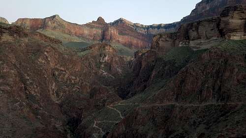
Water on Trail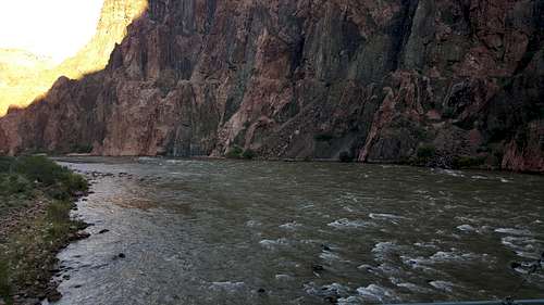
In addition, any trip inside the canyon should be proceeded by a check of the Backcountry Visitor Website to get the latest updates on the water station closure/ availability (see link below.) Once down in the canyon (starting at Indian Garden), there are creeks and springs where water can be found. It is strongly recommended to treat the water, probably for a good reason. There are hikers who drink water right from creeks and springs. As that may be an option sometimes, during certain times of the year the water is muddy due to various factors. In addition, treating the water is not enough in the rainy season. During the monsoon season, all the water in the canyon is absolutely muddy and totally undrinkable. It has to be filtered first and then treated. Here is a list of the water stations along this trail and the distances between them (water available only from mid May to late October:)
Essential Gear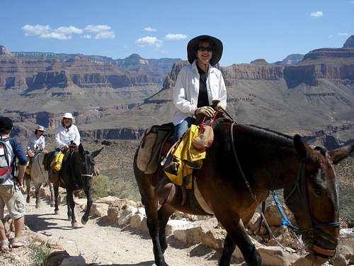 History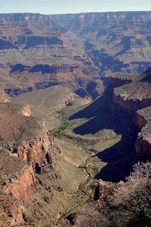 Among the first humans to use what is now known as Bright Angel Trail were ancient hunter-gatherers who likely followed animal paths into the Canyon and then over time improved their own trails. In the late 1880s, Euro American prospecting partners Pete Berry and Niles and Ralph Cameron improved the trail at a cost of $500 in order to better reach mining sites within the Canyon. Cameron invested several thousand dollars into developing the trail, extending it so that it eventually reached all the way from the South Rim to the Colorado River. He also established a camping area at Indian Garden, though he did not keep it in good repair. To recoup his costs (and make a tidy profit), in 1903 he began to charge everyone who wanted to use it $1, plus additional fees for drinking water and other services. Cameron continued to improve his trail, constructing two tunnels along its upper segment to make it more easily traversable. The National Park Service attempted many times to purchase the trail or force Cameron and the county to relinquish control, but these efforts were cannily rebuffed. Seeing that they could neither bully nor buy out Cameron or Coconino County, the Santa Fe Railroad and the Park Service developed their own trails into the Canyon. The Santa Fe developed the Hermit Trail in 1910 to take visitors to their facilities in the interior of the Canyon at Hermit Camp, while the frustrated NPS constructed the South Kaibab Trail to provide free rim-to-river access and an alternative route to Phantom Ranch. Cameron agreed to cede control of the trail to the National Park Service in exchange for a new approach road to the park in 1928. The NPS debated briefly over whether to close the trail, since they had just built the South Kaibab Trail and were concerned over the costs of maintaining two trails to the same place, but soon decided it was useful to have two paths to the river as well as access to Indian Garden. However, they did promptly eliminate the toll. Over the next 11 years the NPS reconstructed nearly the entire length of the trail to make a more uniform gradient and widen the trail to the standard width of four feet. in 1939 the trail was completed in the form modern visitors traverse today. The NPS also constructed trail shelters called Mile-and-a-Half House, Three-Mile House, Indian Garden Rest House, and River Rest House. The trail descends a total of 4380 feet, with an average grade of 10% along its entire length. The NPS has categorized this as a corridor trail, meaning it receives regular maintenance and is patrolled by park rangers. Red TapeThere is a $30 a car fee to enter the Grand Canyon National Park as of January 2018 (when I was last there.) For 2018 there are only four free fee entrance days (compared to 10 in 2017.) These four days are January 15, April 21, September 22 and November 11. There is talk to increase the entrance fee to $70 per car during peak season. There are also permits required when it comes to camping. (See link below.) LinksNPS Bright Angel Trail: http://www.nps.gov/grca/planyourvisit/upload/Bright_Angel_Trail.pdf Bright Angel Trail Day hike: http://www.nps.gov/grca/planyourvisit/upload/BrightAngelTrail.pdf Trails Distances and facilities associated with each trail: http://www.nps.gov/grca/planyourvisit/trail-distances.htm Critical Backcountry Updates: http://www.nps.gov/grca/planyourvisit/trail-closures.htm#CP_JUMP_140503 Backcountry Permits: http://www.nps.gov/grca/planyourvisit/backcountry-permit.htm ASU Bright Angel Trail: http://grandcanyonhistory.clas.asu.edu/sites_rimtoriverandinnercanyon_brightangeltrail.html |