
|
|
Route |
|---|---|
|
|
38.85690°N / 119.9002°W |
|
|
Hike |
|
|
Half a day |
|
|
Easy when no snow |
|
|
Approach
From South Lake Tahoe, head for Myers on US 50. Just beyond the Agricultural fruit check station on the California side, take a left on highway 89. Go 9.6 miles (over Luther Pass) and watch closely for a side road on the left (north) side of the highway. It isn't super obviousand all I recall is a post. This is FS 051and is the road you want. Go more on the mileage. If you end up at the junction of highways 88 / 89, turn around and try again. It'd be 1.8 miles and on the right (which is how I found it the first time). The road goes uphill and you'll see (not obvious from the road) some FS info signs. From there the road starts strongly uphill but is manageable with careful driving by a passenger car like my Honda Accord.
You'll cross a cattle guard at 1.8 miles. Stay on the the main road and you'll drop down and cross a bridge at 2.5 miles. If you continue to follow the signs of 051, avoid the side spurs that you encounter. As the road worsened and all my attention was diverted to paying attention to not having some nasty minded rock punture my gas tank or take out a tire, I ceased my note taking so I don't have additional mileage noted No matter, the way on the road is obvious. I use a GPS alot and so I have marked the coordinates down as to where I parked my vehicle. This spot would make a good campsite with a small creek not far from you and a fire ring already present. The use road that leads to this spot branches off from 051 and hence the need for co-ordinates. I didn't follow 051 all the way to the end as I could see a logical route X-country up towards the peak. The elevation of the camp spot is close to 8600 feet. The GPS mileage to Freel is less than 1.5 miles and 2300 feet higher.
Route Description
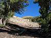
Climb: More of a hike actually. I had GPS'd the summit and used that to provide my direction. I headed slightly NE and up the hillside, carefully picking my line. At 9400 feet, I had a clear view of the peak (see photo image below) and the "sandy slope" where the use trail that comes from the end of the 051 road is reached. After making the connection with the use trail, it is simply a slog to the top. At the saddle between Freel and Job's Sister, a well tromped in use trail is available and provides an easy way to the top. The highest point contains an ammo box type of register. The view from there is FANTASTIC and worth the effort. I made it up in less than 2 hours and down in 40 minutes. Elevation gain from car: 2400 feet in a bit more than2 miles. A very direct approach but beware of the following:
I've heard there is a concern for some rare and endangered plants. Tahoe Draba is named to grow up here. With care, any plants may be avoided. Once you hit the area above the sandy slope mentioned above
(elevation of the top of the sandy slope is 9600 feet) you'll find the going gets slower. Try and stay to the use trail and avoid any vegetation. Sometimes you go up two steps and slide down one but the descent is fast due to this.
 |  |  |
weekend - Aug 30, 2011 7:00 pm - Hasn't voted
trail selectionAt the parking area (4.65 mi in from 89) the trail most obvious is straight ahead from the road in (051) and goes to Job's. The trail to the saddle between Freel and Job's sister is to the north and isn't clear. Word is you just head north through the trees to get to Freel and/or Job's Sister.
Ambret - Aug 13, 2013 2:41 pm - Hasn't voted
Forest Road 051You will most likely need 4WD and high clearance on Forest Road 051. Rivucha and I tried it on Aug 12, 2013 and could not get past the first 100 yards (we only had 2WD). We later talked to some folks who were able to get to the trailhead. They said the first part was the worst.