
|
|
Route |
|---|---|
|
|
39.32080°N / 106.1511°W |
|
|
Snow Climbs / Descents |
|
|
Half a day |
|
|
Class 2 / Moderate Snow |
|
|
Introduction
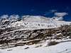
These fun snow routes lead to the slightly lower summit of West Mount Buckskin, and generally hold snow much later in the year than the other areas of Buckskin. After a good snow year, this area is climbable and skiable until mid to late June.
These slopes are generally mellow, intermediate routes that provide great ski runs and snow climbs. They are also really fun glissades. Access from Kite Lake make them very accessible in late Spring after the Kite Lake road melts out.
 |  |  |  |  |
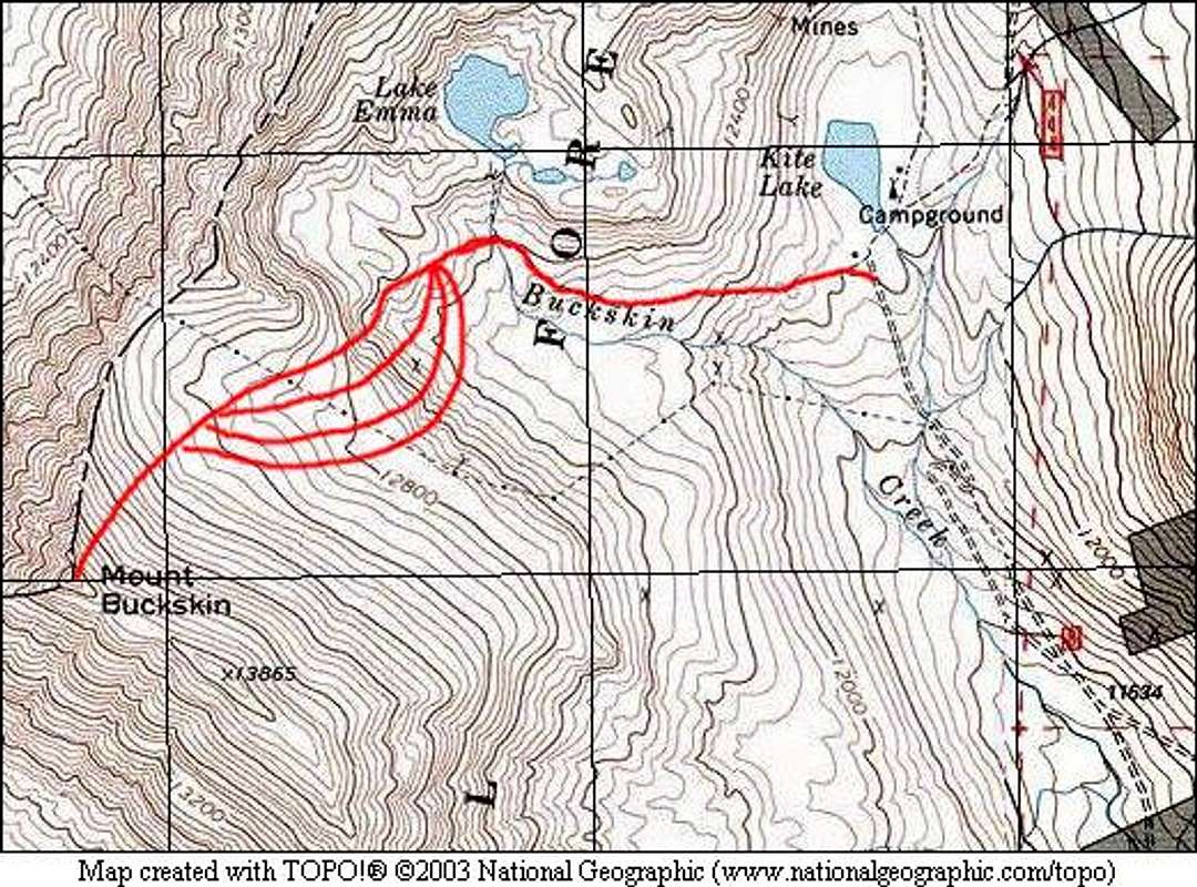
Approach
Kite Lake Trailhead: 12,000 feet.
Drive on Colorado 9 from the north or south to the town of Alma. In the center of Alma, look for a wooden sign that marks the Buckskin Creek Road (also called the Kite Lake Road, Park County 8).
Follow the Kite Lake Road for 6 miles to the pay parking area. Parking costs $3, and camping costs $7. This road can be done with a passenger car, but it can be very rugged and rutted after a hard winter. Most cars can make it to near the Sweet Home Mine.
Snow closure will vary on Kite Lake. Typically in winter, snow closure will be below the old mill at 4.0 miles from Alma. If you intend to snow climb and ski this route, chances are you will have to park below the actual Kite Lake parking area. Ensure that you factor this into your start time.
Route Description
Begin on the Northeast Slopes route, and follow it on the Lake Emma Trail until you reach the flat area below Buckskin's broad Northeast slopes. Angle toward the snow slopes on the North side of this slope.
The snow slopes here are usually separated by some rock ribs. The gullies toward the North side are steeper, the steepest being the gully that is below the North Ridge. Choose your ascent route.
Above these slopes, pass under the powerlines on another brief flat section and gain the upper slopes that will take you to the summit of West Buckskin. These slopes are broad, hold good snow, and are less steep than the lower slopes. Gain the summit of West Buckskin.
If you choose to hit the actual summit, follow the easy, short ridge. It's only Class 2.
Descent Options:
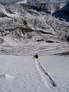
Glissade: This is a fun glissade route. Bring your axe.
Ski: This is a great intermediate ski. The upper slopes are pretty easy, and offer nice, broad slopes for turns. The lower, steeper area allows you to pick your line to fit your ability. The gully on the skier's left (most Noth) is steepest, and is really fun. The more you go to the skier's right(South), the easier the slopes will be. If you time this right, you should be able to ski right back to your car.
Round Trip Mileage: 3.3 miles
Elevation Gain: 1,800 feet
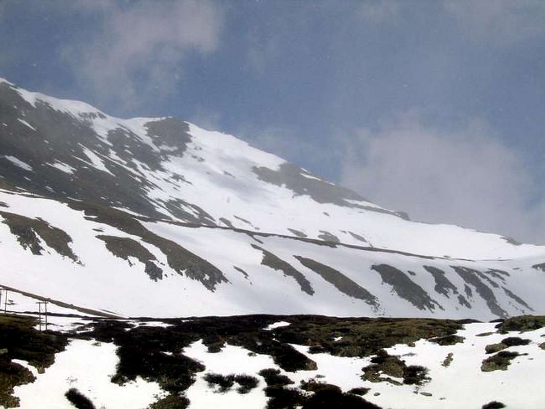
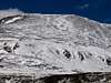
This cloudy route photo shows the lower, steeper slopes, and the several options available on these snow routes. The snow slopes leading to the summit of West Buckskin are visible.
 |  |  |
Essential Gear
Snow climb: You may not need an ice axe, but if the snow is really hard or you intend to glissade down, bring it. Crampons will probably not be needed except for when the snow has matured and is rock hard. If the snow isn't too mature, poles will be the only thing you'll need.
Ski: Skis, of course. It will be possible to skin until you reach the lower slopes. In general, the slopes to the summit are too steep to skin without ski crampons. Avalanche gear is always necessary.
Hike: It's possible to hike this when there is no snow, but these steeper slopes are probably less pleasant than the other routes on this site. I would go with one of the other routes, and only use this one for snow.
Backcountry Ski Ratings and Disclaimer
Skiing in the backcountry is nothing like skiing at a resort. Ratings of "beginner," "intermediate," and "advanced" are backcountry ratings. They do not correspond to ski resorts. At ski resorts, beginner and intermediate runs are almost always groomed and cleared of obstacles. Not so in the backcountry. Expect to find rocks, trees, patchy snow, and all sorts of obstacles on the easiest of runs. Route selection and avalanche avoidance are also key to your safe navigation of backcountry ski terrain.

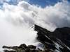
The main summit of Mount Buckskin shrouded in clouds from the summit of West Buckskin.
Avalanche Information
Check the Colorado Avalanche information Center's Website for current information on Mount Buckskin.
These slopes could be prone to sliding under the right conditions. Use caution.