
-
 9111 Hits
-
 75.67% Score
-
 6 Votes
|
|
Route |
|---|---|
|
|
40.26370°N / 105.607°W |
|
|
Hike w/ Some "Boulder Hopping" |
|
|
Most of a day |
|
|
Class 2 |
|
|
Approach
From Longs Peak Trailhead:10.2 miles roundtrip,
3,880 feet elevation gain
A straight-forward approach. Begin your hike at the Longs Peak TH, at about 9,400 feet. Follow the Longs Peak Trail through timberline and out onto Mills Moraine. When you break out of the trees, Mount Lady Washington and its east slopes are visible directly in front of you (west). Follow the Chasm Lake Trail to the saddle, or hike directly to the east slopes of Mount Lady Washington.
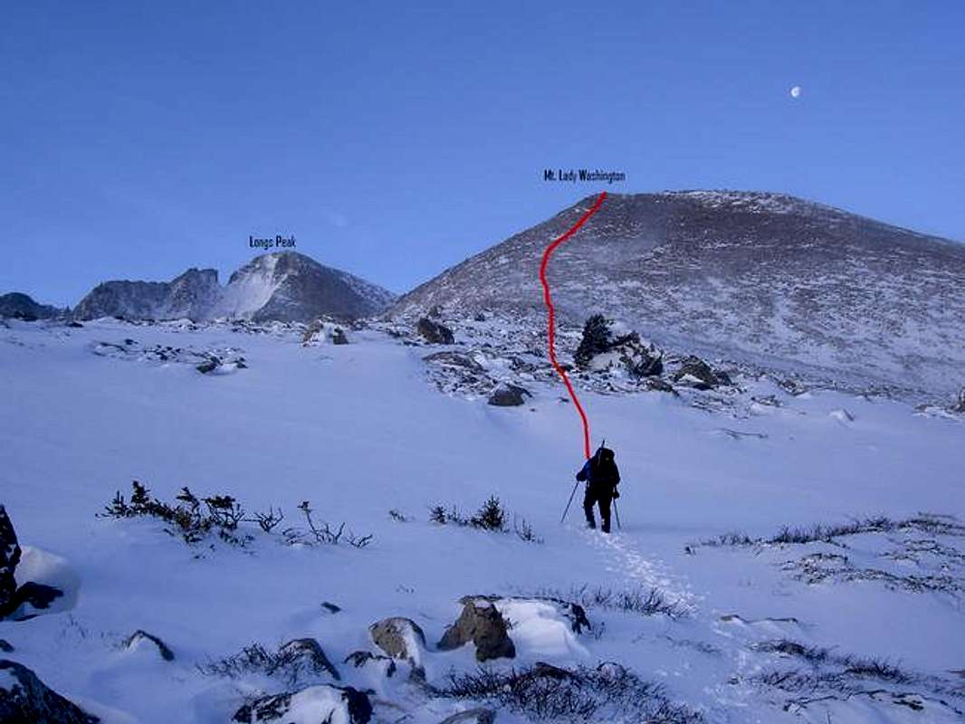
Photo by coloradoiceclimber
 |  |
Route Description
After the approach, there is a steady, 1,500-foot hike to the summit. The objective is obvious from the beginning, but the east slopes of Mount Lady Washington do have some surprises. I found the slopes to consist more of big boulders than just talus. This provided some fun class 2+ near the top, especially in the snow. Most of the rocks and boulders are solid, making things quite enjoyable as you relish the views of the Diamond, Twin Sisters, Lumpy Ridge, and the Mummy Range.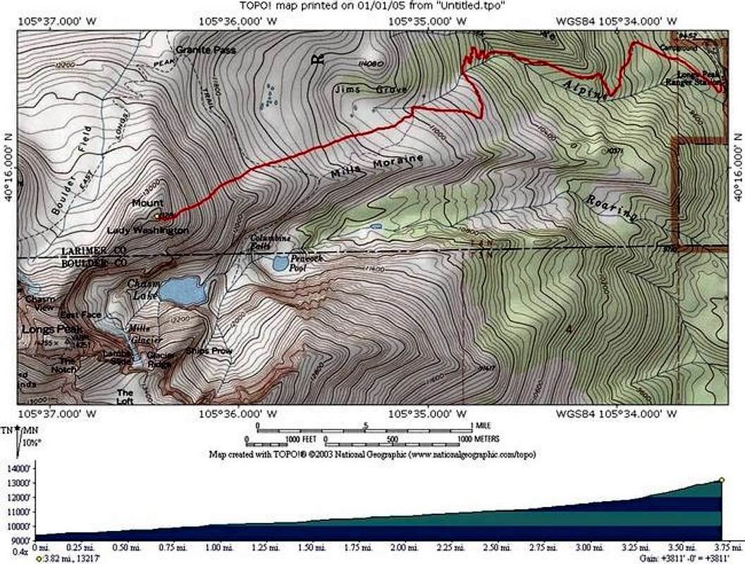
Topo provided by coloradoiceclimber
At the ridge crest, the summit is the obvious highest point right in front of you.
The main hazard on this mountain? Wind! We nearly blew away as we crawled the last 40 yards to the summit, but we were mostly shielded from the wind during our climb of the east slopes. I have heard this from others also, so just be ready for it.
Essential Gear
Good boots, and a camera!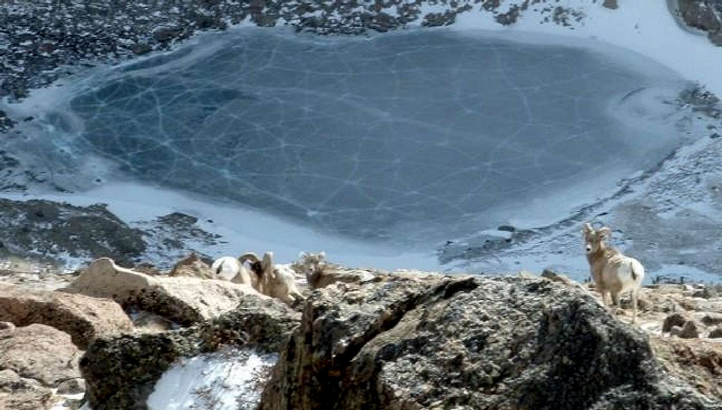
Bighorn Sheep at 12,200 feet