
|
|
Route |
|---|---|
|
|
38.00800°N / 105.604°W |
|
|
Scrambling |
|
|
Summer, Fall |
|
|
Most of a day |
|
|
Class 3 |
|
|
Overview
This route approaches Mount Adams from the less commonly climbed, east side. It is feasible for a long, one-day, round trip from Denver or Colorado Springs. The route is 12 miles round trip, with 4800' elevation gain and a quarter mile of easy (depending on conditions) scrambling near the summit. It's a good workout, and offers spectacular scenery.
The route is virtually the same as Roach's Southeast Face route documented in Colorado Thirteeners but with some variation in the final 0.1 mile. I originally named it the Northeast Ridge route on SummitPost, but have since deferred to Roach's nomenclature.
Getting There
 Sunrise on the Sangres
The roads are smooth all the way to the Horn Creek Trailhead, allowing you to reach your destination in 3.5 hours or less from Denver. At Westcliffe, turn south on Colorado highway 69 for 0.4 miles to Hermit Road. Go west on Hermit Road for 1.2 miles to Macy Lane. Continue south on Macy Lane for 5 miles. If the lighting is good, you will have some nice photo opportunities along Macy Road. Pass Schoolfield Road and turn west again on Horn Road, which is well signed. Follow Horn Road for 3 miles to the trailhead. The trailhead is just past Horn Creek Ranch. I measured the total driving distance from Westcliffe to trailhead at 9.7 miles. There is plenty of free parking and a well maintained outhouse at the trailhead.
Approach
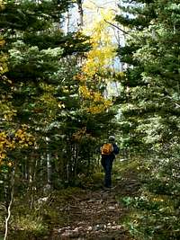 Horn Creek Trail
Follow a good trail 0.3 mi west until you intersect the Rainbow Trail (signed). The Rainbow Trail runs north and south along the east side of the Sangre de Cristo mountain range. Turning south would take you to Macy Lakes, so turn north instead. Follow the Rainbow Trail north for only 200 yards to the next signed intersection. Turn left (west) onto FT 1342. Follow this trail mostly west thru beautiful aspen and pine forests, meadows, and stream crossings for 4.5 miles until you reach Horn Lake. You will be ascending between Little Baldy Mountain on your left, and Little Horn Peak on your right. They are little only in comparison to the surrounding peaks.
 Upper Horn Lake
Route Description
 Southeast Face/Northest Ridge
Ahead and to your right is the long, steep slope leading to Adams' northeast ridge. Pick out a path of least resistance up the slope, aiming for a large gap in the ridge line. This long slope gives the route its name, and it may test your resolve! Once you reach the ridge, cross to its north side. This is a nice place to stow your ski poles that might hold you back on the ridge. Staying within 100 vertical feet of the ridge crest on the north side, climb to a flatter portion of the ridge 0.2 miles ahead. The ridge curves south just beyond this point. Cross back to the east side of the ridge, well below the ridge line, for your final assault on the summit. This route completely avoids the small cliff on the north side of the summit cap.
 View to the south (Humboldt Peak)
Essential Gear
Ice ax, October through June. Dress warmly and Enjoy the scenery!