
|
|
Route |
|---|---|
|
|
42.44190°N / 13.68320°E |
|
|
Mountaineering |
|
|
Spring, Summer, Fall |
|
|
Most of a day |
|
|
PD- II/III UIAA |
|
|
Overview
 |
|---|
The south side of Monte Prena is characterised by steep ridges of rock, pinnacles, couloirs, and long rivers of gravel that come down from the mountain to the wide plateau of Campo Imperatore. In this wild and unusual scenery, that remembers in a small way the landscapes of central Asia and south-western USA, we can find some interesting routes, most of them marked with paint, that can be placed at the border between hiking and climbing. The most difficult of them, at least for the engagement of its climbing passages, is the Via dei Laghetti route.
This route, marked with paint from the Alpine Club of Penne, climbs up some couloirs, mostly walking but also climbing on many short cliffs and chimneys.
On this route you have to face the most difficoult passages of climbing (III UIAA) of all the marked trail of Gran Sasso Range, but they are quite short and not exposed. Comparing Via dei Laghetti with the near Via Brancadoro, I can say that is surely more demanding, but a little less exposed: on the whole, in my opinion Via dei Laghetti is harder than Via Brancadoro.
The best seasons to climb are summer and autumn: in particular, in early summer you can see at best the beautiful pools of clear water characterising the route (“Laghetti” in italian means “little lakes”).
Avoid the hottest days: the route is exposed on south side!
Getting There
The route starts from the side of Monte Prena looking towards Campo Imperatore, in the near of the start of Via Brancadoro.For a detailed description see the "Getting there" description of the main page of Monte Prena
 Click to enlarge
Approaching
 Monte Prena seen from the approach trail "through the Fornaca"
1) Through the Canala: coming from Fonte Cerreto, at Km 43,390 of the road S.S. 17bis, about 1 Km after the deviation to S. Stefano di Sessanio, take a wide trail crossing the flatland in direction of Monte Prena; the trail enters in the river of gravel called Canala, reaches the rocks of Monte Prena south side, then goes on the right till reaches a stone with the writing “Via dei Laghetti” (about 1h 30min from the road)
2) Through the Fornaca and the Veticole saddle: coming from Fonte Cerreto, at Km 48,000 of the road S. S. 17bis, about 5 Km after the deviation to S. Stefano di Sessanio and 2 km before the deviation to Fonte Vetica, take a dirt road in Monte Prena direction; drive on the road for about 3 or 4 Km until you reach the starting point of the trail leading to the Lubrano Bivak (note: the bivak is no more, it was blown away by a storm not many years ago!), in proximity of some curves of the road and not so far from the ruins of an old mine (about 1750 m).
Take the trail, not always visible in the first stretch, rising up meadows, then crossing the hillside and passing on the rim of the Fornaca gully (a little canyon with a gravel covered bed). The trail enters now in the dry creek bed: cross it (don’t follow the track leading to the ruins of Lubrano Bivak) and rise up the pastures leading on the Veticole saddle (about 1975m); reached the saddle, leave on your right Via Brancadoro and go down on a steep slope, until you reach the bottom of the river of gravel called Canala; from there, follow the trail, bearing towards Monte Prena: a stone with the wrinting “Via dei Laghetti” shows the start of the route (about 1h 15min).
Both approaching are good, but I advise the #2.
Route description
 One of the typical pools of water (laghetti) that give the name to the route
After this first and demanding little rock face, walk up following the trail, rising up gravelly slopes and broken rocks on the border of the couloir. When the track goes back in the bed of the couloir, you have to face a difficoult stretch of the route, climbing up several smooth slabs and short cliffs (II UIAA, some passages of III).
After this point, there’s another stretch of trail where you have to walk among meadows and screes, out of the bed of the couloir. The path crosses on the right, climbing up to a little saddle, then rises up a slope and enters in another couloir, climbs several slabs, short but smooth, and a steep chimney with few holds (II and III UIAA). These are the last climbing passages: now the trail goes up through steep gravelly slopes until reach another saddle, where Via Brancadoro joins.
From there, rising up a wide and steep ridge (look around: here is one of the few places where you can find the Appenninic Edelweiss – Leontopodium Nivalis – a rare flower!) you reach the summit of Monte Prena (2561m - 3h from the start of the route, 4h 30min from the car if you choose the approach trail through the Fornaca, 4h 15min if you chose the approach trail through the Canala )
Descent
The easiest descent is from the normal route (trail marked with nr 7):
from the summit, go down in a steep gravelly couloir on the north side (the trail, well marked with paint, starts on the right of the summit, looking toward north).
Where the slope become less steep, cross on the right until you reach a wide saddle: from there the trail descends through Campo Imperatore, crossing some couloirs and screes. The path goes on the east ridge of Monte Prena and follows it until reaches the pass Vado di Ferruccio (2245m). From there the trail goes down crossing the meadows of Monte Camicia west side.
After a long walk, crossing pastures and not so deep couloir, you reach the dirt road leading to the old mine: if you started from Fornaca approach trail, the starting point is few minutes on your right, along the road (2h from the summit).
If you chose the Canala approach trail, you have to continue walking on the road for some minutes, than, in proximity of a curve of the road, leave the road and cross the Fornaca river of gravel. Then, cross under the slopes of Monte Veticoso until you reach the trail you walked going up. Follow it until you arrive to the road S.S. 17bis, where you parked the car (2h 30min from the summit)
Another possible descent, but only for experienced climber, is from Via Brancadoro (F+, II UIAA):
from the summit, come back on the way you climb until you reach the saddle where Via Brancadoro meets Via dei Laghetti.

Images of the Route
Here you can see some pictures showing some climbing passages of Via dei Laghetti

|

|

|
|---|

|
")
|

|
")
|
|---|
Sceneries
Here you can see some pictures showing the views and the landscapes you can see both climbing Via dei Laghetti route and on the descent route.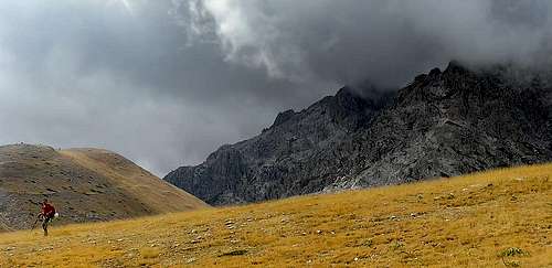 Monte Prena seen from the near of Fornaca
 Fornaca couloir and Campo Imperatore plateau
 The wild east side of Monte Prena
 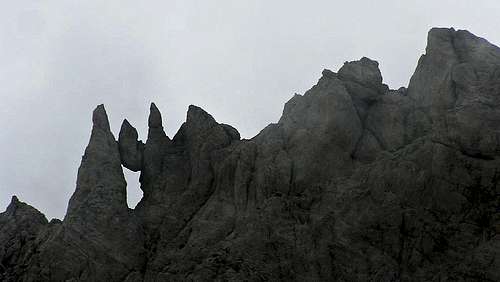 Stunning pinnacles on the Monte Prena north ridge
 Monte Camicia summit as you can see from Monte Prena top
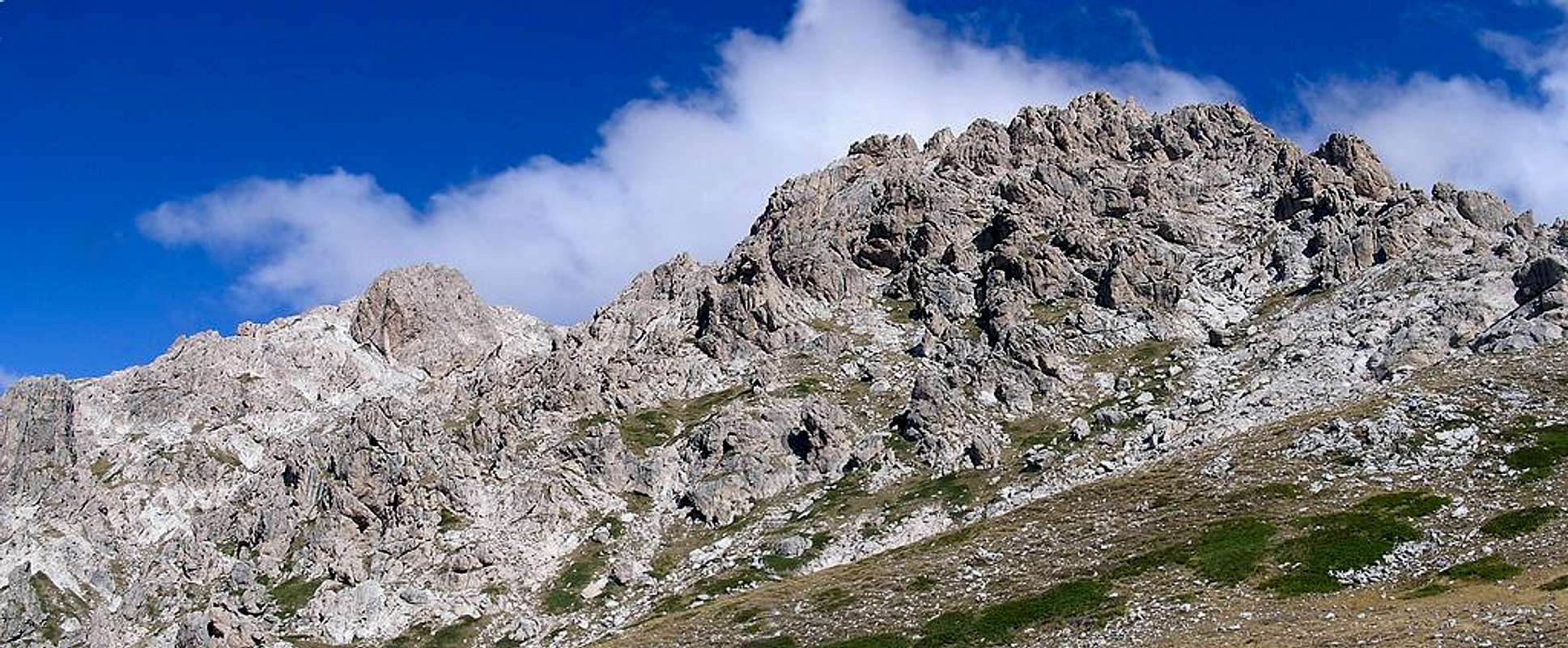  |
Essential Gears
Helmet: it’s advised: even if the danger of rock falling is not so high, is better that you use helmet, also to protect your head from possible fall.Harness, rope, gear for belaying and rappelling: they aren’t necessary for mountaineers, but if you take with you hikers the rope can be very useful. This gears could be useful also to more experienced climbers in case of bad weather conditions: in case of rain the couloir is filled by water and the cliffs become waterfalls!
Notice that among all the route there aren’t equipped belays or anchors for rappels.
 If you take with you hikers not experienced in climbing, carry with you a rope
Books, Guides, Maps, External Links

L. Grazzini, P. Abbate, “Gran Sasso d’Italia”, Cai-Tci, 1992
S. Ardito, “A piedi sul Gran Sasso”, Iter, 1992
A. Alesi, M. Calibani, A. Palermi, “Gran Sasso – Le più belle escursioni”, SER, 1996
Best map is “Gran Sasso d’Italia. La carta dei sentieri”, edited by Cai-L’Aquila.
Weather condition:
Meteo bulletin Meteomont - Abruzian Appennines