

visentin - May 22, 2009 4:41 pm - Voted 10/10
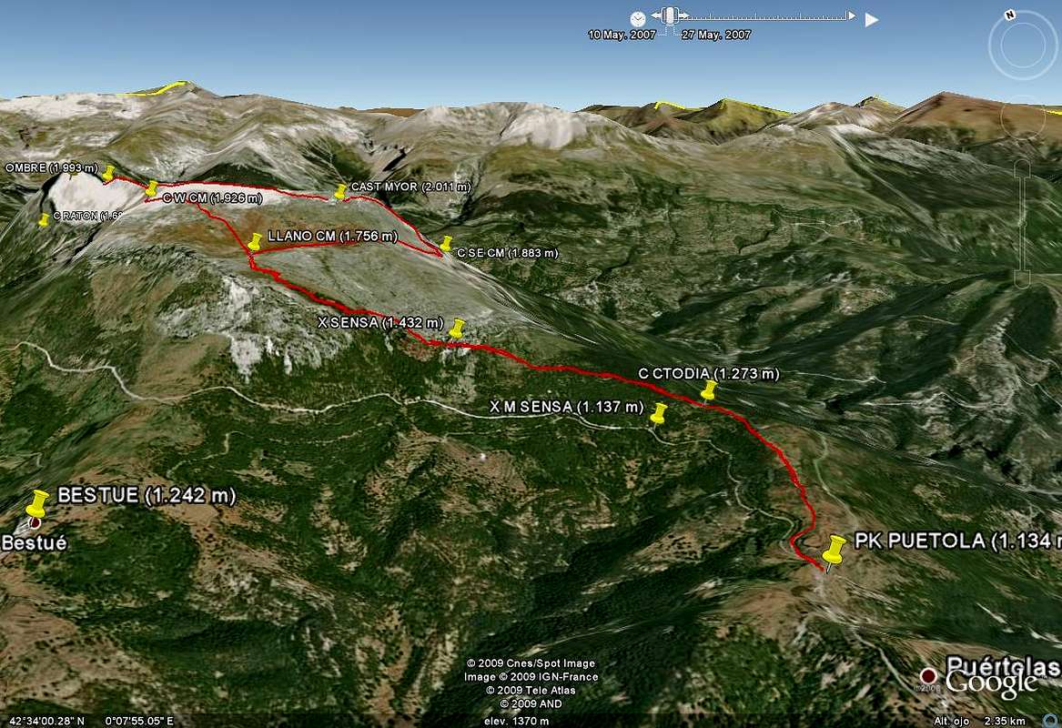
routeI'm not sure the red line is very accurate, it should go under the cliffs before the Sensa. It would be worth to draw on this pic the second trail that starts straight under the point 1432 (Sensa).
At "Raton" pass, I always wondered if there was a way to get up here. Ever heard of it ?

Rafa Bartolome - May 23, 2009 1:22 pm - Hasn't voted
Re: routethis track is the real made with my gps, it's not a draw because it's the path. The second trailhead is under the cliffs of Sensa in effect but is less known and without signals (it's difficult for the people to find it). I don't like draw over the Google Earth (the draw is a suposition not a reality and I only use the map with my gps Garmin). Cuello Ratón is the col of GR15 from Escuain but I don't know if that route exists. In my opinion isn't a normal route (I saw the col from peña L'Ombre and it's a rare approach). In the image of google Earth Col.Ratón appears under P. L'ombre but the real position is behind in this image.
visentin - May 23, 2009 4:03 pm - Voted 10/10
Re: routeI didn't know this route you took with your GPS. I think it's a distinct one which I didn't know and is not the one I described (niether the one I took in reality), which goes vertically under Sensa). As for Raton, I spoke about the caption on the very left of your picture, which I thought to be the hollow between L'Ombre and the main plateau (but I think the yellow pin shown something behind the mountain on Google Earth)


Comments
Post a Comment