
-
 5454 Hits
-
 75.39% Score
-
 6 Votes
|
|
Route |
|---|---|
|
|
18.16172°S / 69.14502°W |
|
|
Download GPX » View Route on Map |
|
|
Mountaineering |
|
|
Winter |
|
|
A few days |
|
|
F |
|
|
Overview
This is the standard route from Sajama / Bolivia, probably the easiest way to the summit of Volcan Parinacota.Getting There
Take a driver with a 4x4 car to the end point of the street at approx. 5000 meters sea-level (GPS coordinates: S18.15349 W69.11638). The track for the car is on the attached GPX file. At this point is is not permitted to continue by car.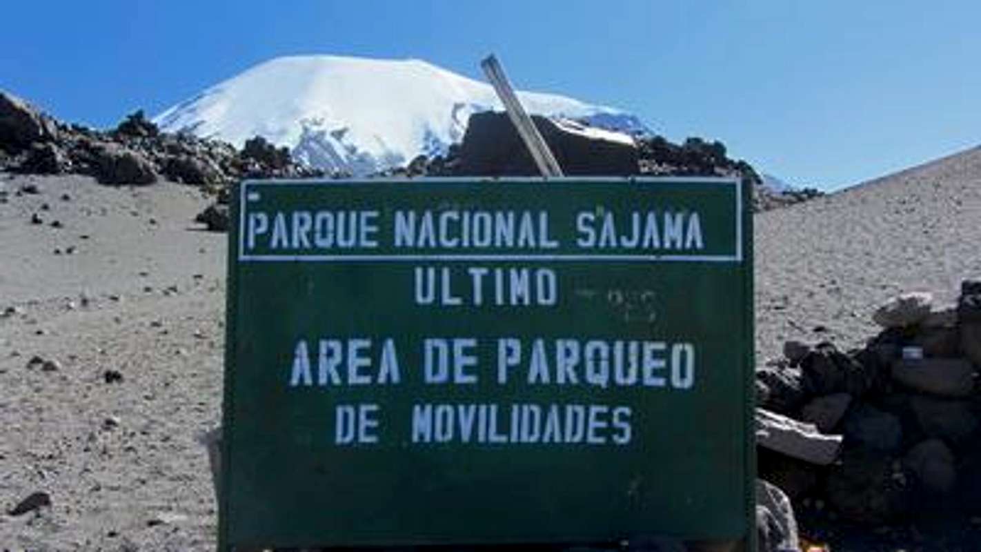
Sign at the starting hiking point to Parinacota - Further driving by car is not permitted
Route Description
Hike about one to two hours to the base camp at 5141 meters (GPS coordinates: S18.15248 W69.12235), a flat, cosy and wind protected spot.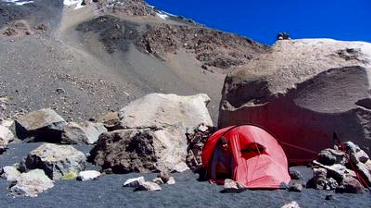
Our base camp on Parinacota
Start early on the next morning to achieve the summit it is a long, very long day! Follow the valley up and turn left (southwest direction) after approx. 1000 meters to the rocky slopes on a visible trail till the snow line. The steep snow slopes to the crater are endless and sometimes adorned with penitent snow and ice more than 1 meters high. We achieved the crater at S18.16084 W69.14153.
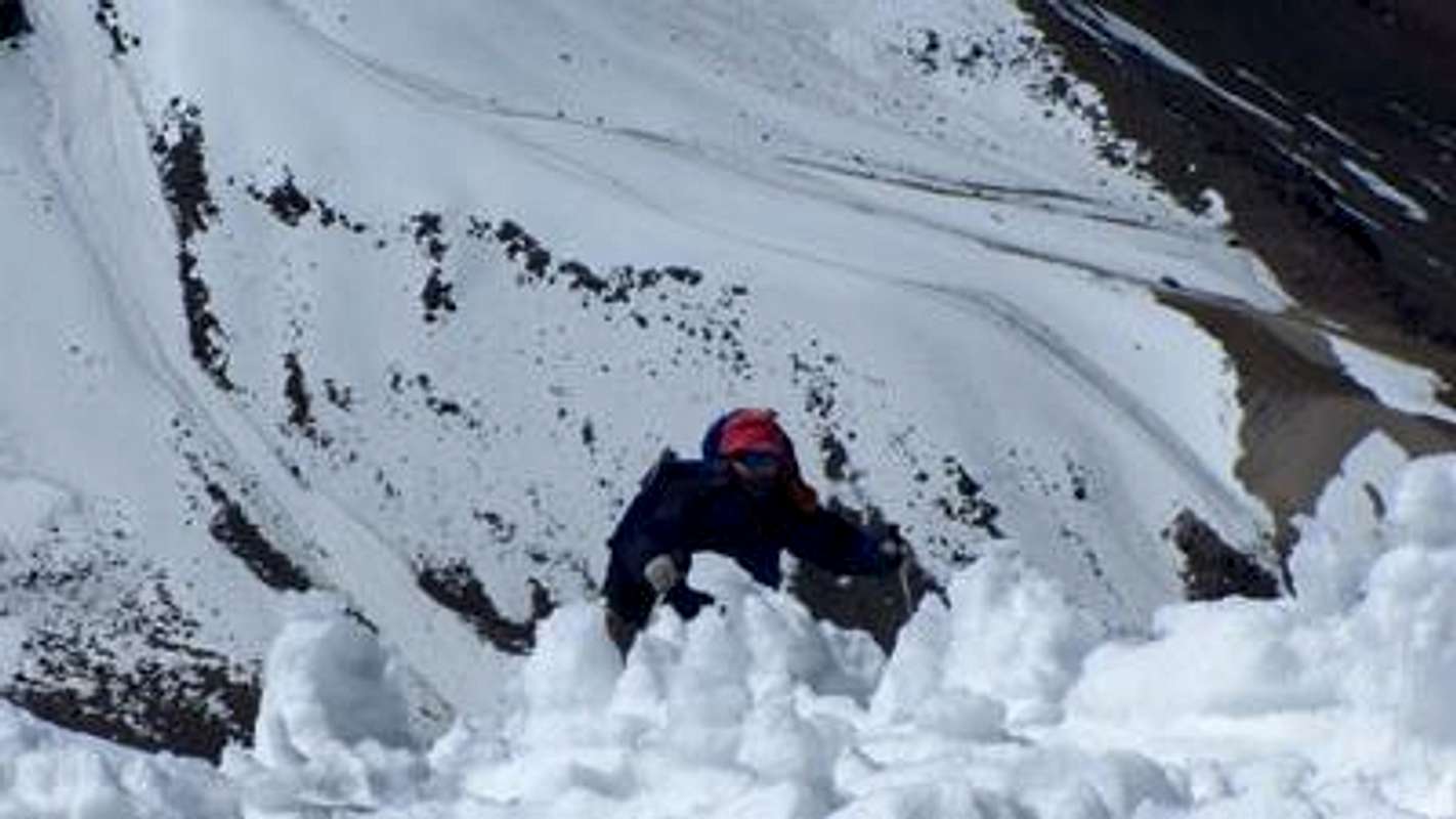
Fighting with the penitents
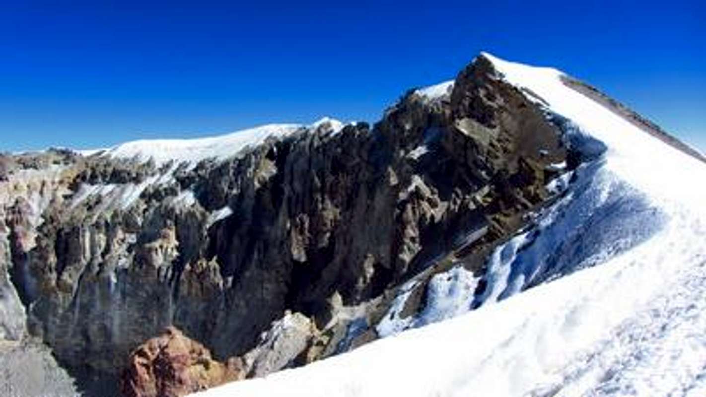
Achieving the crater with the main summit on the left
Turn right on the ridge (west) and climb over a secondary summit to the top (GPS coordinates: S18.16172 W69.14502) - approximately half an hour from the point where the crater had been gained.
The last steps to the summit of Volcan Parinacota
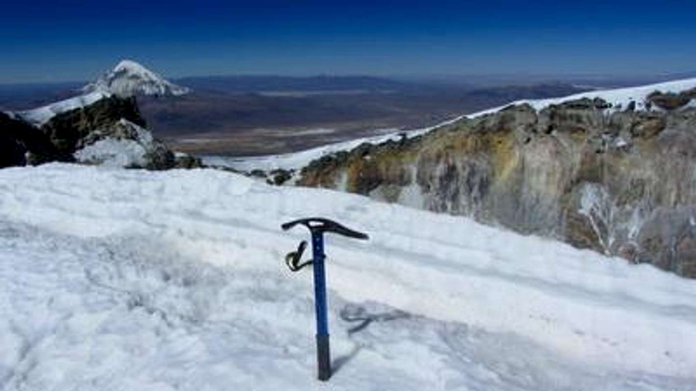
On the summit of Volcan Parinacota, 6342 meters sea-level. Nevado Sajama on the top left.
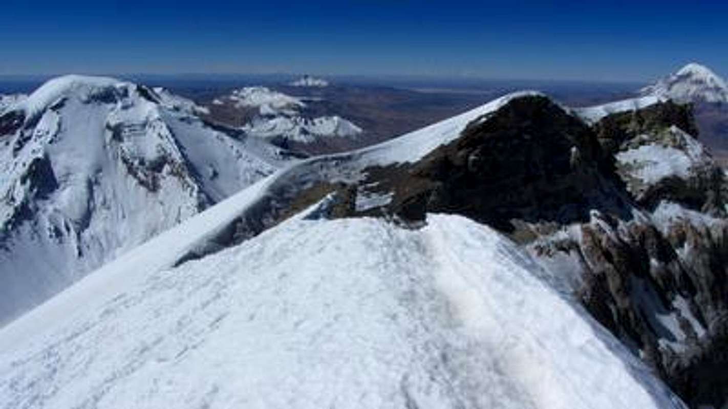
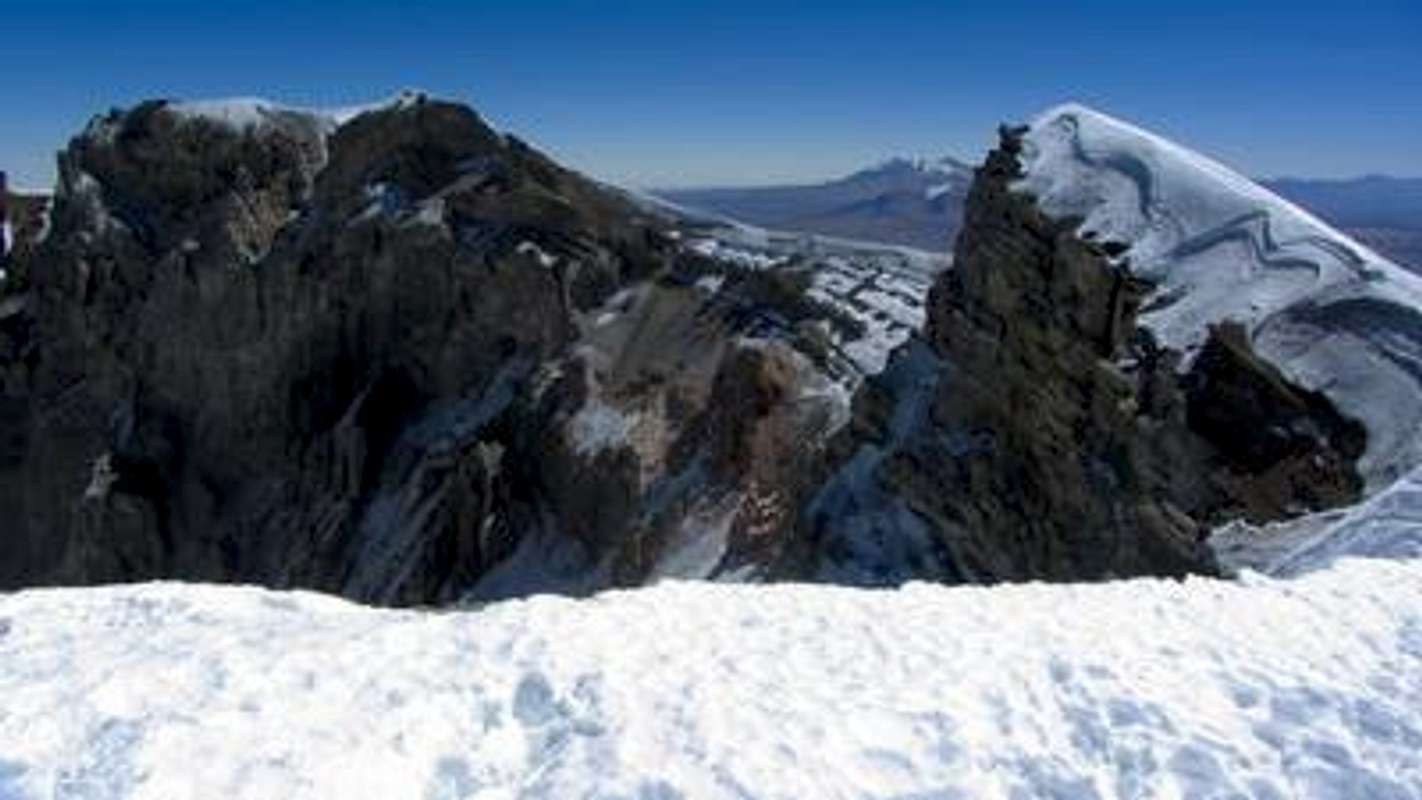
Eastern view back the ridge to the point where the crater had been achieved with Volcan Pomerape on the left and Volcan Sajama on the right

Southern view into the crater with Volcan Guallatire in the background (top center)