
|
|
Mountain/Rock |
|---|---|
|
|
46.07076°N / 117.46257°W |
|
|
Asotin |
|
|
Hiking |
|
|
Summer, Fall |
|
|
5880 ft / 1792 m |
|
|
Overview
Saddle Butte is a mountain located in Asotin County, Washington. Most peaks in the county are mid-to-low elevation peaks and Saddle Butte is one of the tallest of them, although the county highpoint is located at the northern end of neighboring Ray Ridge (northwest of Saddle Butte). Despite not being the highest point in the county, Saddle Butte has 974’ of prominence and, as such, is Asotin County’s greatest prominence point (CoGPP). This distinction coupled with spectacular summit views and being the site of a former fire lookout can give this mountain notoriety for peakbaggers. Looking SE From Saddle Butte Summit
Most of the slopes on Saddle Butte are forested, but the wide and barren mountaintop once provided an ideal location for a fire lookout. A 20’ tall L-4 lookout, with a top cabin 8’ x 10’ in size, once stood on the southeastern side of the summit area (shown as Point 5859 on maps). This section of the summit area provided, and still provides, an ideal location from which to see far to the north, east, and south. The lookout tower was constructed in 1932, using wood brought in on pack horses. That same year, Dick Shafer was the first person to man the lookout, after having served a major role in the transportation of the building materials and the construction of the tower. The lookout tower was torn down many years ago, but no records show exactly when that occurred. All that remains is the concrete bases of the bottom corners.
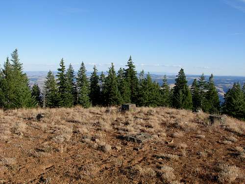 Leftover Concrete Bases From Former Fire Lookout Tower
The true summit (5880’+ elevation) location is near the center of the mountaintop, only a short distance away from the old lookout site. A small antenna and repeater station sit atop the peak. A dirt/gravel road leads to the summit, and even slightly beyond. Near the upper end of the road, at a grove of trees near the true summit, visitors can find an old sign on a tree that says Saddle Butte.
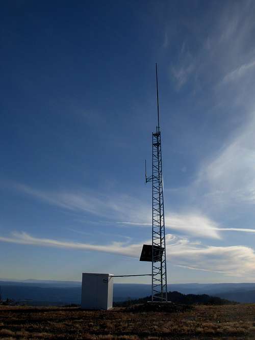 Repeater Station At Saddle Butte Summit
Saddle Butte received its name many years ago by local stockmen who thought the mountain's appearance resembled a horse saddle. Another local pioneer, Henry Hansen, attempted to have the peak name be recognized as "Saddlehorn Mountain". Hansen declared the mountain had an appearance more like a saddlehorn than a saddle, and he even distributed sketches of the mountain showing that representation. However, "Saddle Butte" remained the predominantly used peak name and ultimately the officially recognized name.
Getting There
FROM HIGHWAY 12 IN POMEROY, WA:
1) Drive south on 15 Street.
2) After 15.0 miles, the road enters the Umatilla National Forest and becomes known as Forest Road 40 (FR-40). Upon entering Umatilla National Forest, the route becomes a dirt road.
3) After 21.5 miles further along FR-40, turn right onto FR-470 (a.k.a. “Saddle Butte Road”).
NOTE: FR-40 becomes a rougher and narrower road after passing over a saddle 15.0 miles from entering Umatilla National Forest. Slow down and drive carefully beyond that point.
4) Drive 1.7 miles up FR-470 to the summit of Saddle Butte.
NOTE: Although FR-470 might be passable to some passenger vehicles, extra caution is needed for vehicles attempting to reach the summit. The summit road is single-lane, with very few turnouts, and can have many hidden rocks in the grassy middle sections of the roadway. High-clearance vehicles should have no issues. Hiking to the summit via FR-470 should have no issues, as well.
 Driving Along FR-470 Towards Summit
FROM HIGHWAY 129 IN ASOTIN, WA:
1) Drive southwest on Baumeister Road. The road soon becomes known as Asotin Creek Road.
2) After 3.0 miles, turn right to continue on Asotin Creek Road. This road is soon known as Lickfork Road and later known as FR-41.
3) After 26.8 miles along Asotin Creek Road/Lickfork Road/FR-41, turn left onto FR-42.
4) After 1.0 mile along FR-42, turn left (south) onto FR-40.
5) After 13.8 miles along FR-40, turn right onto FR-470 (a.k.a. “Saddle Butte Road”).
NOTE: FR-40 becomes a rougher and narrower road after passing over a saddle 7.3 miles from the FR-40/FR-42 intersection. Slow down and drive carefully beyond that point.
6) Drive 1.7 miles up FR-470 to the summit of Saddle Butte.
NOTE: Although FR-470 might be passable to some passenger vehicles, extra caution is needed for vehicles attempting to reach the summit. The summit road is single-lane, with very few turnouts, and can have many hidden rocks in the grassy middle sections of the roadway. High-clearance vehicles should have no issues. Hiking to the summit via FR-470 should have no issues, as well.
 Driving Along FR-470 Towards Summit
Red Tape
Currently, no Northwest Forest Pass or any other permit is required to hike, drive, and/or summit Saddle Butte.However, it is recommended to check with the Umatilla National Forest for current conditions, permits, etc. prior to visiting the area.
Camping
There are no rules prohibiting camping, especially car-camping, at the summit of Saddle Butte. The two major rules to follow on the mountain would be "Leave No Trace Behind" and no campfires. The summit views, including a great vantage point for sunsets and sunrises, would make a car-camping experience at Saddle Butte more enjoyable than many other summit destinations.There are multiple campgrounds, officially-established and backcountry types, located off FR-40 and adjoining forest roads in the area.
It is recommended to check with the Umatilla National Forest or obtain a Forest Map prior to visiting the area.