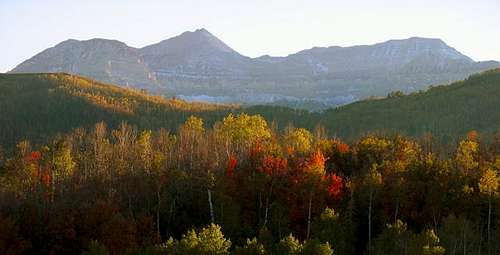
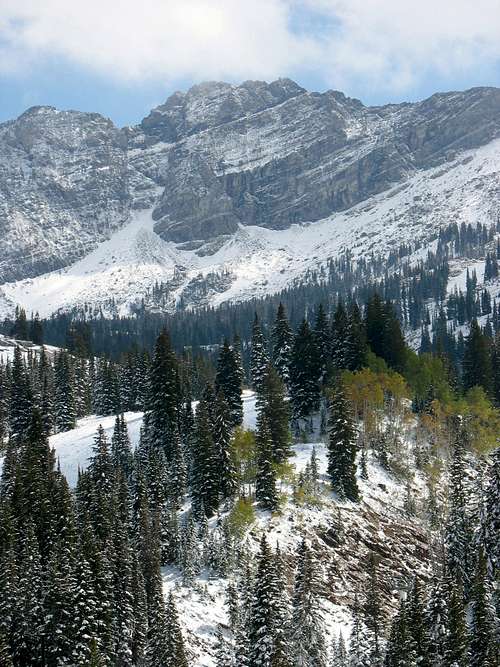
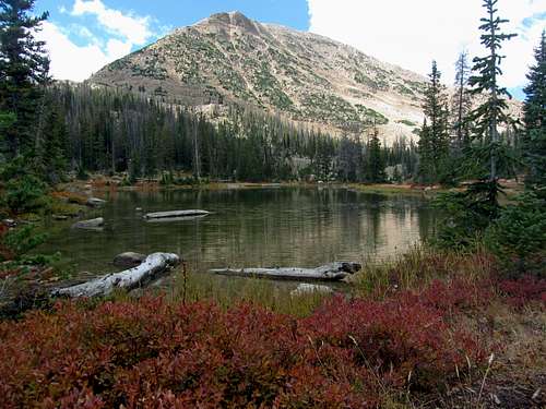
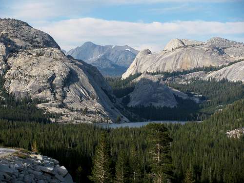
![Southern Jordanelle]() Greatest Snow on Earth
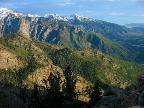
Greatest Snow on EarthSalt Lake City, Utah is a great place to experience the outdoors, especially for those seeking quality mountain hikes and breathtaking scenery. When asked what Utah has to offer, most people are quick to mention the famous red rock national parks to the south or skiing in arguably the best snow on earth (which I can attest to after growing up skiing where it’s much icier), but many overlook the mountain hiking aspect.
Within an hour or two from downtown Salt Lake City, there are hundreds of miles of trails, as well as several worthwhile peaks to summit. Options exist for every level of hiker, making it the ideal training ground for anyone from the most inexperienced of weekend warriors to more hardcore mountaineers. Since the unique location combines the benefits of living near a major city with having quick and easy access to the mountains, it offers the rare experience of allowing one to mix quality day hikes with everyday work life.
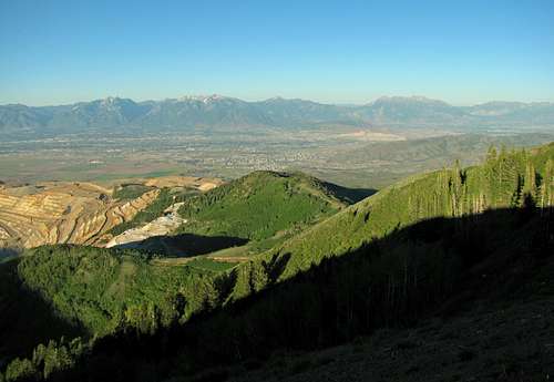
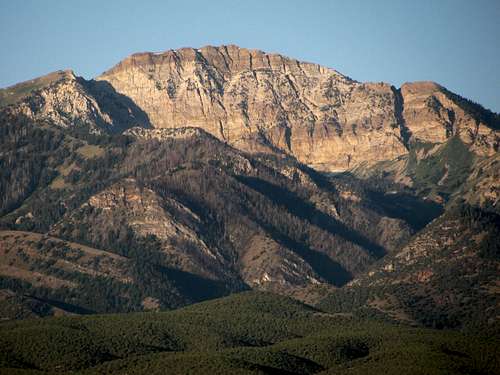
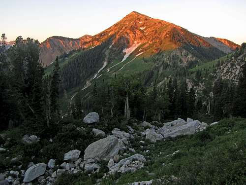
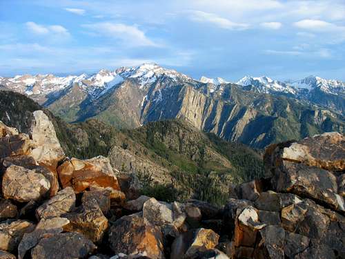
![Peaks over Salt Lake Valley]() Wasatch Peaks rising above Salt Lake Valley
Wasatch Peaks rising above Salt Lake Valley
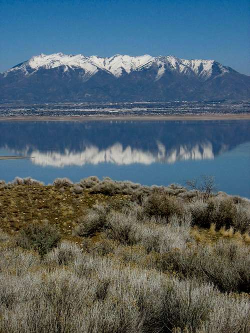
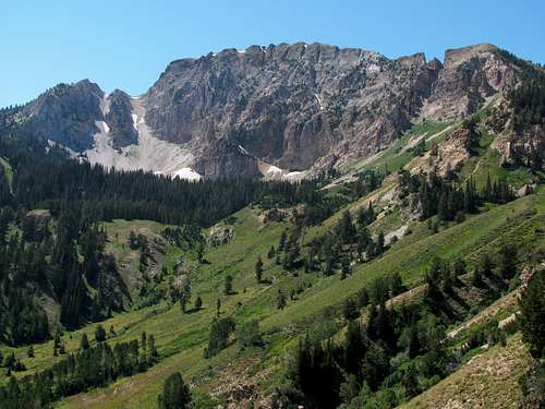
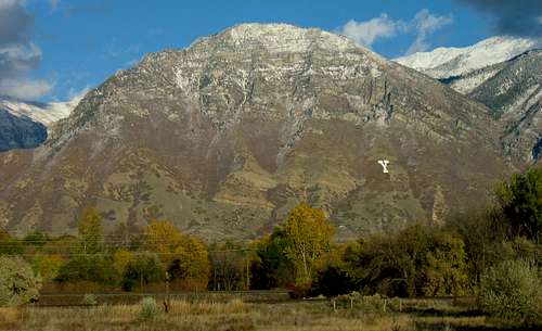
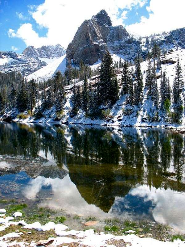
![Mt. Ogden from Antelope Island]() Wasatch Mountain reflection ...
Wasatch Mountain reflection ...
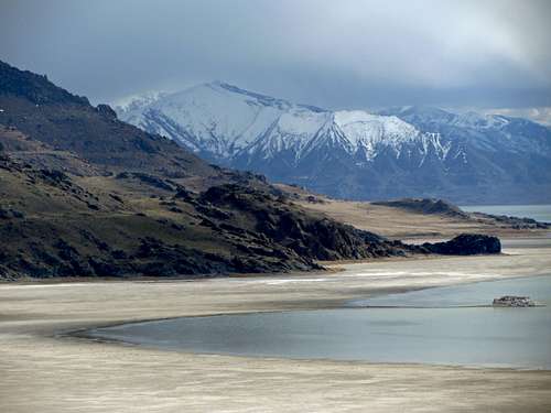
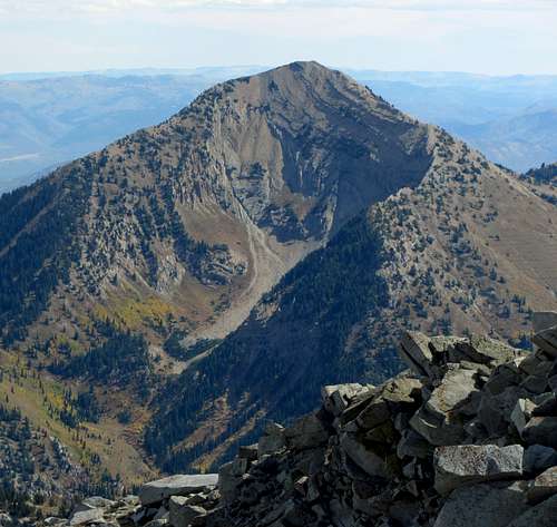
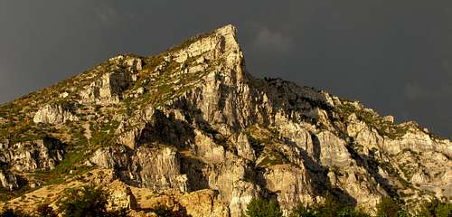
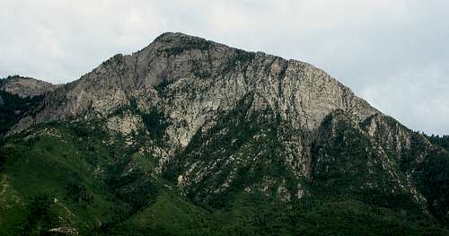
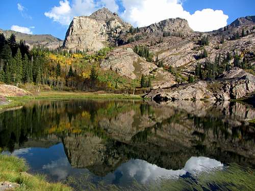
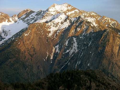
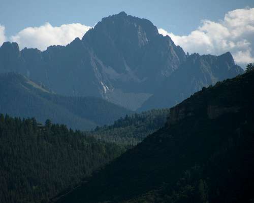
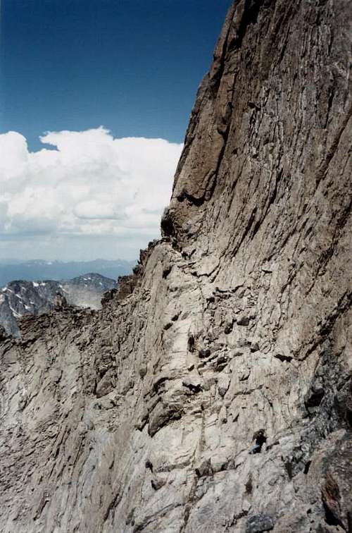
![Kessler Peak]() ... from Antelope Island
... from Antelope Island
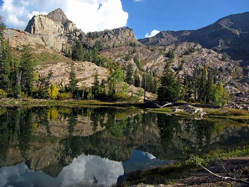
I wanted to highlight five different aspects of why Salt Lake City is such an awesome hiking hub, from the perspective of someone mainly interested in doing non-technical day hikes (which don’t require you to have an ice axe, rope, or helmet, just simply the hiking essentials). It has top-notch scenic roads, easy trail hikes to scenic lakes, moderate hikes on well-maintained trails to impressive summits, and more difficult hikes to rugged peaks which require scrambling. Also, the city’s central location within the western United States makes it the perfect launching point to other scenic mountain hiking locations.
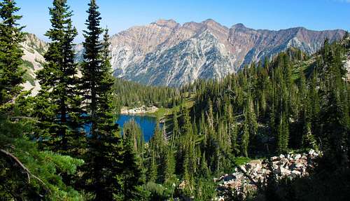
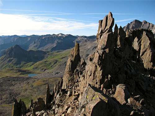
![Cottonwood Ridge through the trees]() Red Pine Lake in Little Cottonwood Canyon
Red Pine Lake in Little Cottonwood Canyon
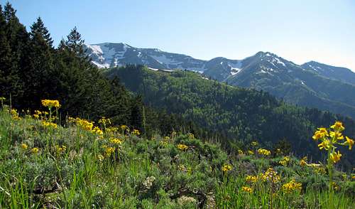
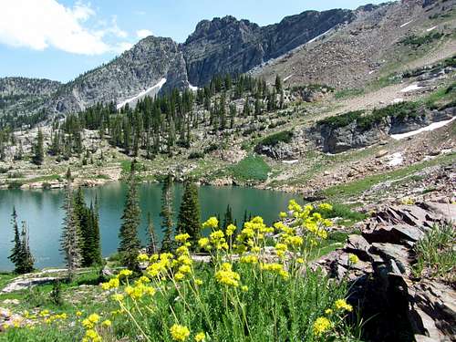
![Butterfield Peak wildflowers]() Butterfield Peak, Oquirrh Mountains
Butterfield Peak, Oquirrh Mountains
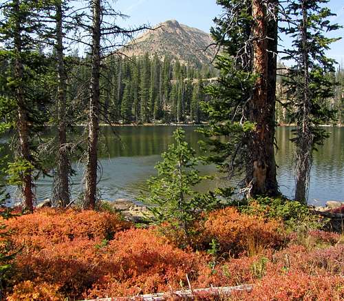
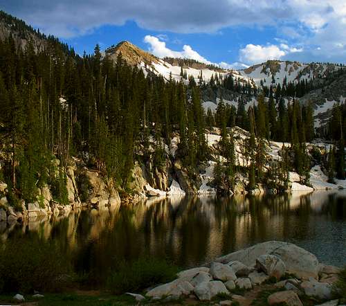
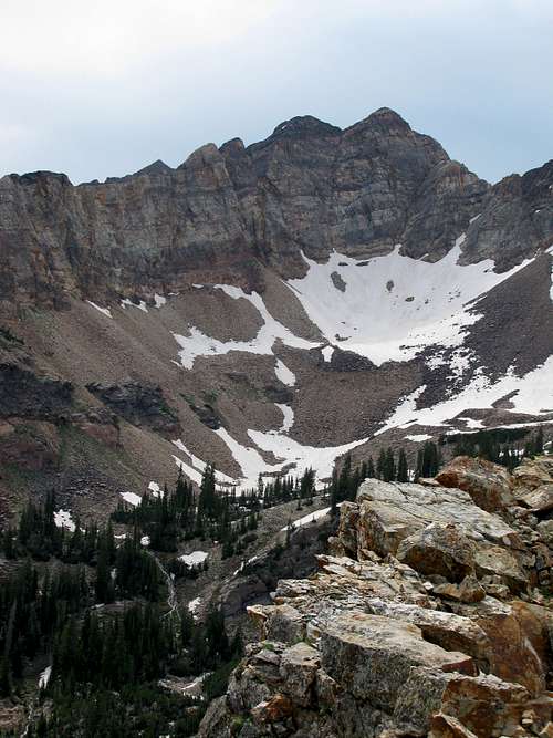
![Mount Watson]() Cliff Lake, Uinta Mountains
Cliff Lake, Uinta Mountains
I could easily have expanded each set of examples from seven to ten, but these should serve as a good starting point for someone who is in the area looking for some of the best mountain scenery and hikes around (and with mountain lists, seven seems to be the magic number: i.e. the Seven Summits). Since it’s sometimes difficult to rank by favorites, for the examples below I’ve listed everything by order of how strenuous the hike is (for the drives, I’ve instead sorted them by the highest elevation reached), factoring in things like roundtrip mileage, elevation gain, and technical difficulty. In doing this, I assigned a numerical value of 1 (very easy) through 10 (very strenuous) to each hike, to help give some sort of logical progression to those looking to get into more difficult hikes, although for those new to scrambling the technical difficulty may be more of a deciding factor. It should be noted that for assigning a technical difficulty to each hike, I follow a softer rating more similar to the Colorado rating system than the Yosemite Decimal System (YDS) that originated in California. So a class 3 scramble on this page would likely only warrant a class 2 rating in California, which helps me justify that these hikes can be done by almost anyone in good shape. Basically, I follow this set of guidelines: Class 1 = trail, Class 2 = off-trail / boulder hopping, Class 3 = easy scrambling requiring hands (where most would descend facing away from the mountain), Class 4 = more difficult scrambling (where most would descend facing into the mountain, but not steep enough to require a rope).
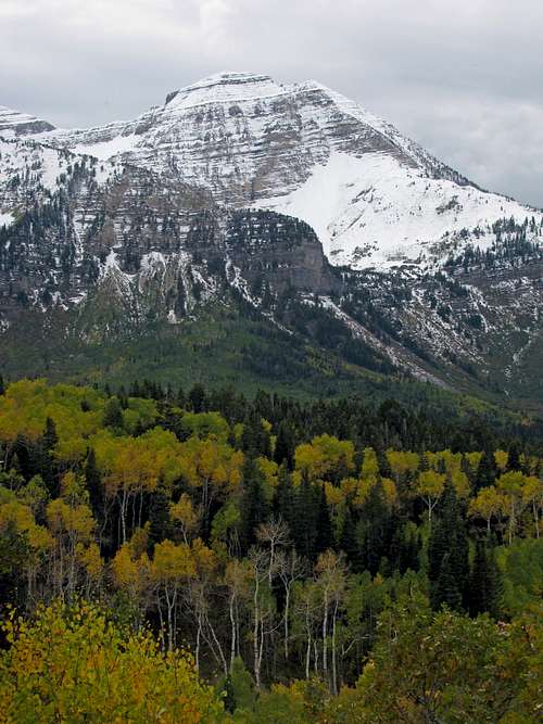
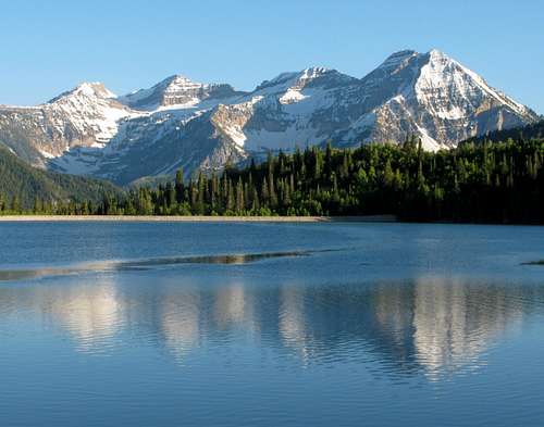
![West Slopes]() Mount Timpangos (left) and Cascade Mountain (center)
Mount Timpangos (left) and Cascade Mountain (center)
![Mount Ogden and Allen Peak]() Mount Ogden (left) and Allen Peak (right)
Mount Ogden (left) and Allen Peak (right)
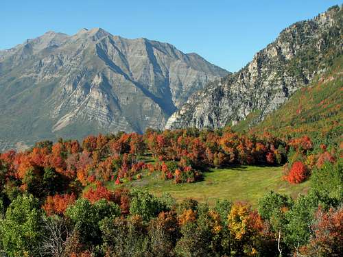
![Lone Peak & Bighorn Peak fall colors]() Lone Peak & Bighorn Peak fall colors
Lone Peak & Bighorn Peak fall colorsWhile many of the people on this site could do day hikes well into the teens on a difficulty scale such as this, these lists are meant for more average hikers like myself who you’d typically run into on the trails. For someone in decent shape, it should be possible to complete all of these hikes within 12 hours (including driving time to and from downtown Salt Lake City for the local hikes I’ve listed), with the more difficult hikes approaching the upper end of this time scale. Regardless, I think they’re all justifiable as hikes that are easy enough to do in a single day. For each hike, I’ve also listed a Google Maps drive time estimate for those who may be curious how long it takes to reach the trailhead from downtown Salt Lake City (if you’re driving from somewhere like Sandy though, most of these times would be much shorter), and for some of the hikes there is also an associated trip report, which can be accessed by clicking on the link with the "~" symbol.
7 Best Scenic Mountain Roads
Everyone has to start somewhere. For some people new to Utah or just new to mountainous areas in general, the mountains may seem like a scary and unforgiving place, but driving around on one of the many scenic roads in the area will help them become more comfortable with their new surroundings and gain a greater appreciation of the beauty which is so easily accessible. I’ve listed these roads in order of the highest elevation reached. Big Cottonwood Canyon Road stays open up to the ski resort of Brighton and Little Cottonwood Canyon stays open up to the ski resort of Alta year round, but the other roads are closed during all of winter, most of spring, and part of fall. Typically they are all open from Memorial Day up until the first big dumping of snow in the fall, but you’ll want to first check with the Forest Service before setting out on these drives if you notice snow in the mountains from the valleys below.
1. Alpine Loop Scenic Byway
* 20 miles long (connects mouth of American Fork Canyon with Provo Canyon Road)
* Highest Elevation: 8,080 feet
![North Timpanogos from Alpine Loop]() North Timpanogos east aspect
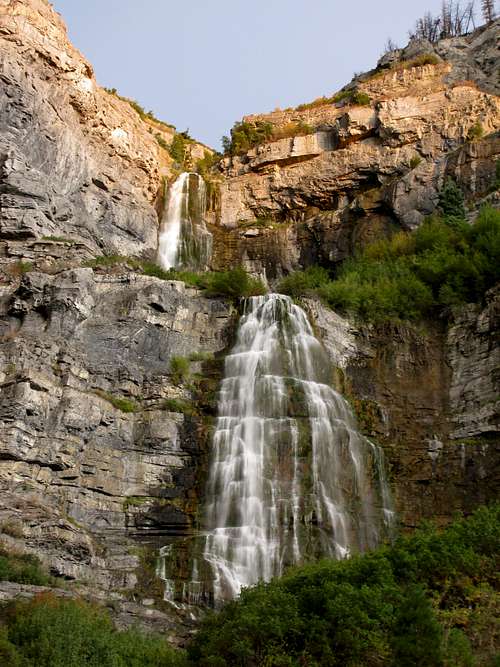
North Timpanogos east aspect![Timpanogos Fall Colors]() Mount Timpanogos fall colors
Mount Timpanogos fall colorsThe Alpine Loop behind Mount Timpanogos features some of the best scenery in the Wasatch. Doing the full loop, you’ll drive through American Fork Canyon on the north end and Provo Canyon on the south end. American Fork Canyon has some impressive limestone cliffs towering above, and the Provo Canyon side is just as impressive with several waterfalls, the most notable of which is Bridal Veil Falls. For those short on time, the drive from American Fork Canyon to the top of the loop (at the loop turnoff just before the turnoff for Cascade Springs) is particularly scenic, especially in the fall when the road is surrounded by red maples at the lower elevations and by yellow aspens higher up. Driving up to Silver Flat Reservoir (where the water level is full in the spring, but drops as summer progresses) along the rough dirt road that splits off to the north after Tibble Fork Reservoir (doable, but not recommended for passenger cars) rewards you with one of the best possible views of the Timpanogos Massif, and for those brave enough to take their high-clearance vehicles on more rugged terrain, the Timpooneke Road wrapping around the north side of Timp offers additional opportunities to explore.
2. Squaw Peak Road
* 28 miles long (from Provo Canyon to Hobble Creek Canyon)
* Highest Elevation: 8,550 feet
![Cascade Mountain Cliffs]() Cascade Mountain
Cascade Mountain![Squaw Peak Road views]() Squaw Peak Road fall colors
Squaw Peak Road fall colorsTo get a nice bird’s eye view from the mountains above Provo, check out the Squaw Peak Road. Most people take the right fork after six miles and stop at the scenic overlook at 6,673 feet, but if you take the left fork the road turns to dirt and continues winding south underneath Cascade Mountain and Provo Peak to the east. The road gets rougher the higher you go, so a high clearance 4-wheel drive vehicle is recommended. It tops out at around 8,550 feet at a point just behind (to the east of) Buckley Mountain, and then starts the descent into Hobble Creek Canyon to the southeast. It’s definitely worth a trip if you’ve got a vehicle that’s up to the task.
3. Butterfield Canyon Road
* 10 miles long (from start of canyon to top of road near West Mountain summit)
* Highest Elevation: 9,000 feet
![Lowe Peak from Butterfield Canyon]() Lowe Peak
Lowe Peak![Wasatch view from Oquirrhs]() Oquirrh Mountain overlook
Oquirrh Mountain overlookButterfield Canyon Road, starting west of the town of Herriman in the southwest corner of the Salt Lake Valley, is paved up until the pass that connects with Middle Canyon Road coming up from the town of Tooele to the west. From the pass (where there are a few available parking spots and trailheads for trails leading south towards the Butterfields Peaks and other mountains), a dirt road leads north to the top of West Mountain. It’s a little rough, but fine for passenger cars. While you’re not surrounded by panoramic views of rugged cliffs on the way up like many of the other roads listed here (it mostly goes through more gentle, forested terrain), you do get an awesome view from the top of the road, where there is a big open dirt area big enough for several dozen cars to park. From the top you can look out at many of the major Wasatch peaks to the east on the other side of the valley, extending all the way from the town of Bountiful to the north down to the town of Provo to the south.
4. Nebo Loop Scenic Byway
* 34 miles long (connects South Canyon Road near Payson with Salt Creek Canyon Road near Nephi)
* Highest Elevation: 9,300 feet
![Mount Nebo alpenglow]() Mount Nebo sunrise
Mount Nebo sunrise![Nebo Bench]() Highest Wasatch peak
Highest Wasatch peakThis road, perhaps more than any other, gives the sense of being much higher up than the surrounding terrain. The best part is probably the section extending from Payson Lakes in the north to the Devils Garden lookout near the south end. In several spots are views of forested areas far below to the east, with Mount Nebo standing proudly above the road to the west. Mount Nebo is the highest peak in the Wasatch Mountains and the most prominent peak around, which you definitely notice as you do this drive. The maples down lower and aspens higher up make this a great drive to do in the fall, and since this road is farther from Salt Lake City than the others it is typically less crowded.
5. Little Cottonwood Canyon Scenic Byway
* 11 miles long (from mouth of canyon to top of road near Albion Basin campgrounds)
* Highest Elevation: 9,400 feet
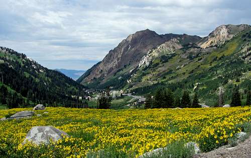
![Mount Superior from Albion Basin road]() Little Cottonwood Canyon wildflowers
Little Cottonwood Canyon wildflowers![Fresh snow at Albion Basin]() Albion Basin
Albion BasinLittle Cottonwood Canyon is surrounded by some of the highest and most impressive peaks in the Wasatch Mountains. To the north is the Cottonwood Ridge, where the terrain is so steep that there are few trails leading up this way, and to the south is the Alpine Ridge, where most of the Wasatch 11,000-foot peaks are found. Higher up in the canyon are the ski resorts of Snowbird and Alta, which can receive over 700 inches of snow in a good snow year, as well as scenic Albion Basin, which might just be the prettiest place in the Wasatch. The last part of the road leading up into Albion Basin past the mini-town of Alta transitions to dirt (but very well maintained and passable for any vehicle), and since this area is so popular there are free shuttles during summer weekends and holidays to get people to the usually already full parking lots at the Catherine Pass and Cecret Lake trailheads. In late summer there are all sorts of wildflowers in the basin, and on most hikes you’re likely to see moose in the area.
6. Big Cottonwood Canyon Scenic Byway
* 17 miles long (from mouth of canyon to top of road at Guardsman Pass)
* Highest Elevation: 9,700 feet
![Storm Peak from main canyon road]() Storm Mountain
Storm Mountain![Road to Guardsman Pass]() Guardsman Pass
Guardsman PassNear the lower parts of Big Cottonwood Canyon are impressive cliffs towering over the various picnic sites, and higher up in the canyon towards the ski resorts of Solitude and Brighton the canyon opens up more. Before you get to the Brighton parking lot you can turn north onto another road that will lead you all the way up to Guardsman Pass, and in this area are many big groves of aspen trees which turn from green to yellow in the fall. Guardsman Pass marks the highest paved road in the Wasatch, and a rough dirt road also leads from there down to Park City on the other side.
7. Mirror Lake Scenic Byway
* 35 miles long (from town of Kamas to Ruth Lake Trailhead)
* Highest Elevation: 10,715 feet
![Bald Mountain and Reids Peak]() Bald Mountain and Reids Peak
Bald Mountain and Reids Peak![Hayden Peak from Bald Mountain Pass Overlook]() Hayden Peak over Moose Lake
Hayden Peak over Moose LakeThe Mirror Lake Scenic Byway runs between the towns of Kamas, UT and Evanston, WY and skirts the western edge of the Uinta Mountain Range, which contain the highest peaks in the state of Utah. If wanting to just see the more scenic parts of the road, then one could simply drive through Kamas to get to the byway and then turn around near the Ruth Lake Trailhead, but if Christmas Meadows is the end destination then driving from Salt Lake City it would take the same amount of time regardless of whether you went through Kamas or Evanston. The prettiest part of the road is the section in between Provo River Falls and the Ruth Lake Trailhead, with the highest paved road in Utah topping out at Bald Mountain Pass at an elevation of 10,715 feet. At this overlook one can see numerous high Uinta peaks poking above the tree line, with lakes scattered throughout the endless sea of evergreen trees in every direction. This area has a more secluded feel than the Wasatch, and despite some areas being close enough to access in a day, most parts of the Uintas are better appreciated as part of an extended backpacking/camping trip.
7 Best Lake Hikes
Most everyone loves visiting a nice, scenic lake in the mountains. In general, these hikes are easier than the ones leading to the top of a mountain, and offer a destination that the whole family (young kids included) can enjoy. While these aren’t necessarily the easiest non-summit hikes around, in my opinion they offer the best overall scenery.
1. Ruth Lake
* Drive Time From SLC: 1 hour, 37 minutes
* Distance: 1.5 miles roundtrip
* Ruth Lake Trailhead: 10,150 feet
* Ruth Lake Elevation: 10,350 feet
* Elevation Gain: 200 feet
* Effort Required: 1/10
![Pond near Ruth Lake]() Pond near Ruth Lake
Pond near Ruth Lake![Hayden Peak reflection]() Hayden Peak reflection in Ruth Lake
Hayden Peak reflection in Ruth LakeThis hands-down offers the best scenery for the least amount of effort. The trail is well-marked, gradual, and short enough that most anyone can do it. The only challenge is the relatively long drive to get into the Uintas, but it takes you along the Mirror Lake Scenic Byway, which is one of the prettiest roads in the state of Utah.
2. Cecret Lake
* Drive Time From SLC: 51 minutes
* Distance: 1.6 miles roundtrip
* Cecret Lake Trailhead: 9,400 feet
* Cecret Lake Elevation: 9,880 feet
* Elevation Gain: 480 feet
* Effort Required: 1/10
![Albion Basin pink/red wildflowers]() Albion Basin wildflowers
Albion Basin wildflowers
![Cecret Lake wildflowers]() Cecret Lake wildflowers
Cecret Lake wildflowersFor the little amount of effort required, this is probably the most scenic hike that you can do in the Wasatch. Starting in beautiful Albion Basin, the trail winds past some campgrounds, through some wildflower-filled meadows, and then up a steeper rocky trail up to the lake. The parking lot at the trailhead fills up pretty quickly, even on weekdays, so arrive early if you want to avoid the crowds.
3. Lake Catherine
* Drive Time From SLC: 45 minutes
* Distance: 4 miles roundtrip
* Brighton Lakes Trailhead: 8,750 feet
* Catherine Lake Elevation: 9,950 feet
* Elevation Gain: 1,200 feet
* Effort Required: 2/10
![Lake Mary Sunset]() Lake Mary
Lake Mary
![Lake Catherine]() Lake Catherine
Lake CatherineThis trail will take you past three scenic lakes. Starting at the south end of the Brighton ski area parking lot, you’ll walk up underneath a couple chair lifts, then after 450 vertical feet you’ll cut to the right (southwest) into a short forested section. A short time later you’ll arrive at Lake Mary, which is actually a man-made dam, with Mount Millicent, Mount Wolverine, and Sunset Peak in the background. Keep going along the gradual trail to arrive at Lake Martha, and then hike up one last steep section to get to Lake Catherine. Since it’s higher than most trails in the Wasatch, the wildflowers are usually at their peak a little later here (August in a normal snow year)
4. American Fork Silver Lake
* Drive Time From SLC: 1 hour, 9 minutes
* Distance: 3.5 miles roundtrip
* Silver Lake Trailhead: 7,550 feet
* Silver Lake Elevation: 9,000 feet
* Elevation Gain: 1,450 feet
* Effort Required: 2/10
![Timpanogos Reflection]() Silver Lake Flat Reservoir
Silver Lake Flat Reservoir
![White Baldy over Silver Lake]() Silver Lake
Silver LakeThis trail starts at the parking lot near the north end of the scenic Silver Lake Flat Reservoir (which requires you to drive up a moderate dirt road), where you start out with a nice view of the Mount Timpanogos massif looking back to the south. Above some aspen groves the trail traverses a couple long switchbacks, and a little while farther the trail steepens just below the lake. Silver Lake is nestled below several impressive granite cliffs south of White Baldy.
5. Ibantik Lake
* Drive Time From SLC: 1 hour, 29 minutes
* Distance: 7 miles one way
* Crystal Lake Trailhead: 10,049 feet
* Ibantik Lake Elevation: 10,100 feet
* Elevation Gain: 1,100 feet
* Effort Required: 3/10
![Watson Lake]() Watson Lake
Watson Lake![Ibantik Lake Pano]() Ibantik Lake
Ibantik Lake
There are lakes galore on many of the hikes in the Western Uinta / Mirror Lake Road area, and this one will let you see the most for the least amount of effort. After getting to the southeast shore of Wall Lake, with nice views of Mount Watson to the west and Notch Pass to the north (where you’ll be going), the trail leads north past some interesting rock cliffs and nice meadows up to the pass at 10,600 feet. Descending down the other side are some nice views of Lovenia Lake below. After the trail straightens out again going north at 10,100 feet, just cut off the trail perpendicular to the east to find Ibantik Lake. On the way back down from Notch Pass, instead of taking the same trail back towards Wall Lake, take the one branching off to the west towards Clyde Lake. After passing by a few more lakes, including Clyde Lake, turn left (south) onto the trail near the base of Mount Watson's northeast ridge, to take a different loop trail leading back to the Crystal Lake Trailhead. This will allow you to see 15 total lakes on your hike. For an easier loop with less mileage and elevation gain (6 miles and 600 feet), the sidetrip to Ibantik Lake can be left out, but it's probably the most scenic and secluded one in this area.
6. Maybird Lake
* Drive Time From SLC: 36 minutes
* Distance: 7.5 miles roundtrip
* White Pine Trailhead: 7,650 feet
* Maybird Lake Elevation: 9,750 feet
* Elevation Gain: 2,100 feet
* Effort Required: 3/10
![Maybird Gulch]() Pfeifferhorn over Maybird Lake
Pfeifferhorn over Maybird Lake
![Red Pine Lake]() Red Pine Lake is also accessible from this trail
Red Pine Lake is also accessible from this trailThis is my favorite lake in the Wasatch, offering impressive views of Pfeifferhorn to the south and some nice views of the highest peaks on the Cottonwood Ridge on the other side of the canyon to the north. About a mile into the hike, take the right fork (indicated by sign directing you to Red Pine Lake, a more well-known scenic lake in its own right, albeit with more crowds and slightly lesser views of the major nearby peaks). After hiking higher, with some nice views looking down towards the mouth of Little Cottonwood Canyon, you’ll encounter another trail breaking off to the right from the main Red Pine Lake trail 2.5 miles from the trailhead (there’s a little footbridge crossing a stream here). Follow this faint trail for a little over another mile over the ridge into Maybird Gulch, and you’ll get to the main lake (there are actually three lakes, but the trail ends at the main one).
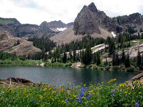
7. Lake Blanche
* Drive Time From SLC: 28 minutes
* Distance: 6 miles roundtrip
* Mill B South Fork Trailhead: 6,200 feet
* Lake Blanche Elevation: 8,920 feet
* Elevation Gain: 2,720 feet
* Effort Required: 4/10
![Lake Blanche on the way down]() Lake Blanche
Lake Blanche![Lake Florence]() Lake Florence
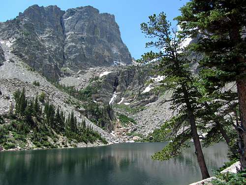
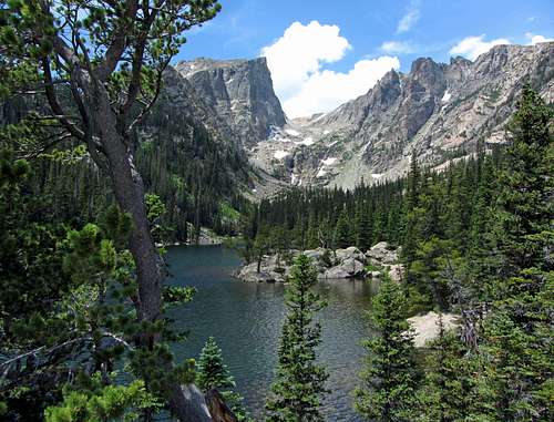
Lake FlorenceMany consider this to be the prettiest lake in all of the Wasatch, and after going there it’s hard to argue with this assessment. The trail itself offers a variety of scenery on the way up, and although steep overall, the grade is constant for the most part. The red stone slabs, green trees, dark rock on the peaks above, and various wildflowers make this one of the most colorful areas around, and definitely worth the extra effort (it’s a more difficult lake hike than most). For those willing to go the extra mile, nearby Lake Florence and Lake Lillian offer even more outdoor eye candy.
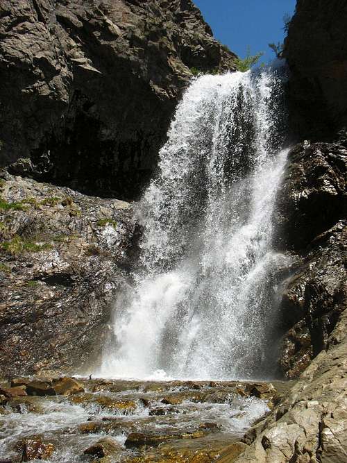
Some of the trails on these hikes are also used to get to peaks mentioned in the other lists below, so if you wanted to add a couple more mutually exclusive trails, or if lakes aren’t necessarily your thing, then you could look into visiting one of the waterfalls below:
![Adams Canyon waterfall]() Adams Canyon waterfall Adams Canyon waterfall |
![Bells Canyon waterfall]() Bells Canyon waterfall Bells Canyon waterfall |
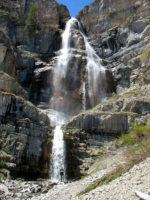
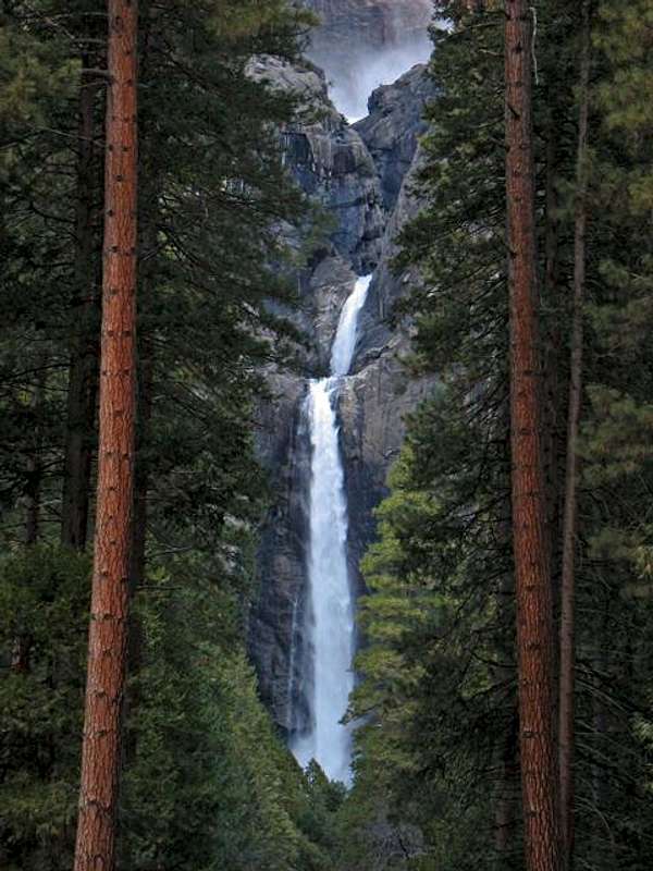
![Bridal Veil Falls]() Bridal Veil Falls Bridal Veil Falls |
![Stewart Falls]() Stewart Falls Stewart Falls |
7 Best Peak Hikes
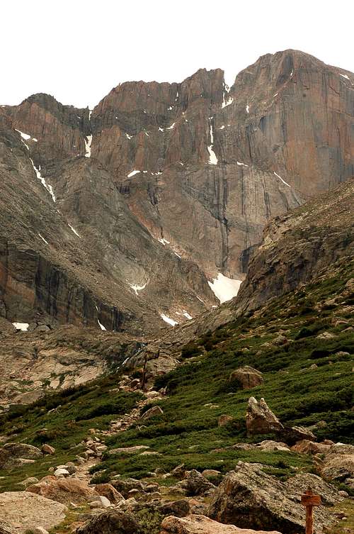
Among the mountains on this list are three of the four nearby Ultra-Prominence Peaks (mountains with at least 5,000 feet of prominence) that are doable as day hikes (apologies to Flattop Mountain in the Oquirrh Range, but Mount Nebo, Mount Timpanogos, and Deseret Peak are more impressive). Almost all of these peaks have well-defined trails the entire way, meaning there is no route-finding to speak of, even for Mount Nebo and Mount Raymond where the trails become fainter near the summit. Box Elder Peak is the only walk-up in which the trail completely disappears on the final parts of the north ridge below the summit. While Mount Raymond’s northeast ridge does have a few places that require using your hands for some short easy scrambling moves (there were just too many good scrambles to choose from, so I bumped it down to this list), it is not very sustained, hence its inclusion here.
1. Bald Mountain ~
* Drive Time From SLC: 1 hour, 32 minutes
* Distance: 2.8 miles roundtrip
* Bald Mountain Trailhead: 10,764 feet
* Summit Elevation: 11,947 feet
* Elevation Gain: 1,185 feet
* Technical Difficulty: Class 1
* Effort Required: 3/10
![Reids Peak and Bald Mountain ...]() Bald Mountain over Wall Lake
Bald Mountain over Wall Lake![Bald Mountain Eastern Wall]() Eastern cliffs
Eastern cliffsLocated at the western edge of the Uinta Mountains, this is the best bang for your buck trail hike peak around since it gives awesome views (especially of the dozens of nearby lakes) for minimal effort. The trail is short enough that most anyone can make it to the top, but you’ll want to keep a close eye on younger children near the sheer cliffs dropping down to the east below the summit. Also, be aware that afternoon lightning storms are more common in this area.
2. Mount Raymond ~
* Drive Time From SLC: 35 minutes
* Distance: 8 miles roundtrip
* Butler Fork Trailhead: 7,080 feet
* Summit Elevation: 10,241 feet
* Elevation Gain: 3,161 feet
* Technical Difficulty: Class 2+
* Effort Required: 5/10
![Raymond summit over Big Cottonwood Canyon]() Raymond summit
Raymond summit
![Mount Raymond fall colors]() Mount Raymond
Mount RaymondThe approach from Butler Fork passes through some beautiful groves of aspen trees, with nice views of Cottonwood Ridge to the south as you get higher. The northeast ridge of Mount Raymond crosses some steep rocky terrain, giving a small glimpse into the types of obstacles faced on some of the more difficult scrambles listed in the next section below (this would be a good warm up for one of those hikes if you’re new to scrambling).
3. Deseret Peak
* Drive Time From SLC: 1 hour, 16 minutes
* Distance: 7 miles roundtrip
* Loop Campground Trailhead: 7,470 feet
* Summit Elevation: 11,031 feet
* Elevation Gain: 3,600 feet
* Technical Difficulty: Class 1+
* Effort Required: 5/10
![Deseret Peak]() Deseret Peak
Deseret Peak
![Deseret Peak oasis]() Highest peak in the Stansbury Mountains
Highest peak in the Stansbury Mountains
Located above an alpine oasis in the Stansbury Mountains, this peak offers unique views of the desert terrain to the west and the salt flats around the southwest corner of the Great Salt Lake. For the best experience on the mountain, go up the South Willow Trail and down the Pockets Fork Trail for a nice loop (the stats above are for this route).
4. Ben Lomond ~
* Drive Time From SLC: 55 minutes
* Distance: 16 miles roundtrip
* North Ogden Divide Trailhead: 6,200 feet
* Summit Elevation: 9,712 feet
* Elevation Gain: 3,512 feet
* Technical Difficulty: Class 1+
* Effort Required: 6/10
![Ben Lomond from Skyline Trail]() Ben Lomond ...
Ben Lomond ...![Ben Lomond over Ogden]() ... over city of Ogden
... over city of OgdenTowering over the city of Ogden, the summit of this well-known peak can be accessed via the long but gentle Skyline Trail. From the top there are impressive views of the slightly higher Willard Peak to the north and Willard Bay down below to the west.
5. Mount Nebo ~
* Drive Time From SLC: 1 hour, 43 minutes
* Distance: 9 miles roundtrip
* North Route Trailhead: 9,200 feet
* Summit Elevation: 11,928 feet
* Elevation Gain: 3,400 feet
* Technical Difficulty: Class 2
* Effort Required: 6/10
![Nebo north ridge trail]() North ridge
North ridge
![Fall colors below Mount Nebo]() Mount Nebo
Mount NeboRising over 7,500 feet above the town of Nephi, the summit of the highest mountain in the Wasatch Range offers expansive views in every direction. Upon arriving at a pass to the northwest of the peak north of Mount Nebo, the trail descends down to Wolf Pass and then ascends steeply up Mount Nebo’s north ridge. From there the ridge narrows and the trail becomes faint closer to the top, but despite some exposed terrain no scrambling is required.
6. Mount Timpanogos ~
* Drive Time From SLC: 54 minutes
* Distance: 15 miles roundtrip
* Timpooneke Trailhead: 7,360 feet
* Summit Elevation: 11,750 feet
* Elevation Gain: 4,400 feet
* Technical Difficulty: Class 1+
* Effort Required: 7/10
![Wildflowers below Timp summit]() Timpanogos wildflowers
Timpanogos wildflowers![Summit above snowfield]() Timpanogos snowfield
Timpanogos snowfieldThe most popular mountain in the entire state of Utah has a little bit of everything, with views consisting of waterfalls, wildflowers, beautiful alpine meadows, rugged ridges high above the tree line, and mountain goats if you’re lucky. There are two popular trails leading to the top. The Aspen Grove trail features several waterfalls on the way up and better overall scenery (along with the Cecret Lake and Lake Blanche hikes it's probably the most scenic trail in all of the Wasatch), but is slightly steeper and more difficult, and includes a small section of off-trail class 2 hiking before meeting up with the Timpooneke Trail just below the saddle overlooking Utah Valley. The longer but less steep Timpooneke Trail is considered by most to be the easier option, so it's stats are the ones listed above, and when done as a loop with a descent of the permanent snowfield later in the summer, offers one of the best hiking experiences in all of the Rocky Mountains. If you only do one hike in the Salt Lake area, make sure it’s this one. Go on a weekday to avoid the larger crowds.
7. Box Elder Peak ~* Drive Time From SLC: 55 minutes
* Distance: 10 miles roundtrip
* Deer Creek Trailhead: 6,780 feet
* Summit Elevation: 11,101 feet
* Elevation Gain: 4,500 feet
* Technical Difficulty: Class 2
* Effort Required: 7/10
![Box Elder alpenglow]() Box Elder alpenglow
Box Elder alpenglow![Box Elder Peak]() Box Elder cirque
Box Elder cirque
Box Elder Peak, a relatively unknown peak due to its close proximity to the much more popular Mount Timpanogos, is a very under-rated walkup. The views around the meadow at the intersection of the Deer Creek and Dry Creek trails are top-notch, and the best rewards are reserved for those willing to hike the remainder of the way up the trail-less north ridge.
If you're looking for an easy lower-elevation summit hike that can be done safely almost year round (when the higher peaks are covered in snow), these ones offer nice views as well:
7 Best Peak Scrambles
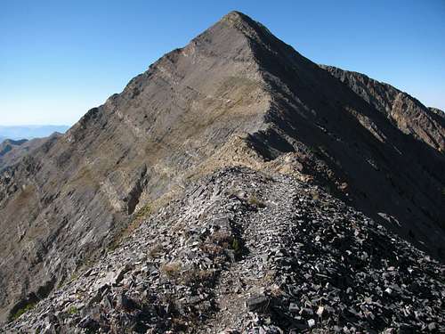
The Big Cottonwood Canyon and Little Cottonwood Canyon area of the Wasatch showcases what I feel is the best selling point of all when it comes to why the Salt Lake City area is unmatched as a day hiking hub. The sheer abundance of quality non-technical scrambles located in such a small geographical area made it hard to narrow this list down to seven peaks, and others may completely disagree on which ones are the best, but of the scrambles listed below you won’t find a stinker in the bunch. They all have terrain on which some class 3 scrambling is required (easy climbing with the aid of your hands), and a few of them require a couple more difficult class 4 moves, which for most people will involve down-climbing while facing into the mountain, hence the "+" part of the 3+ technical rating. Lone Peak and Twin Peaks are a cut above the other SLC day hikes mentioned here in terms of the amount of energy you’ll need to expend to obtain the summit, but if exposure (the amount of air beneath your feet on the steepest section of scrambling) is the main deterrent, then here's my biased order of the following hikes listed from least exposed to most exposed: Mount Olympus, Mount Superior, Pfeifferhorn, Sundial Peak, Lone Peak, Broads Fork Twin Peaks, & Devil's Castle.
1. Devil’s Castle ~
* Drive Time From SLC: 51 minutes
* Distance: 3.6 miles roundtrip
* Cecret Lake Trailhead: 9,400 feet
* Summit Elevation: 10,920 feet
* Elevation Gain: 1,520 feet
* Technical Difficulty: Class 3+
* Effort Required: 4/10
![Devil's Castle west summit]() West summit
West summit![Devil's Castle from Mount Baldy]() Devil's Castle
Devil's CastleThis peak provides the best bang for your buck of any scramble around. Getting to the top and back can be done relatively quickly (going past the previously mentioned Cecret Lake), but the scramble over the three main summits is among the most technically-demanding of any of the Wasatch peaks (getting to the highest middle summit from the west requires some very exposed class 4 moves over and around a knife-edge ridge). Albion Basin is heavily-visited in late summer, when the bright wildflowers offer a stark contrast to the intimidating north face above.
2. Mount Olympus
* Drive Time From SLC: 18 minutes
* Distance: 7 miles roundtrip
* Tolcat Canyon Trailhead: 4,840 feet
* Summit Elevation: 9,026 feet
* Elevation Gain: 4,200 feet
* Technical Difficulty: Class 3
* Effort Required: 6/10
![Mount Olympus from I-215 to the north]() Mount Olympus
Mount Olympus![Mount Olympus summit view]() Summit view
Summit viewRising straight up above the east side of the Salt Lake Valley, this popular mountain is the most easily accessible of any of the other mountains on this list (which is saying something, considering how close the mountains are to the cities on the Wasatch Front). The reward for getting up the steep trail and doing a little easy scrambling at the top is one of the best summit views of any peak in the range, with many of the centrally located Wasatch 11ers visible to the south.
3. Mount Superior ~
* Drive Time From SLC: 41 minutes
* Distance: 5.6 miles roundtrip
* Cardiff Pass Trailhead: 8,640 feet
* Summit Elevation: 11,132 feet
* Elevation Gain: 2,750 feet
* Technical Difficulty: Class 3
* Effort Required: 6/10
![Monte Cristo from Sundial]()
Monte Cristo
![Mount Superior from Albion Basin]() Mount Superior
Mount Superior
Rising abruptly above Alta at the back of Little Cottonwood Canyon, this impressive mountain (Monte Cristo is actually the name of the highest summit but I like calling the whole thing Mount Superior) has some of the most sustained scrambling on its standard route of any Wasatch mountain (White Baldy might be the only peak with more). As you hike and scramble up the east ridge from Cardiff Pass, you’ll be treated to top-notch views of jagged peaks and ridges all around, especially from the final summit of Monte Cristo (below which is the most difficult part of the Cottonwood Ridge mountaineering traverse).
4. Sundial Peak ~
* Drive Time From SLC: 28 minutes
* Distance: 9 miles roundtrip
* Mill B South Fork Trailhead: 6,200 feet
* Summit Elevation: 10,320 feet
* Elevation Gain: 4,150 feet
* Technical Difficulty: Class 3
* Effort Required: 7/10
![Sundial Peak reflection]() Sundial Peak over Lake Blanche ...
Sundial Peak over Lake Blanche ...
![Lake Lillian]() ... and Lake Lillian
... and Lake Lillian
The previously mentioned Lake Blanche is arguably the most scenic lake in the entire Wasatch, with Sundial towering above and Monte Cristo looming in the background. Sundial Peak, the emblem of the Wasatch Mountain Club, is actually just the high point of a lower ridge extending north from Cottonwood Ridge (go up the southwest slopes of Sundial Peak to get to the saddle between Sundial Peak and Cottonwood Ridge), but the enjoyable exposed scrambling along the south ridge on the standard route to the top makes up for its lack of prominence.
5. Pfeifferhorn ~
* Drive Time From SLC: 36 minutes
* Distance: 10 miles roundtrip
* White Pine Trailhead: 7,626 feet
* Summit Elevation: 11,326 feet
* Elevation Gain: 3,700 feet
* Technical Difficulty: Class 3
* Effort Required: 7/10
![Pfeifferhorn Sunrise]() Pfeifferhorn
Pfeifferhorn![Pfeifferhorn east face]() East ridge
East ridgeNicknamed the “Little Matterhorn”, this impressive peak is located in the heart of the Wasatch. The main trail goes past scenic Red Pine Lake (sharing its initial approach with that of the previously mentioned Maybird Lake), with some boulder-hopping needed to reach the Alpine Ridge above and a short section of scrambling before the final ascent to the summit. There are great views to the south towards Box Elder Peak and Mount Timpanogos, to the west towards the rest of the Alpine Ridge, and north towards the Cottonwood Ridge.
6. Broads Fork Twin Peaks ~
* Drive Time From SLC: 28 minutes
* Distance: 10 miles roundtrip
* Broads Fork Trailhead: 6,200 feet
* Summit Elevation: 11,330 feet
* Elevation Gain: 5,200 feet
* Technical Difficulty: Class 3+
* Effort Required: 9/10
![Sunset on Broads Fork Twin Peaks]() Twin Peaks
Twin Peaks![Broads Fork Wildflowers Below Sunrise Peak]() Broads Fork meadow
Broads Fork meadowThis is the highest peak on the Cottonwood Ridge, where the most difficult scrambling and some of the most rugged terrain in the Wasatch is found. The loose scree field leading up to the ridge from upper Broads Fork requires considerable effort to ascend, and the crux of the east ridge is a 20-foot, class 4 chimney climb. The views looking down on Big and Little Cottonwood Canyon make the struggle worth it, though. The idyllic lower meadow offers a rewarding destination for the more casual hiker.
7. Lone Peak ~
* Drive Time From SLC: 40 minutes
* Distance: 12.6 miles roundtrip
* Jacob’s Ladder Trailhead: 5,600 feet
* Summit Elevation: 11,253 feet
* Elevation Gain: 5,700 feet
* Technical Difficulty: Class 3+
* Effort Required: 9/10
![Lone Peak from Suncrest Dr.]() Lone Peak
Lone Peak![Lone Peak summit]() North Ridge
North Ridge
Considered by many to be the most difficult mountain to climb in the Wasatch, this monarch's high, exposed summit is a very worthwhile goal. The spectacular granite cirque offers some of the best rock-climbing around, and crossing the north ridge knife edge to stand on top of the tiny summit block with sheer drop-offs on three sides provides quite a rush. Most people use the southwest-facing Jacob’s Ladder trail, which despite being the shortest route still requires you to gain over a vertical mile of elevation and is quite steep and hot during summer afternoons. Some use the Bear/Cherry Canyon trail instead (longer, more elevation gain) since it's less steep and passes by a stream that can be used to obtain water.
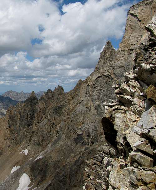
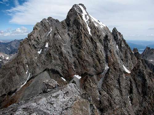
The seven hikes listed above have as their goal just a single summit, but there are several more difficult ridge scrambles combining multiple peaks in one shot. These are my personal favorites, offering the most rugged alpine scenery around:
|
|
|
![Mount Timpanogos from Box Elder]() Timpanogos Traverse ~ Timpanogos Traverse ~ |
|
7 Best Neighboring Day Hike Areas
There’s a good reason why Salt Lake City was nicknamed the Crossroads of the West. Its central location in the western United States makes it the ideal spot from which to branch out and explore other impressive mountain ranges within the Rocky Mountain Chain, as well as other areas notable for their outstanding scenery. All of the areas listed below have that special “it” factor, where you can immediately sense that you’re entering a special place upon driving in. While other areas may have peaks just as impressive as those listed below (such as the Wind River Range in Wyoming, for example), these ones offer easy access to the mountains and a wide variety of day hikes for every level of hiker. For me personally, it’s been easier to schedule family trips to areas like these, since there are decent hotels nearby to sleep in and things to see for the wife and kids as well. Five of the areas listed below were easy to come up with since they are already national parks, but the San Juan Mountains of Colorado and Sawtooth Mountains of Idaho offer nice alternatives for those seeking more solitude away from the crowds. In coming up with this list I tried to consider areas that could be reached within a day’s drive of Salt Lake City, so I again arbitrarily used the 12 hour requirement, tracking the time it takes to drive to a nearby town (if it’s for a national park, it’s just outside the boundaries since that’s where there are generally more affordable hotel rates). From Salt Lake City it's possible to drive to any trailhead in the American Rockies or the Sierra Mountains in under 12 hours, with only some sections of the Cascade Mountains taking slightly longer to reach.
![Crossroads of the West]() Salt Lake City is surrounded by other awesome hiking areas in every direction, all accessible in less than a day's drive.
Salt Lake City is surrounded by other awesome hiking areas in every direction, all accessible in less than a day's drive.
I’ve also listed a single (usually well-known) must-do peak hike/scramble for each area, which will give you one of the most scenic and rewarding day hikes around. If you’ve already done some of the scrambles above or something equivalent to them then you shouldn’t have any problems with these ones. Despite not really requiring much scrambling compared to the others and being much shorter in length, the Angels Landing hike is quite exposed and probably not a good idea for anyone with a debilitating fear of heights. Half Dome and Longs Peak will definitely require good conditioning to tackle in a single day, but the route-finding on their standard routes is easy enough that many brave souls attempt them as their first big peak hikes, despite the fact that there is a significant amount of scrambling below the summit of each one. The remaining hikes on the list require a bit more route-finding, so it may help to have at least one person in your group who is more experienced and confident with scrambling.
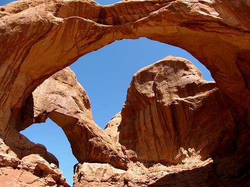
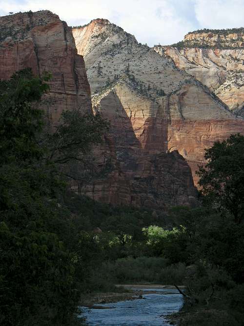
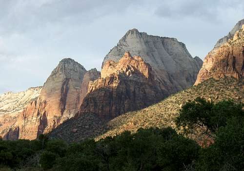
1. Zion National Park, UT
* Drive Time From SLC to Springdale, UT: 4 hours, 22 minutes
![Sunset on Bridge Mountain]() Bridge Mountain
Bridge Mountain
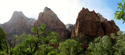
![Court of the Patriarchs]() Court of the Patriarchs
Court of the PatriarchsThis is one of the more unique national parks in the country, with impressive cliffs rivaling those found in Yosemite. Although it’s not necessarily a great draw for peak baggers, there are some great hikes here, especially along the popular Zion Canyon. Among the best slot canyons are Hidden Canyon, the Narrows, and the Subway, which involve wading in water and even a little scrambling. Despite all of the lush vegetation found between the steep sandstone cliffs, it does get quite hot here, so the best times to come are typically in late spring or early fall when it’s cool but the flash flood danger is relatively low. Shuttles are required to get around Zion Canyon, but they’re pretty good about being on time.
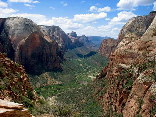
![View south of Zion Canyon]() Zion Canyon
Zion CanyonAngels Landing ~
* Drive Time From Springdale: 13 minutes
* Distance: 5 miles roundtrip
* Grotto Trailhead: 4,300 feet
* Summit Elevation: 5,785 feet
* Elevation Gain: 1,488 feet
* Technical Difficulty: Class 2+
* Effort Required: 4/10
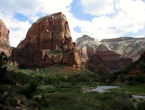
![Angels Landing]() Angels Landing
Angels Landing
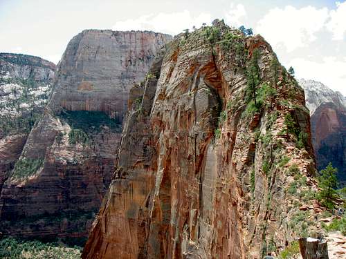
![Great White Throne and Angels Landing]() Chains route
Chains routeAngels Landing is a great goal for those who want awesome views up and down Zion Canyon and aren’t afraid of heights. After a short, steep hike from the canyon floor (with the impressive Great White Throne on the other side), the paved trail goes through a narrow canyon, and then switchbacks up Walter’s Wiggles to Scout Lookout. This is where many people stop, as the last half mile is quite exposed, although the trail is well-maintained and does not really require any scrambling (the chains are more to comfort those wanting something to hold onto while gazing down the cliffs dropping a thousand feet on each side). The skinniest part of the trail is about the width of a sidewalk, but most of the time you’re actually not that close to the cliffs themselves.
2. Glacier National Park, MT
* Drive Time From SLC to St. Mary, MT: 10 hours, 8 minutes
![Lower Two Medicine Lake]() Lower Two Medicine Lake
Lower Two Medicine Lake
![Swiftcurrent Creek below Grinnell]() Many Glacier area
Many Glacier areaI’ll be bold and say that Glacier National Park has the best views and scenery of any location in the lower 48 states. Not only is it one of the best places for viewing wildlife (it’s easier to see grizzly bears here than anywhere else, which may or may not be incentive to get out into the backcountry => just be sure to carry bear spray), but the lake, waterfall, glacier, and mountain views here can’t be beat. My personal favorite areas are Logan Pass and the Many Glacier area, as they probably offer the best starting points for some really nice day hikes, but there are other great areas as well. The only downside may be that the rock on most of the peaks is generally a little loose and crumbly, but once you get used to that it’s not too bad.
![Hidden Lake overlook]() Hidden Lake overlook
Hidden Lake overlookReynolds Mountain ~
* Drive Time From St. Mary: 32 minutes
* Distance: 6 miles roundtrip
* Hidden Lake Trailhead: 6,646 feet
* Summit Elevation: 9,125 feet
* Elevation Gain: 2,500 feet
* Technical Difficulty: Class 3
* Effort Required: 5/10
![Reynolds Mountain]() Reynolds Mountain
Reynolds Mountain
![Reynolds' exposed scrambling]() Southwest slopes route
Southwest slopes routeReynolds Mountain is the horn-shaped peak presiding over Logan Pass at the top of the Going-to-the-Sun Road, which is probably the most scenic mountain road in the United States. Picking just one must-do hike in Glacier is impossible since there are so many other great peaks, but this one is nice since you get some amazing scenery for minimal effort, and it offers a brief glimpse into what some of the other longer, more difficult peak scrambles are like. This popular trail starts at the Logan Pass Visitor Center and proceeds up to a pass overlooking Hidden Lake. From the pass between Reynolds Mountain and Clements Mountain, take the faint trail breaking off to the south. You’ll cross some snow as you traverse the east side of a little ridge, and then go right under the west face of the peak (with awesome views looking down towards Hidden Lake) as you circle around to the base of the southwest slopes between Dragon’s Tail and Reynolds Mountain. The route goes up through some loose scree until a few hundred feet below the summit, cuts back to the west for some solid scrambling, and then loops back around to the east taking you to the summit, with some cool exposed cliffs below.
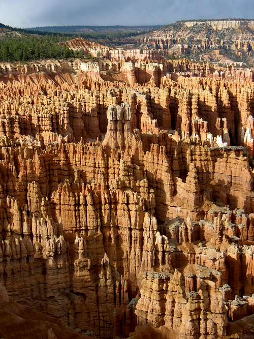
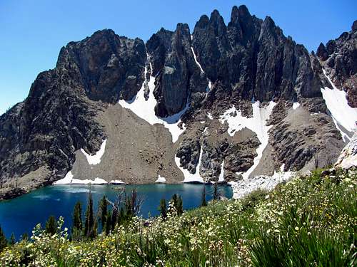
3. San Juan Mountains, CO
* Drive Time From SLC to Ouray, CO: 6 hours, 5 minutes
![Sunset at Molas Lake]() Molas Lake
Molas Lake
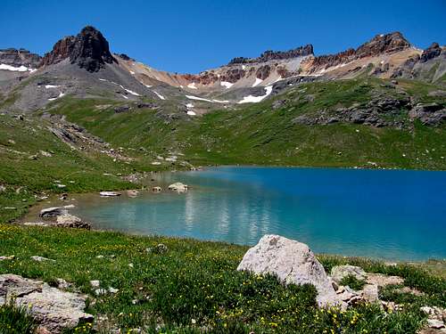
![Ice Lake]() Ice Lake
Ice LakeThe San Juans are Colorado’s finest range, and while the most impressive peaks in the Needle and Grenadier sub-ranges require backpacking to reach, the range still contains plenty of day hiking opportunities. Surrounded by a vast sea of mountains, the towns of Telluride, Durango, Lake City, and Silverton offer great bases from which to explore, but Ouray may be the best mountain town in the state. Known primarily as an ice climbing mecca, it marks the northern end of the Million Dollar Highway, one of the most scenic roads in the Rocky Mountains, and really conveys a sense of the rich mining history in the area. There is a wide variety of terrain in the San Juans, from the gentle grassy slopes of the Uncompahgre Wilderness to the rugged granite peaks of the Weminuche Wilderness and volcanic origins of the Mount Sneffels Wilderness, and this area also contains the prettiest lakes in the state.
![Sneffels Range]() Sneffels Range
Sneffels RangeMount Sneffels ~
* Drive Time From Ouray: 28 minutes
* Distance: 6 miles roundtrip
* Yankee Boy Basin Trailhead: 11,350 feet
* Summit Elevation: 14,150 feet
* Elevation Gain: 2,900 feet
* Technical Difficulty: Class 3
* Effort Required: 6/10
![Mount Sneffels northeast aspect]() Mount Sneffels
Mount Sneffels
![Southwest Ridge spires]() Southwest ridge route
Southwest ridge routeMount Sneffels stands sentinel over the impressive northern escarpment of the San Juans, and is the clear monarch of the area. There is a very aesthetic approach from Blue Lakes Basin, but most opt to climb the peak using the shorter approach from Yankee Boy Basin, which is one of the best places to spot columbines (Colorado state flower). After driving up some exciting shelf sections of a dirt road and arriving at the lower trailhead (there’s a restroom here), you can either continue driving up the rough road (if you’ve got a good 4WD vehicle) or just hike up it, which is better since you get to enjoy the scenery better. The Lavender Col standard route is loose and not as fun to ascend as descend, so I’d recommend scrambling up the much more enjoyable southwest ridge (class 3), and then hiking back down the standard route (class 2+, with one short class 3 move at V-notch) for an awesome scenic loop. After hiking to Blue Lakes Pass, the first part of the scramble weaves under sharp pinnacles through several gullies filled with loose rock. Higher up the ridge, the route opens up onto more solid rock, with some nice exposure as you approach the summit.
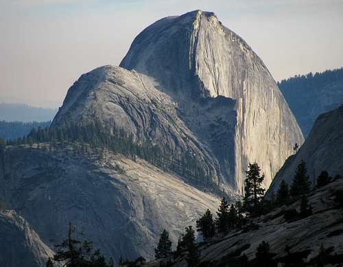
4. Yosemite National Park, CA
* Drive Time From SLC to El Portal, CA: 10 hours, 31 minutes
![Yosemite Falls and Sequoias]() Yosemite Falls
Yosemite Falls
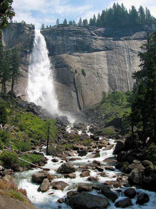
![Nevada Falls]() Nevada Falls
Nevada FallsThe home of big wall climbing has many things that you just can’t find anywhere else, and it doesn’t take long in Yosemite to see why it is what kick-started the great national park system. Among the unique sights you’ll see are giant sequoias, awesome waterfalls (most impressive in the spring or early summer), and of course world-class granite walls which will challenge even the most skilled of climbers. The most popular area is Yosemite Valley, which gets very crowded in the summer, so for a more enjoyable experience it is best not to come during holidays or weekends. Tioga Road offers access to other nice day hiking areas such as Tuolumne Meadows and Tenaya Lake, which are typically less crowded.
![Tenaya Lake from the west]() Tenaya Lake
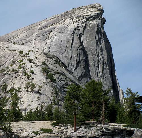
Tenaya LakeHalf Dome ~
* Drive Time From El Portal: 31 minutes
* Distance: 15.4 miles roundtrip
* Happy Isles Trailhead: 4,105 feet
* Summit Elevation: 8,842 feet
* Elevation Gain: 4,800 feet
* Technical Difficulty: Class 3
* Effort Required: 8/10
![Half Dome from Olmstead Point]() Half Dome
Half Dome
![Half Dome east aspect]() Cables route
Cables routeHalf Dome is impressive from every angle you look at it, and is probably the most climbed peak in all of the Sierra Mountains, and maybe even the entire United States. As such, permits are required (which must be purchased well in advance in a lottery system on the www.recreation.gov website), limiting the number of cables users to 300 a day (which is a good thing, since in the past sometimes over a thousand people a day would climb them, causing some major congestion). Near the bottom, the Mist Trail and Muir Trail split and then meet back up again above the big waterfalls. To avoid the late-day crowds, I’d recommend taking the steeper Mist Trail on the way up (where you can get close to Vernal Falls and Nevada Falls, two very impressive waterfalls that give the trail its name) and taking the Muir Trail on the way down for an awesome loop. Above the falls, the trail is a little sandy and not as scenic as it progresses upwards through a forest of sequoias, but once you get closer to the sub-dome east of Half Dome’s summit you’ll see why cables had to be installed for average hikers to make it to the top. The granite is slick, but with the help of cables (which are usually up between Memorial Day and Columbus Day) and wooden planks, all it takes is a little upper body strength to get to the top. You can bring your own gloves to help grip the cables, but there’s usually a big pile of them at the bottom to choose from.
5. Sawtooth Mountains, ID
* Drive Time From SLC to Stanley, ID: 5 hours, 42 minutes
![Gorgeous Thompson Lake]() Gorgeous un-named lake ...
Gorgeous un-named lake ...
![Thompson summit south view]() ... in the Sawtooth Mountains
... in the Sawtooth MountainsLocated in central Idaho, the Sawtooth Mountains are a hidden gem, even among more knowledgeable hikers. The range is filled with countless pristine lakes and saw-shaped ridges (hence the name), with enough to keep anyone happily occupied. While many people choose to backpack here, there are still many worthwhile day hikes as well. While the Sawtooths don’t have the elevation of some other areas, they are just as rugged as the peaks you’ll find almost anywhere else, with views similar to the more popular Sierra or Teton Mountains. If you’re craving incredible surroundings without the crowds, then this is the place for you.
![Sawtooth alpenglow & wildflowers]() Sawtooth sunrise
Sawtooth sunriseThompson Peak ~
* Drive Time From Stanley: 11 minutes
* Distance: 13 miles roundtrip
* Redfish Lake Trailhead: 6,560 feet
* Summit Elevation: 10,751 feet
* Elevation Gain: 4,250 feet
* Technical Difficulty: Class 3
* Effort Required: 8/10
![Thompson Peak over 9,000 foot lake]() Thompson Peak
Thompson Peak
![Thompson pond reflection]() South couloir route wraps around behind right side
South couloir route wraps around behind right side Thompson Peak is the highest peak in the Sawtooths. The standard trail starts near Redfish Lake, with jaw-dropping views of jagged Heyburn Mountain and Horstmann Peak to the southwest as you hike along the gradual trail on the ridge above Fishhook Creek. After a few miles the trail steepens, traversing around the southwest slopes of Williams Peak. Upon reaching a meadow the trail disappears, so just keep moving southwest towards the un-named lake at 9,000 feet. From this beautiful lake you’ll catch an awesome view of Thompson Peak to the southwest and its impressive east ridge. After moving west through loose talus past a couple large ponds, you can ascend the headwall between Thompson Peak and Williams Peak either on its south end (snow usually stays on this steep slope longer, giving a shorter but more difficult route to the summit) or north end (this takes you a little out of the way, but is technically easier and gives nice views of Thompson’s north face from a distance). The route then circles around Thompson’s west slopes through a couple snowfields, leading up to the saddle between Thompson Peak and Mickey’s Spire. Follow the south ridge up into the south couloir, and then scramble a few hundred feet to the exposed summit.
6. Rocky Mountain National Park, CO
* Drive Time From SLC to Estes Park, CO: 7 hours, 35 minutes
![Hallett Peak over Emerald Lake]() Emerald Lake
Emerald Lake
![Dream Lake]() Dream Lake
Dream LakeMany flatlanders heading west to the Rocky Mountains never venture past Colorado, as there are great hiking areas all throughout the state. Rocky Mountain National Park is one of those areas. Some of the more popular hikes in the Bear Lake area can get crowded (though farther away from the mountains than Salt Lake City, nearby Denver has more people), but the abundant scenery and wildlife is worth the price of admission, and there are many lesser known areas worth a look as well. Driving the Trail Ridge Road gives a glimpse into the extensive terrain above tree line, and will give you lots of ideas for places to hike as well.
![Longs Peak and Hallett Peak]() Longs Peak (left) and Hallett Peak (right) from Flat Top Mountain
Longs Peak (left) and Hallett Peak (right) from Flat Top MountainLongs Peak ~
* Drive Time From Estes Park: 20 minutes
* Distance: 14 miles roundtrip
* Longs Peak Trailhead: 9,260 feet
* Summit Elevation: 14,259 feet
* Elevation Gain: 5,100 feet
* Technical Difficulty: Class 3
* Effort Required: 10/10
![Longs Peak Diamond Face]() Longs Peak
Longs Peak
![Steep cliffs at the Narrows]() Narrows section on Keyhole route
Narrows section on Keyhole routeLongs Peak is a special mountain for me, as it is for many others, because it is the one that really gave me the hiking/climbing bug. As the most popular of the 58 14ers (peaks over 14,000 feet) in the state of Colorado, and also one of the more strenuous by its standard route, everyone hiking in the state should try this one at least once. There are many quality technical routes, the most notable of which are found on the famous Diamond, a 2,000 foot sheer rock face that is one of the highest big walls in North America. The standard Keyhole Route is long, with a significant amount of scrambling at the top, but bullseye symbols along the way make route-finding easy, and the views looking down into Glacier Gorge are great. After the Keyhole the route crosses a series of ledges, goes up a long steep gully called the Trough (at the top there is a big chockstone which most consider to be the crux of the route), goes past some steep cliffs dropping below the Narrows, and then ascends the final Homestretch, a 45 degree slope of slick granite with a couple tracks worn into the rock that help going up and down. Start early (before sunrise to be off of the summit by noon) to avoid thunderstorms.
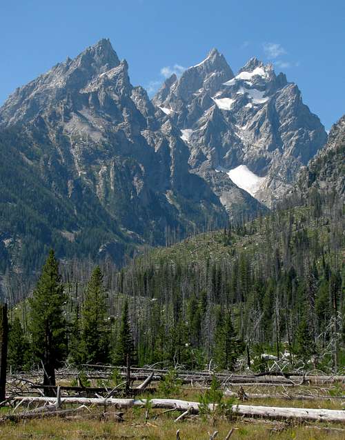
7. Grand Teton National Park, WY
* Drive Time From SLC to Jackson, WY: 4 hours, 38 minutes
![Cathedral Group from Teton Park Road]() Cathedral Group
Cathedral Group
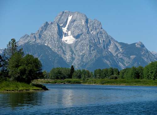
![Mt. Moran from Oxbow Bend]() Mount Moran
Mount MoranAny avid climber will eventually find their way to the iconic Tetons, which as a whole offer more challenging peaks and routes than anywhere else I’ve mentioned in such a condensed area. Even though most of the big peaks require technical climbing to achieve the summit (this is, after all, the birthplace of alpinism in the United States), there are some that can be reached by scrambling, and still some lower ones with trails to the top. There are also plenty of easy hikes starting in the valley below, which the whole family can enjoy. Most hikes up into these mountains require a lot of elevation gain, so you’ll want to be in good shape for them, but the views of the range’s many jagged and rugged peaks from up above make the extra work totally worth it.
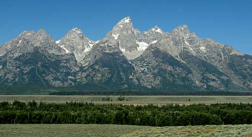
![Tetons from near Glacier View Turnout]() Famous Teton skyline
Famous Teton skylineMiddle Teton ~
* Drive Time From Jackson: 34 minutes
* Distance: 15 miles roundtrip
* Lupine Meadows Trailhead: 6,732 feet
* Summit Elevation: 12,804 feet
* Elevation Gain: 6,100 feet
* Technical Difficulty: Class 3
* Effort Required: 10/10
![Middle Teton & Disappointment Peak]() Middle Teton
Middle Teton
![West face of Middle Teton]() West face below south couloir route
West face below south couloir routeMiddle Teton is probably the easiest of the high peaks found in the park, which speaks to the overall ruggedness of the range since it still requires over 6,000 feet of elevation gain, most of which is over boulders and snow fields with no trail. The well-maintained trail up Garnet Canyon meanders around the run-off stream / falls coming down from the glaciers above until you get to a meadow where some choose to camp for the night. Continuing up the south fork of the canyon you will encounter various size boulders (some bigger than cars) and big patches of snow, none of which are steep enough to warrant the use of an ice axe though, as long as you’re there late enough in the summer (August is best). Once at the saddle between South Teton and Middle Teton, the route turns north towards the southwest couloir, where some easy scrambling will get you to the exposed summit. From there the views of the surrounding peaks, especially the Grand Teton to the north, are amazing.
Other Hikes and Climbs
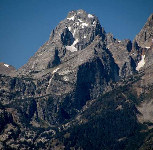
![Grand Teton from Middle Teton]() Grand Teton
Grand Teton
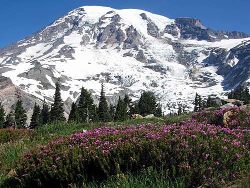
![Mount Rainier over magenta wildflowers]() Mount Rainier
Mount Rainier
While I’ll readily admit that these lists are somewhat subjective, I’m hoping they at least help out those who may not be sure where to start when it comes to getting out into the mountains around Salt Lake City, and show why it is such an awesome hiking hub. It caters to every level of hiker, and is the perfect place for a climber to hone his or her skills in preparation for more difficult mountaineering endeavors.
![Wasatch Elevener Collage]() The twenty ranked peaks in the Wasatch Range with summits over 11,000 feet, some of which made the Best Peak Hikes and Best Peak Scrambles lists above, offer a worthwhile goal for local peak baggers.
The twenty ranked peaks in the Wasatch Range with summits over 11,000 feet, some of which made the Best Peak Hikes and Best Peak Scrambles lists above, offer a worthwhile goal for local peak baggers.
I’m curious what favorite hikes others may have picked that meet these same criteria, so feel free to add a comment in the section below, as there are still many other hikes and areas not mentioned here that I’d like to get out and see. Happy trails!


Comments
Post a Comment