San Jacinto Peak summit area.
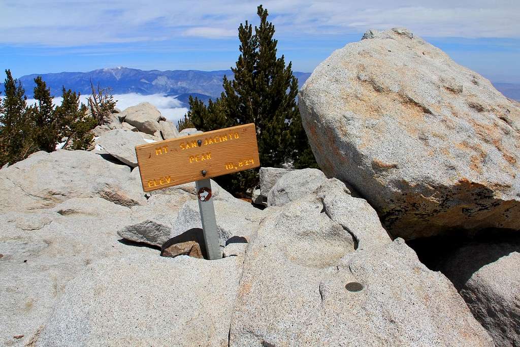
This one shows the popular sign at the summit, the benchmark, the highest point atop the boulder, and looking north in the distance is San Gorgonio Peak. Also notice the low cloud cover in the distance. This cloud cover seems to be covering most of SoCal right now, with it's ceiling at about 5,000 feet. As I drove up from our condo in Escondido all the way to Idyllwild this cloud cover persisted, causing some doubts about conditions on the upper portion of the mountain. However just before reaching Idyllwild the clouds broke to a gorgeous sunny day, with 60 degree temps. I parked the truck at the Marion Mountain trail head and was off up the mountain, all smiles.
The Marion Mountain route seemed pretty easy, a similar gradient to that of Aspen Grove to the summit of Timpanogos in Utah. Some snow persisted above 8,500 feet with some post hole action. I brought my crampons and axe, but never used them. Didn't use my jacket or gloves, either. Hit the summit in just over 3 hours, and chilled up there for 45 minutes, half that time was spent talking with another guy who came up from Idyllwild reaching the top just after I did. I was able to check out the shelter put up there back in the day by the CCC. Something about that shelter gave me the creeps...
I took a slightly different descent from the saddle, and post holed up to my waist in some spots to Drury Peak, the down Drury's north side back to Little Round Valley. More waist deep post hole action. Once getting back to the first junction with the Deer Springs trail, it was cake.
If I get a chance to do this one again I want to try the C2C route! Cool to hit up a California ultra-prom! May 1, 2012.


