


SawtoothSean - Jan 7, 2006 10:09 pm - Hasn't voted
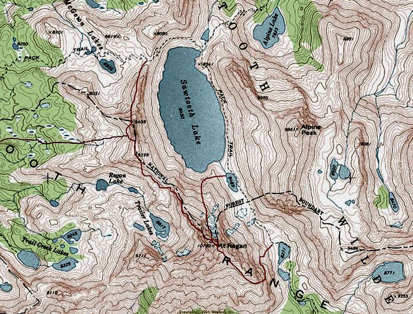
Good SuggestionFrom member Kane: put the routes on the topo. Thanks!

britfoot - Oct 1, 2019 12:11 pm - Hasn't voted
Descent Route on Mt ReganMy husband Alois Smrz (asmrz on Summitpost) and I recently climbed the North Ridge route on Mt. Regan and tried to use the SE Ridge route as a descent. We could not find a cliff-less cross-over on the ridge as shown on your map, resulting in an overly long descent. For those of us who have not climbed the SE Ridge, a GPS way point for the cross-over, and possibly the sharp right turn for the final descent, would be extremely helpful.
SawtoothSean - Oct 1, 2019 6:07 pm - Hasn't voted
SE RidgeThere's one exposed ramp that leads to the summit, on the north side of the SE ridge, just to the right of an obvious headwall. For descent, this would the inversed, and I could see if you didn't go up it, how it might be a challenge to find. Sorry, I don't use GPS but it's there and close to the line traced.


Comments
Post a Comment