Toggle navigation
Mountains
Routes
Images
Trip Reports
Forum
What's New
People
Areas & Ranges
Articles
Trailheads
Canyons
Huts & Campgrounds
Albums
Logistical Centers
Fact Sheets
Lists
Custom Objects
Gear
Plans & Partners
WELCOME TO SUMMITPOST
SIGN IN
REGISTER
Sawtooth Mountain
Additional Parents
Image
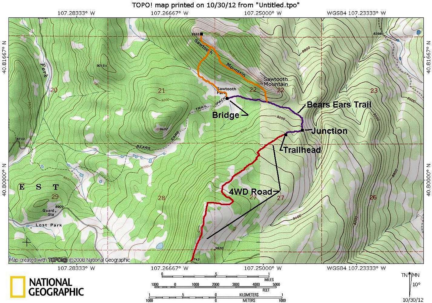
Sawtooth Mountain Map
View High-Resolution Image
Sawtooth Mountain Map
The 4wd Road and east side of the Bears Ears Trail does not show up on the topo map, so they have been drawn in at the approximate location. Red = 4wd Road. Purple = Trails. Orange = Off trail routes.
« PREV
NEXT »
Scott
on
Oct 30, 2012 9:13 pm
Comments & voting
Other parents
Image ID:
823090
5087 Hits
71.06
% Score
1
Votes
Log in to vote
Comments
No comments posted yet.
to post!
Don't have an account?
Sawtooth Mountain
(Mountain/Rock)
« PREV
Viewing
#15 of 15
GALLERY
You are at
the Last
Image
Scott's Image Gallery
« PREV
Viewing
#6057 of 8082
GALLERY
NEXT »
Southeast Ridge via Sawtooth Trailhead
(Route)
Loading....
Photo of the Hour
(Album)
Loading....
×
You need to login in order to vote!
User Name
Password
Remember me
Forgot your password?
Log me out when I close my browser.
Keep me logged in all the time.
sign in as a user
Don't have an account?
Register now for FREE
Rating available
Suggested routes for you
People who climb the same things as you
Comments Available
Create Albums
Register Here


