Toggle navigation
Mountains
Routes
Images
Trip Reports
Forum
What's New
People
Areas & Ranges
Articles
Trailheads
Canyons
Huts & Campgrounds
Albums
Logistical Centers
Fact Sheets
Lists
Custom Objects
Gear
Plans & Partners
WELCOME TO SUMMITPOST
SIGN IN
REGISTER
Mount Asgard
Additional Parents
Image
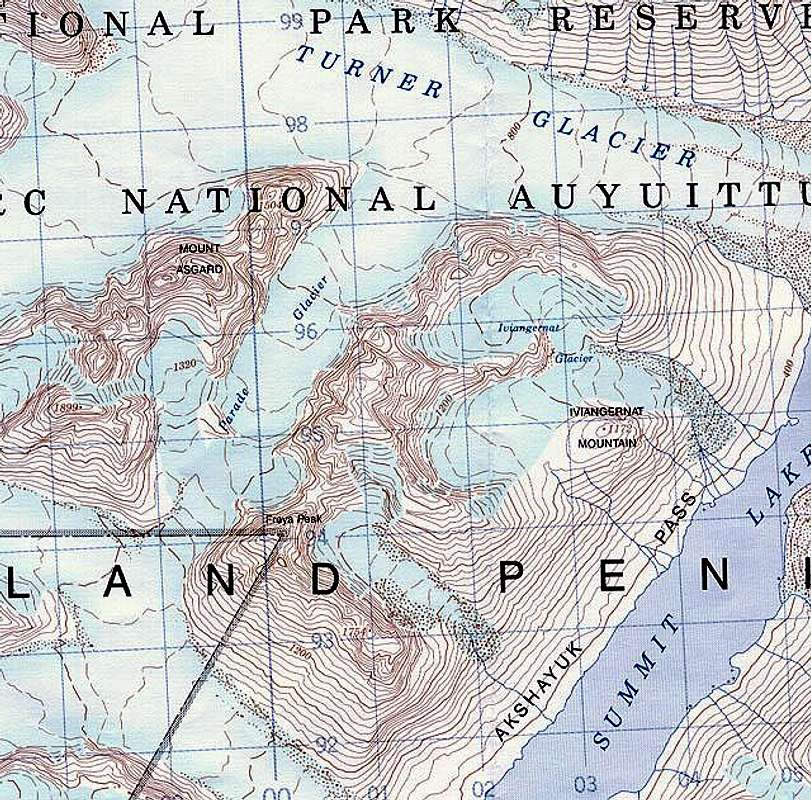
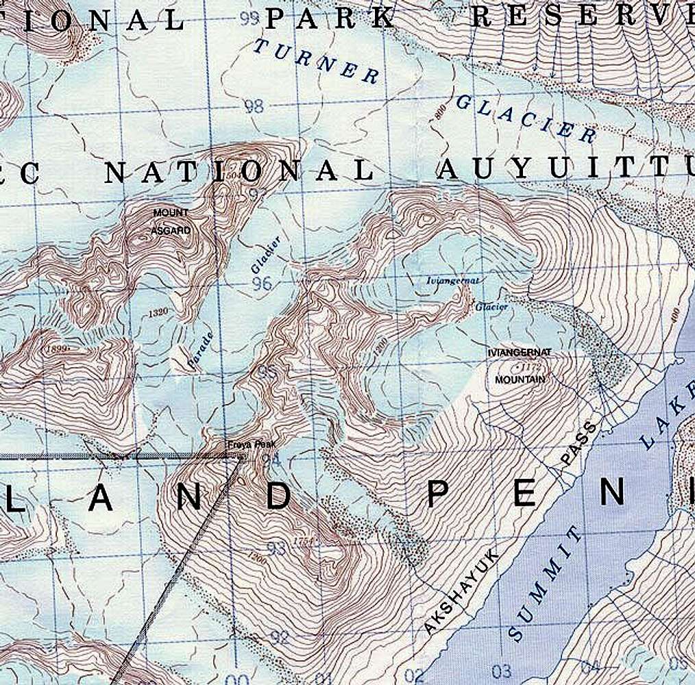
Scanned from 1:50,000 "Mount...
View High-Resolution Image
Scanned from 1:50,000 "Mount...
Scanned from 1:50,000 "Mount Asgard" map published by The Canada Centre for Mapping - Department of Energy, Mines and Resources 1994
Map 26-I/11
1000m grid is 2 deg 4 min off true North
contours at 40m
« PREV
NEXT »
danmerrick
on
Feb 23, 2004 10:53 am
Comments & voting
Other parents
Lat/Lon:
66.44000°N / 65.16°W
Image ID:
42965
5886 Hits
74.92
% Score
5
Votes
Log in to vote
Comments
No comments posted yet.
to post!
Don't have an account?
Mount Asgard
(Mountain/Rock)
You are at
the First
Image
Viewing
#1 of 1
GALLERY
You are at
the Last
Image
danmerrick's Image Gallery
« PREV
Viewing
#7 of 50
GALLERY
NEXT »
×
You need to login in order to vote!
User Name
Password
Remember me
Forgot your password?
Log me out when I close my browser.
Keep me logged in all the time.
sign in as a user
Don't have an account?
Register now for FREE
Rating available
Suggested routes for you
People who climb the same things as you
Comments Available
Create Albums
Register Here


