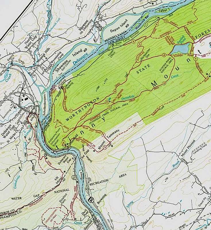
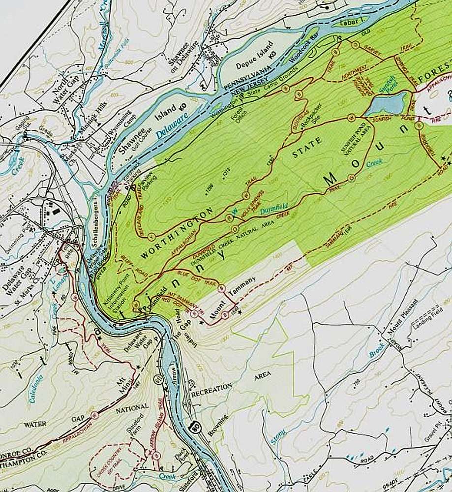
Scanned NYNJATC trail map covering the region around the Delaware Water Gap. I've rotated it so that north is at top. Circled letters refer to trail blaze color (W=white=Appalachian Trail). This is a resubmission now that DWG has been split into two pages.


