
|
|
Mountain/Rock |
|---|---|
|
|
40.73130°N / 110.8919°W |
|
|
11158 ft / 3401 m |
|
|
Overview
Covered here is one mountain with two peaks. The mountain is variably known as Scout Peak (elevation 11,113 feet) because it rises above Scout Lake and Camp Steiner, a boy scout camp; and Lofty Peak (elevation 11,158 feet) because Lofty Lake sits between the two summits. For this page, the north summit will be called Lofty Peak because it is slightly closer to Lofty Lake, and the south summit will be called Scout Peak because it sits slightly closer to Scout Lake. You can call it what you want however, as with many (most) of the Uinta Mountains, the USGS maps have no name. (In the Western Uinta Backcountry Guide, the south summit is called Scout (Lofty) Peak and the north summit Cutthroat Peak due to its proximity to Cutthroat Lake). Don't be suprised to see different names from different sources. The mountain is somewhat unusual due to the fact that a lake sits very near the two summits. There are no trails to the summits, but these are some of the easiest to climb peaks in the entire Uinta Mountains.The Uinta Mountains are one of the few mountain ranges in North America that run east to west rather than north to south. Within the Uinta Mountains are about 2000 lakes, and some 900-1000 are full of trout. Along with the San Juans in Colorado, the Uintas have more contiguous area above timberline than any other area in the Continental United States. This is a beautiful area with many lakes, meadows, wildflowers, and some rugged peaks. Solitude is usually easy to come by once you leave the popular fishing holes behind.
 Lofty Lake sits almost on the summit of the mountain. Scout Peak summit is in the background, only 300 feet above the lake. August 1996
Getting There
Lofty Lake TrailheadTo reach the Lofty/Pass Lake Trailhead, drive Highway 150 32 miles north, and east of Kamas or 46 miles south of Evanston. There is a sign that marks the trailhead (west side of the Highway).
Ruth Lake Trailhead
To reach the Ruth Lake Trailhead, drive Highway 150 35 miles north, and east of Kamas or 43 miles south of Evanston. There is a sign that marks the trailhead (west side of the Highway).
 Kamas Lake and lower slopes of Lofty Peak. Lofty Lake is on top of the bench in the upper left of the photo. Late August 1996.
Routes Overview
Loop Hike Via Lofty LakeThis route is recommended as a loop hike. Breifly put (see the route page for more details), the route heads west to Reids Meadow, north to Kamas Lake, and still farther north to Cutthroat Pass. From Cutthroat Pass, the route follows the Lofty Lake Trail up the ridge and east to Lofty Lake. From the lake, you can either head NE to the summit of Lofty Peak or south to the summit of Scout Peak. Both peaks are about 300 feet above the lake and are easy class 2 ascents. After summiting the peaks, the route returns to the saddle between the two summits, then follows the trail east and then south and down to Scout Lake. From Scout Lake, the route follows the trail SE to Picturesque Lake and then back to the trailhead.
 Scout peak view from Kamas Lake.
Ruth Lake-Cutthroat Lake/Cutthroat Pass Variation
Breifly put (see the route page for more details), the route follows the heavily used Ruth Lake Trail west to Ruth Lake. From Ruth Lake, the route continues on "social trails" west to Naomi Lake and continues cross-country and on social trails around the base of the mountain to Cutthroat Lake. From Cutthroat Lake, the route climbs cross-county to the south to "Cutthroat Pass". From Cutthroat Pass, the route follows the Lofty Lake Trail up the ridge and east to Lofty Lake. From the lake, you can either head NE to the summit of Lofty Peak or south to the summit of Scout Peak (see above).
Ruth Lake-East Pass Variation
Breifly put (see the route page for more details), the route follows the heavily used Ruth Lake Trail west to Ruth Lake. From Ruth Lake, the route scrambles southwest up to the pass at 10,700 feet that is between Peak 10,975 and Lofty Peak. The Lofty Lake Loop trail is reached at the pass. From the pass, the route heads west along the trail to the saddle between Lofty and Scout Peaks. Either peak can be climbed from the saddle (see above).
 Lofty Peak from Jewel Lake
Guidebook Available
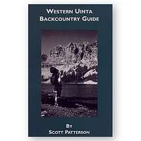
More details about the area can be found in the book Western Uinta Backcountry Guide, including many routes to the summit, and hiking trails to the many lakes, and fishing information. Just send me a PM if you want to purchase the book.SP members can have the book for 1/2 price, and there is no shipping cost.
 Guidebook
Red Tape
No permits are required. There is now a $3 per day use fee for parking along Highway 150.When To Climb
July through September is the normal hiking season here. All trailhead roads above are closed in winter. In winter, expect to walk an extra 15-20 miles each way depending on which direction you are coming from. North of lofty peak. Approaching Cutthroat Pass in summer.
Camping
There are many campgrounds along Highway 150, but they can be crowded and full on summer weekends. In addition to campgrounds, there are several primitive camping sites on each route as described below.Lofty Lake Loop Route
There are good campsites in Reids Meadow. There are only small rocky campsites at Kamas Lake, but there is more room in the meadow north and above the lake. Lofty Lake is a good campsite, but since it right at timberline and near the summit of a mountain, it is rather exposed to the elements.
Ruth Lake Routes
Ruth Lake is pretty popular, so don't expect solitude at that location. There are numerous good campsites throughout the basin before climbing to Cutthroat Pass.
Mountain Conditions
Contact the ranger station in Kamas for current road and trail conditions. Their phone number is 801-783-4338.WEATHER FORECAST FOR WESTERN UINTA MOUNTAINS
Here are some average highs and lows from Mirror Lake at 10,190 feet :
| MONTH | HIGH | LOW |
| JAN | 23 | 0 |
| FEB | 25 | 2 |
| MAR | 29 | 6 |
| APR | 38 | 14 |
| MAY | 47 | 22 |
| JUN | 57 | 31 |
| JUL | 67 | 38 |
| AUG | 65 | 37 |
| SEP | 57 | 30 |
| OCT | 46 | 19 |
| NOV | 32 | 10 |
| DEC | 26 | 4 |
External Links
- climb-utah.com/
Updated trail information