
-
 8047 Hits
-
 76.66% Score
-
 7 Votes
|
|
Mountain/Rock |
|---|---|
|
|
45.56262°N / 112.97447°W |
|
|
Silver Bow |
|
|
Mountaineering |
|
|
10357 ft / 3157 m |
|
|
Overview
Hidden deep inside Montana's Pioneer Range, Sharp Mountian is a peak that few have seen. Only visible for a short time on the Pioneer Scenic Byway to the west, Sharp Mountain is hidden from Granite Mountain on the east, Mt. Tahepia on the south. Sharp Mountain's east summit stands at 10,357ft, and the west summit at 10,144ft.Getting There
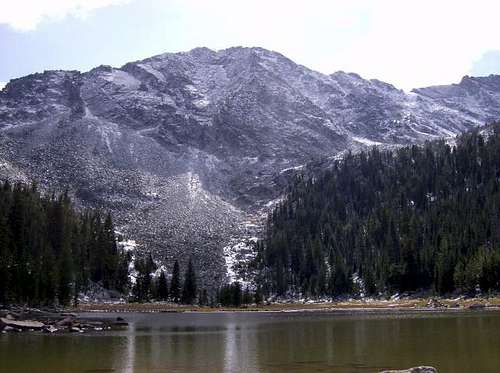
 Lion Lake
Lion Lake Approach:
The Lion Lake trailhead can be reached by taking the Melrose exit off of Interstate 15, which is about 20 miles south of Butte. After going through the town of Melrose, drive about 2 miles and take a right at Canyon Creek Road. Follow the Canyon Creek Road all the way to its end at Canyon Creek Guest Ranch, and be careful not to turn right on the way, that will take you to Vipond Park and back to the pavement. From the trailhead at the end of the road, hike about 1 1/2 miles to a fork in the trail, take the left trail. You will hike about 2 1/2-3 miles and reach a creek crossing. From the creek crossing you have two choices of routes.
1.If you choose to follow the trail, it will take to Grayling Lake and then Lion like after about 1 1/2 miles. From there you boulder-hop up to the top of the left hand ridge or to the saddle above the Lion lake. From the saddle the east summit will be to your right or staight ahead and the west summit will be to your left. From the saddle it is just a walk/boulder hop and a short scramble to the east summit of Sharp Mountain. At the top you will have to walk across a slab of rock with a small ledge on it, this won't be tough unless you do it in snowy conditions, then the slab is like a slip'n'slid to off the north face. After the slab you are on top.
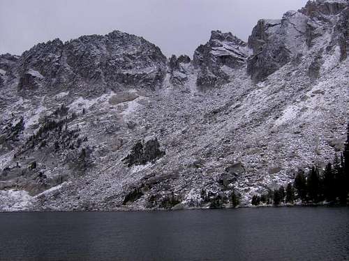
 North Face of Sharp Mountain
2. If you choose to bushwhack to the base of the north face then you don't cross the creek or follow the trail. You follow the creek about a 1-1 1/2 miles through meadows and thick deadfall to a small lake at the base of Sharp Mountain. From the lake you boulder hop up the left side of the boulder field. There are several routes to choose from the boulder field, any route you take will involve a lot of scrambling, but it doesn't get past class 4. One route is the largest chute on the north face. To get into this chute you have to go on the left side of the boulder field and find the small chute that lead to the larger chute. It will enter the larger chute at a ledge above the bottom of the larger chute. The bottom of the larger chute ends in a small cliff, so the left hand smaller chute is a easier way to get into the larger chute. The larger chute stays about 20-50 ft wide and will lead all the way to the top.
Either route on the Lion Creek Trail is about 6 miles from vehicle to summit.
 Waukena Lake
Waukena Lake Approach:
To get to Waukena Lake trailhead take the Apex exit off of Interstate 15 which is about 20 miles farther south than the Melrose exit. Follow the Apex to Willow Creek Rd. and take Willow Creek Rd. until it ends after about 10 miles. It will end after a large clear-cut and at the Waukena Lake trailhead. Take the trail to Waukena Lake (7 miles) and walk up the slope to the summit of Sharp Mountain. The last 100 feet will be a scramble and then you'll top out.
Camping
The Lion Creek route has great camping at Lion and Grayling Lakes, normal wilderness camping rules apply in the Pioneers. Waukena Lakes also has good places for camping.When to Climb
The west summit can be done when there is snow. The east summit should be done in dry conditions because of the large angled slabs near the top that would be dangerous to slide off of, take it from me, I did it in snow and accidentally slid off the last part of the slab and, thank God, I caught myself. The slabs angle down for about 60ft and then drop off the north face. east summit