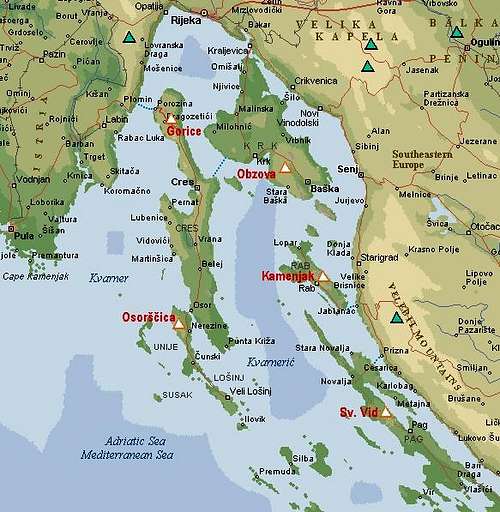
It is widely known that islands along the Croatian coast in Adriatic see are hilly, actually they are mountains, sunken into the sea. But it would be normal, that the highest mountains would rise closer to the coast, where, for example Velebit rises up to the altitude of 1757 m. Osoršćica is one of exceptions. It rises high, even if it is situated on one of the outer islands of Kvarner. It is really worth undertaking the ascent on Osoršćica, especially if you do the crossing of it. The tour can be done in one day, but if you sleep on the mountain, you can combine the summit ascent with visiting some other interesting places nearby - nice beaches, karst holes or even the climbing area. Sleeping on the summit of such a mountain is an unprecedented experience. The sky playing with all sorts of warm colours, clear, deep blue see all around you with some lonely boats on it and a few lighthouses, guarding difficult passages, karst, rocky terrain, but still covered with colourful pillows of flowers, grass and bushes, respectful high-mountain woods with their serenity, after a pleasant ridge hike a small church of St. Mikul (St. Nikola) just below the summit, what else could you wish!
On the main ridge of Osoršćica
Like other islands along the Adriatic coast also Osoršćica is built of limestone from cretaceous period. There are no big walls for climbing, but on its western slopes there are some nice crags where the climbing area is arranged. The mountain has its name by the town Osor, which stands - how strange - on the neighbouring Cres island. But between Cres island and Lošinj island, in Osor town, there's only a few meters wide channel (dug already by the Ancient Romans), where the road crosses by a bridge, which, if rotated, allows also ships to pass. And immediately, on the northern side of Lošinj island a 10 km long and 588 m high mountain rises. It's eastern slopes are a bit less steep than the western ones, the summit ridge is quite sharp, but still alowing a comfortable path to cross it. The ridge itself is quite compact, but when crossing it, you can still distinguish a few separate summits. The highest one is Televrina, 588 m, less than 30 minutes south of it there's St. Mikul (St. Nikola), 558 m and there are some others, less important. Besides Osor, the other town where trailheads for Osoršćica start is Nerezine, east of the highest point. Below are just a few masterpieces of Aleksandar Gospić, showing the views on Osoršćica from the distant Velebit mountains:
Summit Views
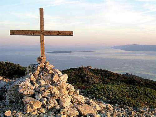
The magnificent view from Sv. Mikula.
From the N ridge towards the NE
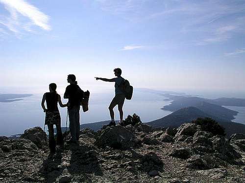
Being situated on Lošinj, one of the outside Kvarner islands, Osoršćica offers a great panorama over the whole area. In a clear day you can see the eastern coast of Istria with Učka, 1394 m, Velebit, 1757 m, islands like Krk, Rab, Pag, down to the outposts of Zadar archipelag, in a very clear day also Triglav, 2864 m in Julian Alps looks close (even if the distance is some 200 km). And vice versa, of course - from all around Kvarner a high cone of Osoršćica is rising out of a blue Adriatic Sea, catching your eye.
Getting There
Osor - one of the trailheads
Nerezine - the most popular trailhead
You can reach Cres and Lošinj by car, using one of two regular ferry-boats:
1. Brestova - Porozina (from Istria to Cres) - during summer and early autumn it goes in 1 h intervals, outside this period less frequently,
There are also long-distance ferry boats, stopping on these islands on their way from Pula (Istria) or Zadar (Dalmacija). The other possibility to travel Kvarner islands is by ship. This way you can reach many towns on Cres or Lošinj islands. The nearest airports are near Rijeka, Pula and Zadar. A small tourist airport is also on Lošinj, SW of Čunski.
Nerezine
The trailheads for Osoršćica ascents along the main road are: Osor, Nerezine and Ćunski. Recently a new road was made from Osor till below the main summit (Televrina). It supports the telecommunication tower, which means two serious destructions of nature on this nice mountain. By this road public traffic is allowed to St. Gaudent hut.
Places To See In the Vicinity
Travelling by Cres and Lošinj islands you can see interesting historic towns, like Cres, Osor, Mali Lošinj, Veli Lošinj, interesting villages, like Lubenice, Beli, Valun, Predošćica, Orlec. On Cres there's a natural phaenomenon - a big fresh water lake Vransko jezero (5.5 km long and 1.5 km wide, its surface is above the sea level, but its bottom is 74 m below the sea level). Both islands are also very developed with tourist facilities of highest quality. Some more information, you can find on: Lošinj island tourist page and elsewhere. On Osoršćica mountain, for hikers and climbers the key places of interest are:
Vela jamaTelevrina (the highest summit) and St. Mikul (small church and second highest summit).
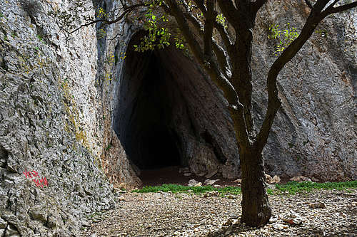
Many interesting caves. In St. Gaudent's cave (east of the summit) supposedly this hermit and bishop of Osor lived around 1050. In Vela jama (on the western slopes) archeologic findings prove that it was inhabited already in paleolithic times. A bit south of it, there's also a cave called Mali Organac.
From the caves on the W slopes a short ferrata goes on top.
30 minutes from the mountain hut there are nice crags with many short climbing routes.
All around the mountain there are nice coves with beaches where you can hike to.
Other nearby places of interest:
Veli and Mali Tržić on Hlamac - abandoned villages above Nerezine, supposedly the birth place of St. Gaudent.
Kaštel above Nerezine - a tower of castello of the noble Draža family from Osor is still seen.
Nerezine with its 3 churches, village square and port.
Osor town with its medieval walls, ruins of old St. Mary and St. Peter church, cathedral and a smaller church, museums and art exhibitions.
Routes Overview
It is recorded, that mountaineering tradition started on Lošinj in 1887, when Rudolf Habsburg, the Austro-Hungarian heir to the throne, ascended Osoršćica and boosted tourism on Lošinj island. But we know, of course, that natives were the ones, who explored the mountain far before. Nowadays some 15 km of mountaineering paths are built (and much more for walking and jogging along the coast).
1. From Osor. The marked path ascends (from autocamp Preko) gently first towards the W, then towards the NW (taking a few shortcuts of the road). On the N ridge it reaches the mountain hut, where we turn left. In continuation we follow the N ridge. On the summit of Križica, 343 m, nice views open. From there, the path becomes a bit more demanding. Some 20 minutes before the summit we have an option to deter right, visit both caves and then ascend the summit via a short ferrata. If not, we simply continue by the more and more panoramic ridge. 3 h 30 min altogether.
2. From Nerezine. The marked path leaves the village towards the W, but we can drive also a bit higher, to Pešćine hamlet. From the parking place, the path starts winding up in many turns over the whole E slope to the summit of St. Mikul. Excellent panorama from there! From the church you can reach the main summit by the S ridge. 2 h altogether.
3. From Nerezine over Počivalice. The marked path goes more southwards than #2, reaches the Počivalice and ascends St. Mikul by the south ridge. To the summit 2 h 30 min.
4. From Čunski. Osoršćica ridge finishes far on the south at Čunski village. Here also the marked path goes up and follows the whole S ridge to St. Mikul and to the main summit. 4 h.
So, the obvious, and recommendable crossing would be: Osor - mountain hut - Televrina (summit) - St. Mikul - Nerezine - Osor. 5 h. You can prolongue this crossing, going over Počivalice or visiting the western slope caves.
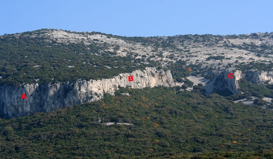
Climbing Area
Some 30 minutes from St. Gaudent mountain hut (reachable by car) there are nice west oriented crags where in 3 sectors more than 30 routes can be found. They are up to 30 m high and their difficulty varies from 4th to 8th degree. See the list of routes and their difficulties below in Outside Links chapter!
The crags of Osoršćica
Red Tape
There are no restrictions on the mountain. To reach Krk island (and continue from there with ferry boat), you pay to cross the bridge.
When To Climb?
All the year. In any case do choose a clear day, which will offer you good visibility. Nothing can be more valuable! Usually the best visibility is, when bura wind (north wind) blows. Also, you can choose to climb up early in the morning or late in the afternoon, when it's not so hot. By far the best option is to sleep on the summit. Take care not to make fire under any conditions! Woods would be in flames immediately! You can see mountain conditions on: WeatherOnLine.
Camping
You can do any tour in a single day. Camping outside touristic destinations is not allowed, but high on the mountain you will have no problems. Again: take care not to make fire under any conditions! Woods would be in flames immediately! On the north ridge of Osoršćica, there's a mountain hut. St. Gaudent hut stands on the altitude of 274 m and can split your ascent in two equal parts. Make sure in Osor if the hut is opened.
Children refers to the set of objects that logically fall under a given object. For example, the
Aconcagua mountain page is a child of the 'Aconcagua Group' and the 'Seven Summits.' The
Aconcagua mountain itself has many routes, photos, and trip reports as children.
Parents refers to a larger category under which an object falls. For example, theAconcagua mountain page has the 'Aconcagua Group' and the 'Seven Summits' asparents and is a parent itself to many routes, photos, and Trip Reports.

 19254 Hits
 91.9% Score
 37 Votes
 The W slopes of Osoršćica
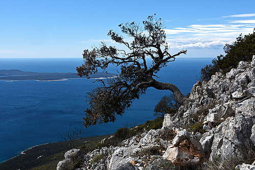


 The magnificent view from Sv. Mikula.
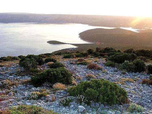 From the N ridge towards the NE
 Osor - one of the trailheads
 Nerezine - the most popular trailhead
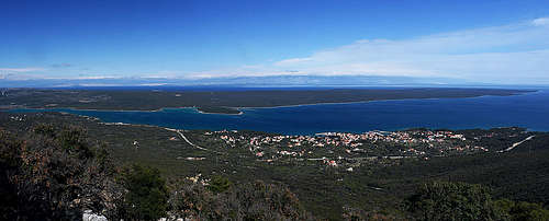
 Morning on the N ridge