-
 107364 Hits
-
 94.68% Score
-
 50 Votes
|
|
Mountain/Rock |
|---|---|
|
|
40.59390°N / 111.7203°W |
|
|
11330 ft / 3453 m |
|
|
Overview
Broads Fork Twin Peaks, more frequently referred to simply as "Twin Peaks", is the highest and most prominent mountain on the eastern skyline behind Salt Lake Valley. With an elevation of 11,330 feet (east summit) and 11,328 feet (west summit), the Twins rise nearly 7,000 vertical feet above the valley floor.
The most commonly used ascent route is via Broads Fork, a class 3 climb of 5,100+ vertical feet with some scrambling and exposure. More difficult routes can be found in Broads Fork, as well as Deaf Smith Canyon, Ferguson Canyon, Tanners Gulch, Stairs Gulch, and Lisa Falls. The center of the Twin Peaks Wilderness Area, the peaks here are some of the most rugged to be found in the Wasatch. Needless to say, the summit views of Salt Lake City and the surrounding Wasatch Mountains are excellent.
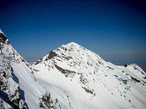
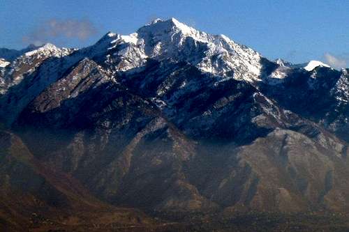 The Broads Fork Twins Massif
Getting There
The Broads Fork trailhead is four miles up the Big Cottonwood Canyon road (UT-190). Get there by either Taking I-15 to I-215 east at about 60th south, or take I-80 east to Wasatch Boulevard. The parking lot fills quickly in the summer months.
Access to Deaf Smith is difficult and threatened by homeowners. The trail starts at the end of Golden Oaks Drive (just off Wasatch Boulevard) at a dirt road. Try to park in a manner that does not distrub the home owners.
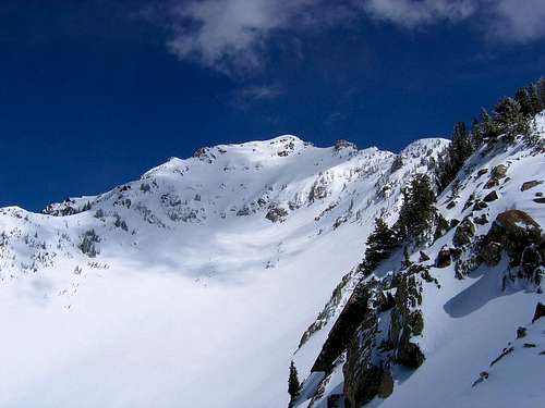
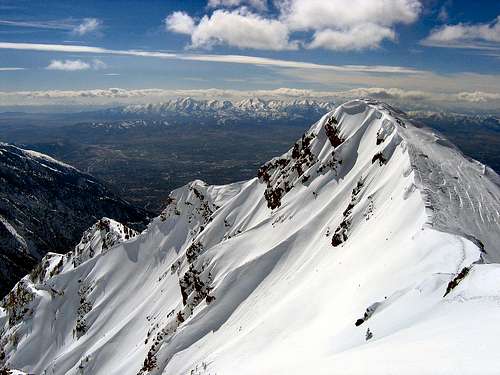 Summit View Looking West
Summary of Routes
Broads Fork Twin Peaks offers a variety of route options, ranging from relatively straight-forward 3rd class scrambles, to exposed 4th class ridges and steep spring snow climbs. Below is a brief summary of some of the more commonly ascended routes. Refer to the route pages for complete details on these routes.

Broads Fork
The standard and by far the most popular route on the mountain. Even so, this is a challenging route which involves over 5,000 vertical feet of elevation gain, and an exposed 3rd class scramble.

Robinson Variation
An excellent variation of the Broads Fork route, this route follows the Broads Fork approach, but then ascends to the saddle well to the north of the summit, then follows the long north ridge which divides Broads Fork and Deaf Smith Canyons.

Tanners Gulch
An excellent Spring and early summer snow climb, although avalanche conditions must be evaluated very carefully. The route often includes ascents of Dromedary and Sunrise Peaks as well.

Stairs Gulch
This route ascends the steep Stairs Gulch drainage to the north of the peak. This route is best done as a Spring snow climb, but only under favorable conditions due to its potentially extreme avalanche danger.

Ferguson Canyon/Traverse From Storm Mtn.
A long but very enjoyable route which begins from the west in Ferguson Canyon. From the summit of Storm Mountain a long ridge can be followed to the summit of the East Twin. This route joins the Robinson Variation at approximately 10,600 feet.
Hounds Tooth Ridge
A very long route which approaches from the west, the main attraction of Hounds Tooth Ridge is as a relatively safe winter ascent route.

Lisa Falls Direct
An infrequently used route beginning in Little Cottonwood Canyon, which ascends the Lisa Falls drainage.

North Ridge
This route begins with the standard Broads Fork approach, but gains the north ridge well before reaching the Broads Fork Meadow. The route merges with the Robinson Variation at the top of the Robinson Couloir.

Deaf Smith Canyon
The major canyon on the west face of the peak, Deaf Smith Canyon forks into a north and south branch, either of which can be followed to the summit by various methods. Deaf Smith Canyon approaches involve elevation gains of 6,000+ feet.

Cottonwood Ridge Traverse
Broads Fork Twin Peaks are the highest point on this long and challenging ridge scramble. From the summit of Broads Fork Twins, the route follows the bulk of the Cottonwood Ridge, passing over the summits of Sunrise Peak, Dromedary Peak, Monte Cristo, and Mount Superior, as well as several other unnamed high points along the ridge.
Red Tape
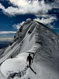
Traversing to the West Twin
Broads Fork Twin Peaks and much of the surrounding area are located within the Twin Peaks Wilderness Area, but no fees or permits are required. The following are not permitted:
- Group sizes exceeding 10 persons
- Camping within 200 feet of lakes, streams, springs, etc.
- Camping within 200 feet of trails
- Camping for more than 3 days at one site
- Short cutting trail switchbacks
- Disposing of garbage, debris, or other waste
<li) Open fires are allowed in the Mill B South Fork (Lake Blanche) drainage within the Twin Peaks Wilderness.
The Deaf Smith Canyon, Ferguson Canyon, and Hounds Tooth Ridge routes begin in or near residential areas, so please show respect to the property owners.When To Climb
Snow lingers in upper Broads Fork well into July most years. Mostly dry climbing can usually be found from July through September. The Deaf Smith route is west-facing and free of snow earlier in the season.
Winter and Spring ascents are more serious undertakings, and require significantly more time and effort. Several of the popular routes are subject to extreme avalanche danger in Winter and Spring; evaluate conditions carefully before proceeding.
![Twin Peak]() The Twins Viewed from Dromedary Peak
The Twins Viewed from Dromedary PeakCamping
Camping is permitted, subject to the restrictions mentioned in the Red Tape section above. Very nice camping spots are located at the lower (north) end of the Broads Fork meadow, at about 8,200 feet (about two miles and 2000 feet of hiking). The upper meadow at around 9,600 feet is also very scenic, but considerably more rocky.
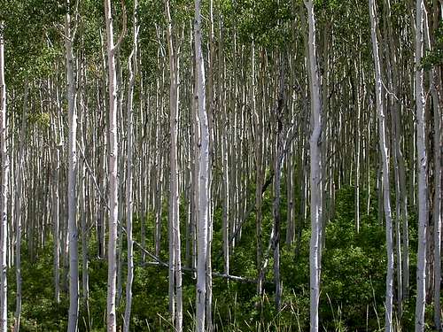
![You pass thru a thick aspen...]() Broads Fork Approach Scenery
Broads Fork Approach SceneryMountain Conditions
- National Weather Service forecast.
- Utah Avalanche Center website.
- AltaCam - Web cams of the mountains at nearby Alta ski resort in Little Cottonwood Canyon.
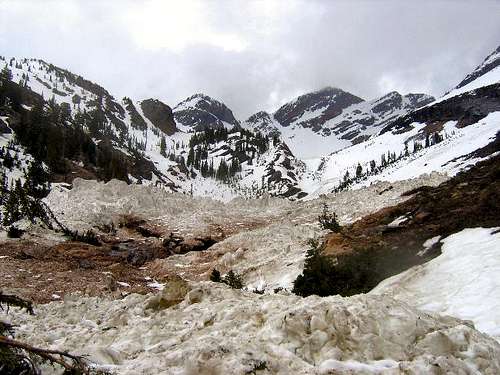
![Broads Fork Avalanche Debris]() Avalanche Debris in Broads Fork
Avalanche Debris in Broads ForkExternal Links
- Twin Peaks-East Twin 2-4-05 (Trackhead)
- Salt Lake Twins North Face Couloir 4-12-05 (Powstash)
![On the southwest ridge]() The Summit on a Deaf Smith Canyon Approach
The Summit on a Deaf Smith Canyon Approach