Saebelspitz / Stallonkofel / Runseck

Saebelspitz / Stallonkofel / Runseck

Page Type Page Type: Mountain/Rock
Location Lat/Lon: 46.64630°N / 12.84470°E
Additional Information Elevation: 7093 ft / 2162 m
Sign the Climber's Log

Overview


Geographical Classification : Eastern Alps > Carnic Alps > Carnic Alps Main Ridge (West) > Saebelspitz / Stallonkofel / Runseck

Saebelspitz / Stallonkofel / Runseck photo_id=122999

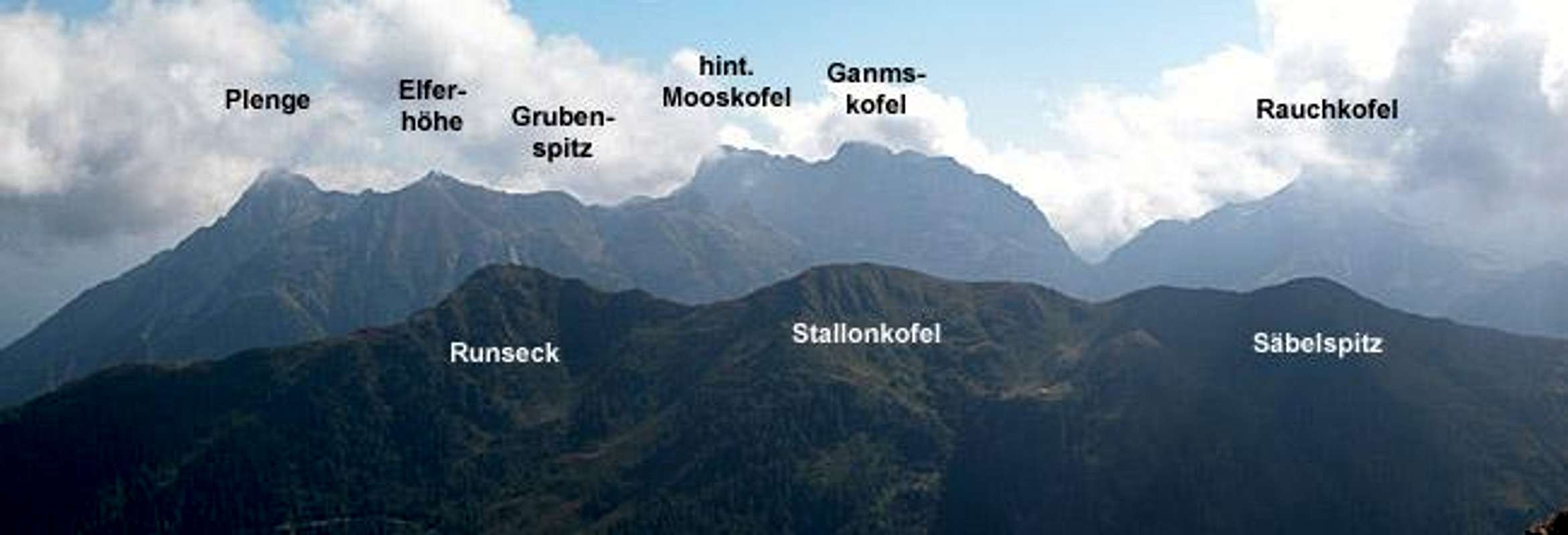
Rather than posting three single pages for the three summits described here, I decided to submit this as a "ridge page". The three summits Saebelspitz, Stallonkofel (also Stallon) and Runseck are located on one of the side ridges which turn off north from the Carnic Alps Main Ridge. Coming from Plöckenpass / Passo di Monte Croce Carnico in the east and turning west it is the second of the side ridges. The three summits are rather bumps in an otherwise smooth ridge and can be easily climbed all year. The whole ridge is a popular ski tour destination in winter and only near the highest and central peak of Stallonkofel will you find some moderate exposure with 100m drops to the eastern side. The ridge separeates the Niedergailer Tal and Wolayer Tal Valleys, which both run from north to south towards the Carnic Alps Main Ridge.

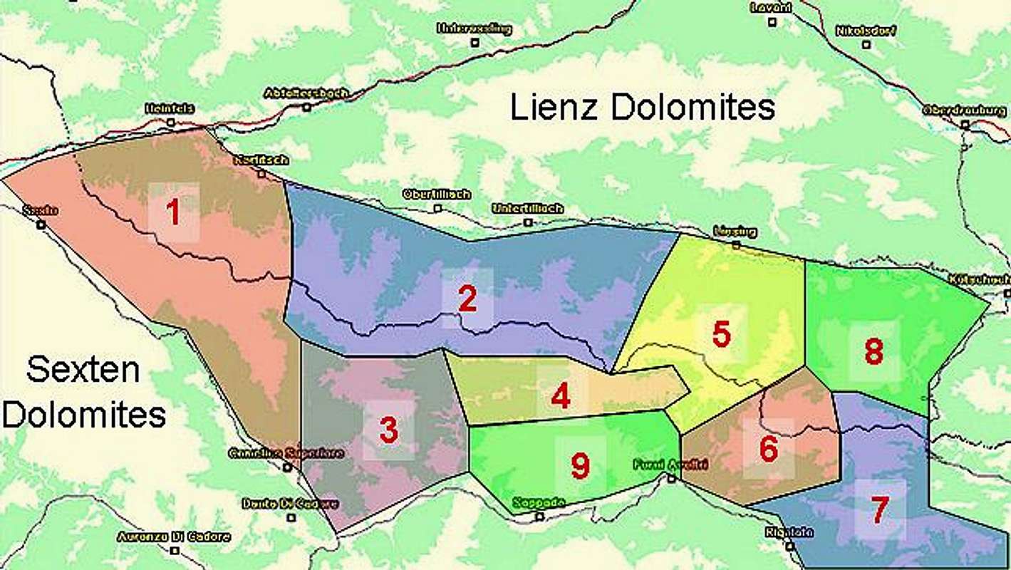
The popularity of the ridge stems from the views it commands in fine weather. It is very close to the highest mountains of the Carnic Alps, Hohe Warte / Coglians and Kellerwand both to the south-east. To the south you have the huge bend of Biegengebirge somewhat hidden behind Kreuzleithöhe, the first (i.e. southernmost) and rocky summit of the ridge. In the south-west there are Letterspitze, Steinwand and Edigon at your fingertips while turning north you will see the whole of the Lienz Dolomites across the Lesachtal Valley.

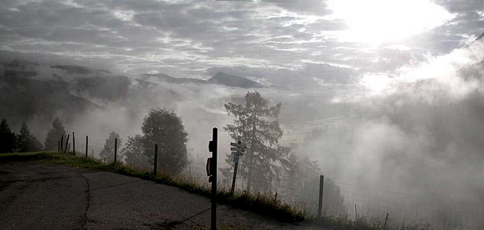
So why are these views missing from this page?

We had the unfortunate bad luck of hiking the ridge in foggy weather. Meaning to climb Rauchkofel from Wolayer Tal Valley we had to turn around because of dark low hanging clouds. We tried to retreat along the Saebelspitz / Stallonkofel / Runseck Ridge which was still was clear of clouds at the time of the decision but once we closed in on the first summit, Saebelspitz, the clouds dropped by 200m and that was it. A day or two later we had a glimpse of the ridge in better weather and felt even more frustrated, now that we saw the real beauty of its location.

As a compensation for the dismal weather the south slopes of Runseck offered us millions of blueberries and raspberries together with occadional currant bushes. It pays to bring a container for collecting your evening dessert...

The single summits in more detail


Saebelspitz / Stallonkofel / Runseck photo_id=113753

Saebelspitz
Elevation: 2159m
Latitude: 46,6407
Longitude: 12,8394

It is not quite clear to me why this summit was called "Säbelspitz". The name means "Sabre Tip" in English and you would certainly expect somthing more pointy than this. From both sides of the ridge the summit is easily reached. There are no difficulties for the summit itself, though the southern ascent routes are very steep and rocky in several parts.
Säbelspitz / Stallon / Runseck photo_id=122997Säbelspitz / Stallon / Runseck photo_id=122975Säbelspitz / Stallon / Runseck photo_id=122974Säbelspitz / Stallon / Runseck photo_id=122984


Stallonkofel
Elevation: 2162m
Latitude: 46,6463N
Longitude: 12,8447E

The most rugged of the summits is Stallonkofel. It is also the highest one and boasts a moderately exposed ridge ascent from the south. In clear weather the exposure might be more intimidating but in the fog through which we hiked nothing could be seen...
Säbelspitz / Stallon / Runseck photo_id=122976Säbelspitz / Stallon / Runseck photo_id=122977Säbelspitz / Stallon / Runseck photo_id=122978Säbelspitz / Stallon / Runseck photo_id=122983


Runseck
Elevation: 2144m
Latitude: 46,6514
Longitude: 12,8487

Runseck is the southernmost of the summits of the ridge. It can be easily reached from the hamlet of Nostra and thus is the most popular of the three summits. It boasts a wooden summit cross, actually quite a nice carving (compared to what you can see otherwise in the Alps). The south face of Runseck is pretty steep and rocky and below it you can find millions of blueberries.

Säbelspitz / Stallon / Runseck photo_id=122980Säbelspitz / Stallon / Runseck photo_id=122979

Getting There


Western Main RidgeWest Central Main RidgeCrode dei LongerinPeralba - Chiadenis - AvanzaEast Central Main RidgeBiegengebirgeKellerwand - Hohe WarteMooskofel GroupRinaldo Group
Interactive map of the western part of the Carnic Alps Main Ridge. The numbers refer to the respective subgroups as given on the Carnic Alps Main Ridge (West) Page. Click on them to get the subgroup description. The Säbelspitz / Stallonkofel / Runseck Ridge is located to the west of subgroup 5.

There are two starting points for the ascent of the ridge, Niedergail and Nostra, both located to the south of Lesachtal Valley which can be reached as follows:

From the West (Brenner Motorway A22)
Leave the Brenner Motorway near Brixen / Bressanone and follow SS49 to the east through Pustertal / Val Pusteria. To the east of Innichen / San Candido you cross the Austrian-Italian border and follow the road (now B100) to Tassenbach. Turn right (south-east) here onto B111, which you follow in direction Mötschach-Mauthen. After Liesing the road to Niedergail turns off right while the road to Nostra turns off between Mattling and Birnbaum.

From the North
There are two possible roads:
  • From Kitzbühel over B108 through the Felbertauern Tunnel to Lienz, then southeast to Oberdrauburg and Kötschach-Mauthen (B110), where you turn on to B111 west into Lesachtal. From this side the Nostra exit turns off south first after you have gone through the village of Birnbaum.
  • From Salzburg along motorway A10 to Spittal. Turn west on B100 to Oberdrauburg, there south to Kötschach-Mauthen were you turn east on B111.

From the South (Udine)
Take Motorway A23 to the exit Camia Tolmezzo. Follow SS52 north to Tolmezzo where you turn onto SS52 bis. This leads to Plöckenpass, where it crosses the Austrian-Italian border. In Austria the road turns into B100 and at Kötschach-Mauthen you have to turn east on B111 into Lesachtal Valley.

Red Tape


Saebelspitz / Stallonkofel / Runseck photo_id=123007

There's no red tape here. South of Kreuzleithöhe the Austrian - Italian border crosses the ridge so it might be a good idea to bring an ID. The Refuges of Wolayer Seehütte and Rifugio Lambertenghi e Romanin are very close so there is no need to camp on the ridge. The descent to Nostra, though more than 1000m in elevation loss, is short and easy. Much of the trail runs along a forest road.

When To Climb


The mountains of the ridge can be climbed all year round. While the usual hiking season is May through October the ridge is popular during winter as a ski tour destination. All three routes can be skied and - as said above - in fine weather you are awarded great views.

Accommodation


The Säbelspitz / Stallonkofel / Runseck Ridge is close to the villages of Niedergail and Nostra. There is - in principle - no need to camp near the mountain. Also there are two refuges in the vicinity, Wolayer See Hütte and Rifugio Lambertenghi e Romanin. Please refer to the relevant section on the Carnic Alps page for more information (opening times, phone numbers).

There are small campgrounds in Lesachtal Valley mostly associated with an inn or hotel. If you are looking for hotel rooms or apartments follow one of the links below

Weather Conditions


The Carnic Alps Main ridge is a weather divide in northern or southern wind conditions so it pays to keep informed. Look at one of the links below :

Maps 'n' Books


Maps
I have been using maps by Kompass Verlag, which are very good for the hiking trails though they don't show ALL the relevant summits of the area.
  • Lienzer Dolomiten / Lesachtal
    1:50000
    Kompass Map WK47
    Kompass Verlag
    ISBN: 3-85491-053-3

As for books please look at the appropriate section of the Carnic Alps page.


Children

Children

Children refers to the set of objects that logically fall under a given object. For example, the Aconcagua mountain page is a child of the 'Aconcagua Group' and the 'Seven Summits.' The Aconcagua mountain itself has many routes, photos, and trip reports as children.