-
 23191 Hits
-
 90.48% Score
-
 32 Votes
|
|
Mountain/Rock |
|---|---|
|
|
45.26006°N / 15.14491°E |
|
|
3874 ft / 1181 m |
|
|
Overview
Thanks to the history of climbs on Klek and easy accessibility, this mountain is very often considered to be the craddle and symbol of mountainering and alpinism in Croatia. And its silouethe, together with edelweiss flower, could be seen on Croatian Mountaineering Association´s official insignia.Klek is a part of Velika Kapela GROUP (masiff) in western Croatia, and also the group´s easternmost mountain.
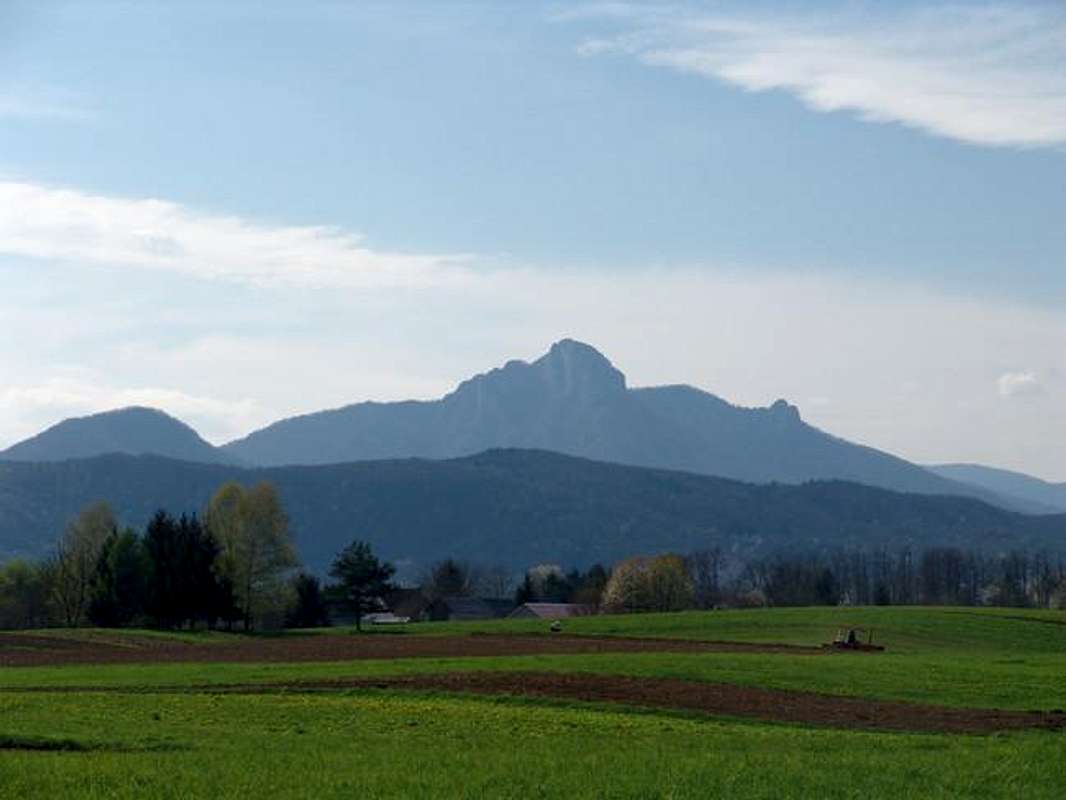
When coming from direction of Panonic plain and from Zagreb this is one of the first of higher mountains you reach in this part of Dinaric Alps, and impression is even strenghtened thanks to Klek´s very recognizable shape – a huge rocky summit that overtops its woodeed base and surrounding wooded summits.
Its elongated rocky ridge is around 3 kms long and stretches in northwest-southeast direction. The most famous features of Klek´s main ridge are 200 m high south-eastern rock (just under Klek´s main summit), somewhat smaller western one and finally Klecice (read Klechice - Klechica is a deminutive from the word Klek) - two stony steeps north of Klek´s summit.
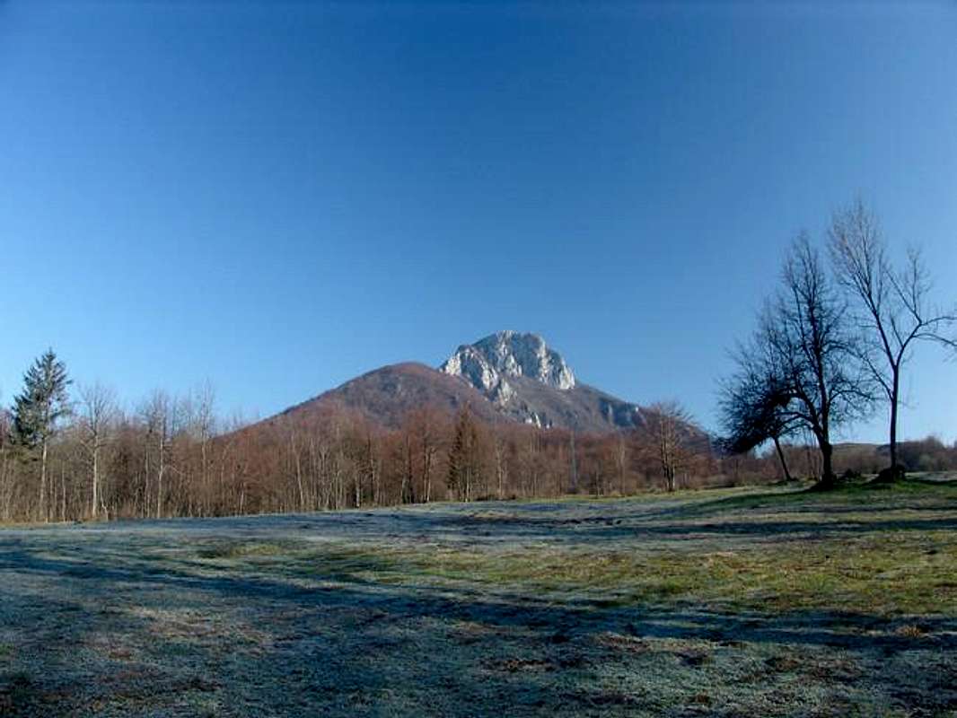
Klek, from Bjelsko village
The Klek´s main summit reaches 1,181 m and it is situated 20 minutes by foot from the „Klek“ mountain hut. Other summits are Klecice at 1,058 m, one other peak at 954 m, and Kobeljak at 953 m.
Despite the first impression of Klek area - and that is abundance of vegetation - Klek and surrounding areas have also some typical carst relief features (carstic caves, holes, carstic-type fields (ponikve) and underground waterflows and streams). Touristically attractive are also some nice grassy meadows like Bjelsko, Kneja and Ravni jarak.
The mountain itself is covered with woods up to its ridge. Along central part of ridge and atop main Klek´s rocks there are some small plateau-like meadows. The mountain has interesting variety of plants, thus making it botanically attractive.
Klek is easy accessible, within conveniet public transport and walks taking from 1 up to 4 hours, to get to its summits from the foot of the mountain. Thus, the mountain is frequently visited - you will most of the times meet people here, especcially on weekends. At its base, the mountain can be approached by paved roads from almost three sides (out of four, of course!).
The mountan´s rocks are alpinistically interesting and very popular, but yet a dozen of fatalities already happened here (thus the rock of Klek holds the first place on this „black list“ of all the mountains in Croatia).
According to a legend Klek is a meeting place of witches, which became also symbol of the mountain itself as a nearby town of Ogulin.
From the summit of Klek major mountains in Velika Kapela group can be seen (especially nice views on Bjelolasica and Bijele and Samarske stijene (rocks). Further away Velebit and other Lika-region mountains can be seen (Licka Pljesivica), as well as some mountains in Western Bosnia&Herzegovina, the Alps and other mountains in Slovenia and other summits and hills of Peri-Panonic area, including Medvednica mountain above Zagreb.
 |  |  |  |  |
Getting There
The best and most popular ascent points to start climb are the town of Ogulin and the villages of Bjelsko (12 kms from Ogulin, the shortest and most popular ascent) Vitunj and Puskarici (read: Pushkaritchi). And these are short (1 h) or a half day´s ascents.You can also approach Klek by other trails that exist in the area like those from direction of Jasenak (connecting trails with Bjelolasica, Bijele and Samarske stijene and other
Ascents from major starting points to Klek mountain will be described in Routes Section of this mountain page.
1. To get to Ogulin
By bus:
The best way to get to Ogulin by bus is from direction of Zagreb and Karlovac. For buses to/from Ogulin see schedules at: Ogulin Bus Station and Zagreb Bus Station.
By car:
From Zagreb direction take A-1 highway in Split direction to the exit Ogulin.
From Split direction - approach also by highway A-1 to the exit Ogulin.
From Rijeka direction - approach by A-6 highway (Zagreb-Rijeka) to Bosiljevo 2 junction and then continue by A-1 to exit Ogulin. You can exit earlier at A-6 in Vrbovsko and drive by local road (20 kms) to Ogulin.
By train:
On Zagreb-Rijeka and Zagreb-Split railways take off at the Ogulin station.
Schedules at Croatian Railways. (For Zagreb departure choose “Zagreb Gl.kol.”– Zagreb Main Station) or Ogulin Train Station
2. To get to the village of Bjelsko
By bus:
To get to Bjelsko you can use local buses that drive from Ogulin to Vrelo, Jasenak and HOC Bjelolasica tourist center (see Bjelolasica SP page). The bus drives app. 2 times a day in target directions. They do not drive weekends!!
For buses to/from Ogulin see schedule at: Ogulin Bus Station.
By car:
If you come from from Zagreb, Split or Rijeka direction follow the same instructons as for Ogulin - described in the previous chapter. After reaching Ogulin, pass through the town and at the western edge of Ogulin turn south in direction of Jasenak and „HOC Bjelolasica“. After the village of Puskarici the next one is Bjelsko (12 kms from Ogulin).
3. To get to the village of Puskarici
The village is the first next settlement after you leave the town of Ogulin in western direction on a way to Bjelsko village - so follow the instructions for Ogulin or Bjelsko.
4. To get to the village of Vitunj
By car:
If you come from from Zagreb, Split or Rijeka direction follow the same instructons as for Ogulin - described in the previous chapter. After reaching Ogulin, pass through the town and at the western edge of Ogulin turn south in direction of Jasenak and „HOC Bjelolasica“. After passing the bridge over Dobra river, some 500 m away from the bridge turn right off the main road, in direction of Turkovici and Vitunj.
By bus:
There are two drives to Vitunj from Ogulin during weekdays. No bus connection on saturday and sunday. Schedules at: Ogulin Bus Station.
 |  |  |  |  |
Red Tape
No special red tape info for this mountain. Not too difficult walks.Despite lots of precipitation, the montains in the area is made of limestone which does not keep the liqid at the surface, so as a precaution take all the water you need with you, during all periods. Before Klek ascent there is a nice water spring in the village of Bjelsko (eastern part of the village, when coming from Ogulin).
Be carefull on the summit of Klek if the ground is wet (after or during rain) because the edges of the rocky summit are rounded and covered with grass and can be very slippery!
 |  |  |  |  |
When To Climb
 General General Like the rest of Velika Kapela, the area around Klek is well known for lots of precipitation all the year round (rain and snow), especcially in winter, spring and fall – more than 3,000 mm a year. You can climb Klek in all periods of year. Although winter conditions can make you more problems, many times the maintainers of the Klek mountain house clear at least a small path in snow up to the house. Also in other „wet“ periods of a year because of clouds and fogs you will be very often left without nice views from the summit of Klek. Spring, Summer, Fall Late spring and early summer are the best periods to hike in the area. Late spring is especcially pleasant and appropriate period to visit, when the weather is fine and vegetation blossoming. Generally the Klek is mostly visited from May untill September. Spring and fall can have lots of rain but also the best views from the summit of other surrounding mountains. Even the summer is the driest period, because of some rainfall and lots of woods the air can be more humid and views less beautifull than in other periods of a year. CampingIt is not very usuall to camp in the mountain areas of Klek and Velika Kapela group because you can find satisfactory network of shelters/bivouacs or mountain houses at a day of half/day´s walk distance. But on Klek itself there is only one mountain house (which suits the needs, for the most times), while the other of Velika Kapela´s huts are far away from Klek around Bjelolasica mountain - and the nearest is almost 6 hours of walk away from Klek. For those mountain huts see Bjelolasica SP page.Tents can be mostly used if existing shelters or mountain houses are full (which does not happen very often), and then by asking the maintainer of the object (if there is any) to camp in the vicinity of the object. 1. On the mountain itself: Mountain hut „Klek“, (at exactly 1,000 m alt.), It is situated on a small ridge south of Klek´s summit - 20 minutes away from it. It was built in 1958. Nice views from the house. Open on weekend all year round. It has around 40 sleeping places, water supply and electricity. Contact persons are Damir Gross, ++385 47 531206, Miljenko Pavesic ++385 47 522384 (situation 2004) 2. Other accomodation possibility in the nearby area: Stozac shelter, at 800 m, can just be used as a shelter in case of need. Open all the time. It is maintained volunteerely by a single person (Mijo Stipetic), who even built 300 wooden steps up to the shelter and the summit of Stozac hill (808 m). The shelter has no electricity, no fresh water, one bad only and a stove. 3. Commercial accommodation: In Ogulin: Information at Tourist info onOgulin and The town of Ogulin official pages. In Vrelo/Jasenak: HOC Bjelolasica - Croatian Olympic Center Bjelolasica is a sports and tourist center situated at the northeastern foot of Bjelolasica in Vrelo village, 14 km from Bjelsko (at the foot of Klek mountain). Beside accomodation possibilities it has developed wide range of outdoor activities including ski, mountain biking, hiking, riding, adventure races, team building, alpinism and more. More at: HOC Bjelolasica - accomodation and HOC Bjelolasica - homepage.
Mountain ConditionsYou can find information on weather condition in the area from standard weather information sources for Croatia (DHMS – The Croatian State Hydrometeorological Institute). The nearest meteo-station for Klek is Ogulin. But be aware that Ogulin is at the edge of Velika Kapela group and sometimes the weather can differ here from that on Klek´s summit. Many times Klek mountain is at the edge of cloudiness and rainfall area while in Ogulin the weather can then be much better.General weather info at: DHMZ-Weather-english page DHMZ-forecasts in English DHMZ-local measuring points Snow conditions at: DHMZ-snow conditions the town of Ogulin (alt. 323 m) is the nearesto official measuring point.
Maps
DistancesBjelsko-Klek mountain house: 45 min-1 hOgulin-Kneja-Klek mountain hut: 3-4 h Ogulin-Puskarici-Klek m.h.: 3 h 30 min Ogulin – Stožac: 2h Vitunj-Gradina-Klek m.h.: 4 h Klek m.h.-the summit of Klek: 20 min Klek m.h.-Klecice: 45 min Klek m.h.– Vrbovsko: 7 h |