
-
 35093 Hits
-
 83.94% Score
-
 18 Votes
|
|
Mountain/Rock |
|---|---|
|
|
48.95647°N / 121.64316°W |
|
|
Whatcom |
|
|
6521 ft / 1988 m |
|
|
Overview
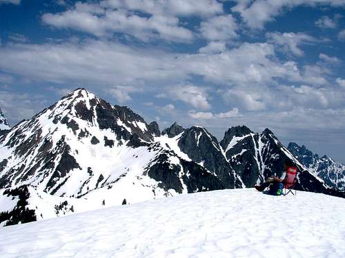 On The Summit, June 2007
Winchester mountain is perhaps the greatest reward for least amount of effort in all the North Cascades. One of the last fire lookouts in the region stands on the summit. Residents of the Bellingham area treasure the area north of Mount Baker and the awesome peaks located there. Views from the summit of Winchester Mountain are dramatic to say the least. The peaks visible from the summit include Canadian Border Peak, American Border Peak, Mount Larrabee, The Pleiades, Slesse Mountain, Goat Mountain, Mount Shuksan, Mount Baker, Mount Sefrit, Tomyhoi Peak, Yellow Aster Butte and more. Being one of the easiest hikes on Hwy 542, it gains only 1,300ft in 2.5 miles from Twin Lakes*. Few places offer a fulfilling alpine experience of this caliber with such little effort.
*NOTE: A high clearance vehicle is required to drive Twin Lakes Road beyond the Yellow Aster Butte trailhead. Otherwise, park at the Yellow Aster Butte trailhead and hike 2 miles and 1,600ft to Twin Lakes (5,200ft). This will change the total mileage from 5 miles round-trip to 9 miles.
Summer:
Due to the long approach on the road* this trail is thankfully a little less popular than it would otherwise be. The hike is very family friendly since you can camp at twin lakes after you've braved the road section, then make an easy day-hike to the summit the next day. Dogs should have no problem with this route. Remember that along with many peaks in the North Cascades, Winchester might be a late bloomer. On high snow years, the parking lot at Twin Lakes might not be melted out until late July while the trail itself could hold a few dangerously steep snow patches and moats until well into August. For this reason most people will plan their hike for August - October.
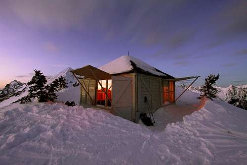 Photo courtesy of StephAbegg
Winter:
This is a popular snowshoe trail in winter. The best choice for a winter ascent is the Winchester Direct Route which bypasses the summer trail. You may want to bring an axe but you can leave the crampons at home except for late season. ALWAYS check the avalanche forecast here and have ample awareness of the signs of danger.
Definitely bring ski or trekking poles to keep your balance. The crux of the climb may be road conditions, which will also dictate the length of the approach. Unfortunately the forest service doesn't post road conditions during winter so you'll have to gamble. This is a good objective in winter since you can skin or snowshoe an easy to follow road to 5,200ft.
Skiing:
Winchester Mountain being can be skied off both the Northwest and Southeast sides. In either case advanced skiing ability and back-country safety and diagnostic skills are required. Cliff bands and avalanche hazards exist on every descent route, a fall could be potentially serious.
The northeast face is most feasible because it brings you back to the road (and your car if you made it to twin lakes) and offers the most gentle route down. The South and West faces offer good skiing but require either climbing/skinning back the way you came -or- hiking over Gold Run Pass (~1,700ft elevation gain) then down to the Yellow Aster Butte trailhead.
You can find trip reports here . Depending on snow pack Winchester can be skied as early as October and as late as June.
 Photo courtesy of ericnoel
Getting There
- From I-5 take exit 255 (Sunset/Mt Baker hwy) and drive east 31 miles to the town of Glacier
- Drive another 13.5 miles and take a left on forest service road 3065 (Twin Lakes Road) adjacent to a large parking lot and a cluster of small buildings.
- Drive 5 miles (stay left at all forks) park at the Yellow Aster Butte/Lake Tomyhoi trailhead
- ***high clearance vehicles may be able to drive beyond this point but it gets very rough. Park at Twin Lakes Trailhead.
Please be respectful and find a good place to park that allows other drivers further access and the ability to turn around. If driving beyond the Yellow Aster Butte trailhead, remember that the Twin Lakes trailhead is at 5,200ft so check your snow levels to see if your car can make it.
Always Check the Current Road Status
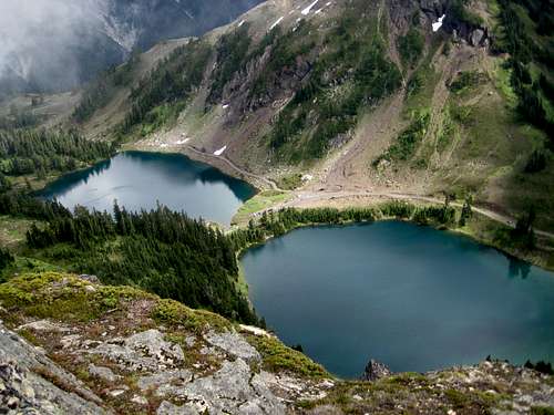 Twin Lakes, Photo courtesy of Travis_
Red Tape
A Northwest Forest Pass is required for each vehicle parked at either the Twin Lakes or Yellow Aster Butte trailhead, $5 Dollars per day or $30 for an annual pass.
Where to get PARKING PASSES:
The Shell Gas Station in Maple Falls, is on the right (heading East). NO GASOLINE AVAILABLE BEYOND THIS POINT!!! There is no gasoline available between Maple Falls and Deming (heading West).
GLACIER PUBLIC RANGER STATION: (360) 599-2714
On the right (heading East) as you leave the town of Glacier. Ranger Station closed for the season after Oct. 11
Bellingham REI: (360) 647-8955
400 36th St Bellingham. Take a left off exit 252 (WWU-Bill McDonald Parkway), another left, it's in the Haggen lot.
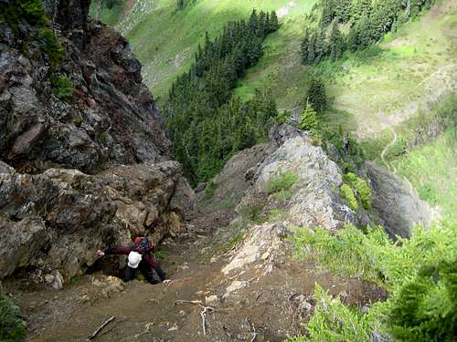 Climbing the north ridge, Photo courtesy of Travis_
When To Climb
This hike is great all year. In Summer or Autumn it's a trail hike and in Spring or Winter it's a snow climb. In Spring be very careful crossing drainages on snow bridges and watch for holes created by melt-out around small trees and rocks. Also, be careful as wet slides and sluffs occur frequently. Use common sense, retreat if conditions don't permit safe travel.
Camping
Campsites are available at Twin Lakes. If your car can make it you can car-camp here. There are also campsites available at High Pass. Please use only established campsites! The Calypso orchid grows here. It is an endangered plant. If you were to trample or camp over one, the forest service would give you a very hefty fine when they caught you.
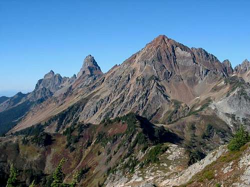 The border peaks and Mount Larrabee, Photo courtesy of ericnoel
Mountain Conditions
Check Snow Level
Check Avalanche Report
Check Weather Forecast
...More Info
Current Road Status
Remember that these are general warnings and forecasts, always use good judgment and retreat if necessary.
External Links
- Winchester Mountain Trail
Description from Wildernet.com . - Views of Winchester Mountain & Twin Lakes
Numerous large photos - Winchester Mountain "Hike of the Week"
From the Seattle Post-Intelligencer newspaper.
Trip Reports
- BeauDaddy's Awesome Photo Trip Report of our 2010 climb of Winchester and Larrabee
- Steph Abegg's Awesome Photo Trip Report of her winter solo and a night spent in the lookout
- TrailPair's August 2010 Trip Report
- GeoHiker's July 2010 Trip Report
- Elvis's July 2010 Trip Report
- GeoTom's September 2009 Trip Report
- Iron's October 2008 Trip Report
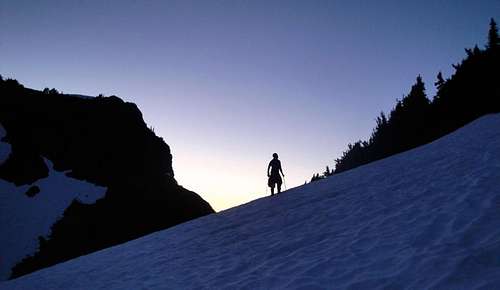 Photo courtesy of beaudaddy85