
-
 16211 Hits
-
 87.26% Score
-
 24 Votes
|
|
Mountain/Rock |
|---|---|
|
|
46.43590°N / 11.74230°E |
|
|
7972 ft / 2430 m |
|
|
Overview
Geographical Classification : Eastern Alps > Dolomites > Marmolada Group > Sas de Adam
Sas de Adam - or Sass de Dama as it is called in Italian - is part of the Colac - Buffaure Subgroup in the Marmolada Group. It is located rather central on the Buffaure Ridge and though itself not really a climbing target shall represent the subgroup here on SP. It is a very popular summit, mostly stemming from the fact that two chair lifts lead to the ridge, on its western end at Buffaure, one on its centre at Sella Brunec. Naturally these chair lifts are ski lifts in winter and this tells you what you might expect on a busy day in any season.
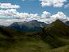
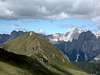
Apart from the summits in the east of the group - Colac, Torre Dantone, Croda Nera and Sasde Roces - the Buffaure Group is composed of smooth, grass covered summits. All are located way above the timberline which makes the ridge one of the best lookout ridges in the whole area. Wait for a fine day and you can find no better place to hike and watch. After a day with 1700m elevation gain on Latemar the day before this was where we wanted to relax. We ended up with another 1500m, which were totally unplanned for.
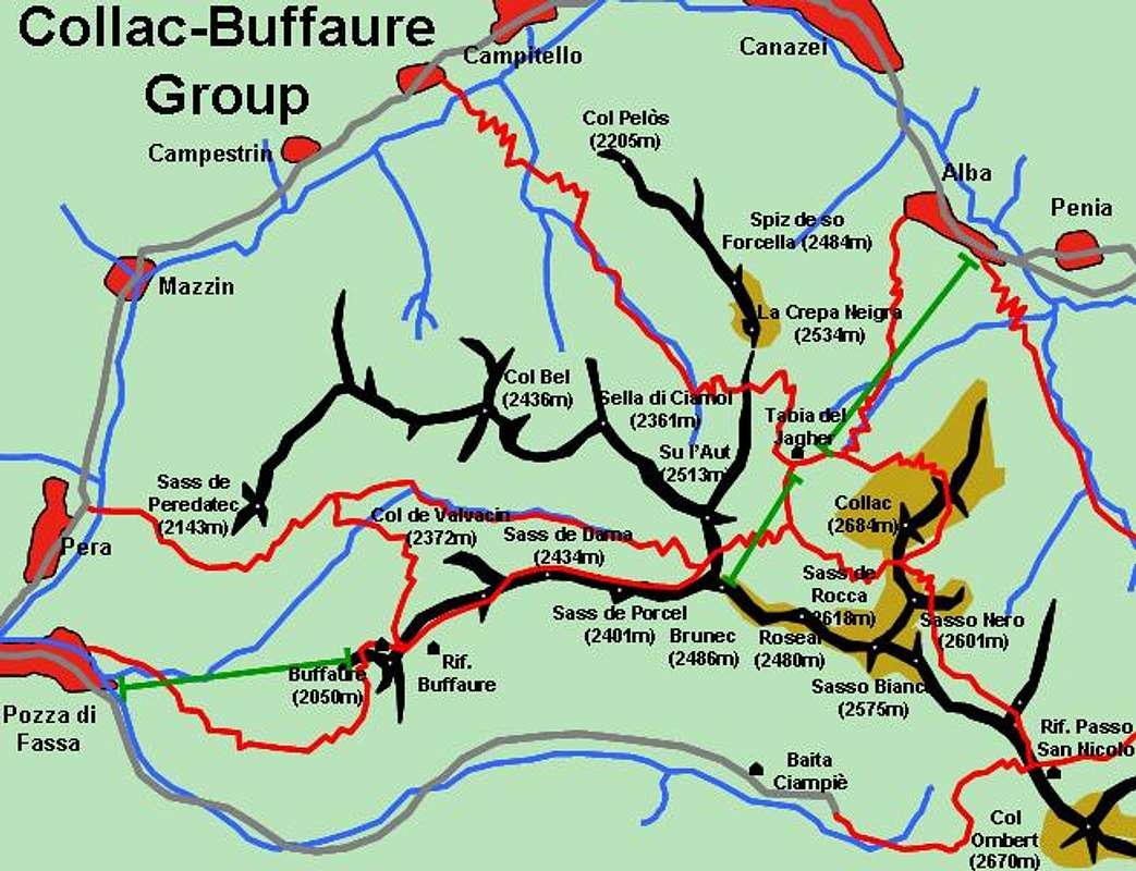
Hand drawn map of the Colac - Buffaure Group. Sentiero Lino Pederiva follows the ridge between Bunec and Passo di San Nicolò
Why? The Buffaure Ridge offers a route, formed like an 8, which is easy but very demanding. It follows the whole ridge from Buffaure in the west to Passo di San Nicolò in the east and returns via Forcia Neigra, Su l'Aut and Sella di Ciamol. All in all, almost 1500m, many of which are breathtakingly beautiful. The first part between Buffaure and Sella Bruneck is an easy hike - here the summits (Sas de Adam among them) are like hills. After Sella Brunec "Sentiero Attrezzato Lino Pederiva" starts, an equipped trail, secured with cables wherever there might be some danger. Imho there is no need to touch the cables even once. Lino Pederiva leads to Passo di San Nicolò with its Rifugio but already shortly after Sasso Bianco the third part of the 8 starts, leading towards Torre Dantone and Colac. From here (Forcia Neigra) you head down towards the central station of the Ciampac cable-car/ chair lift and up again to Sella Brunec. The easiest way would be tu return to Buffaure via Sas de Adam, instead you can climb Su l'Aut and Sella di Ciamol. The last part heads down into Val Jumelina and back up again to Buffaure. A long day well spent! (compare with the little map above, where some of the trails are missing)
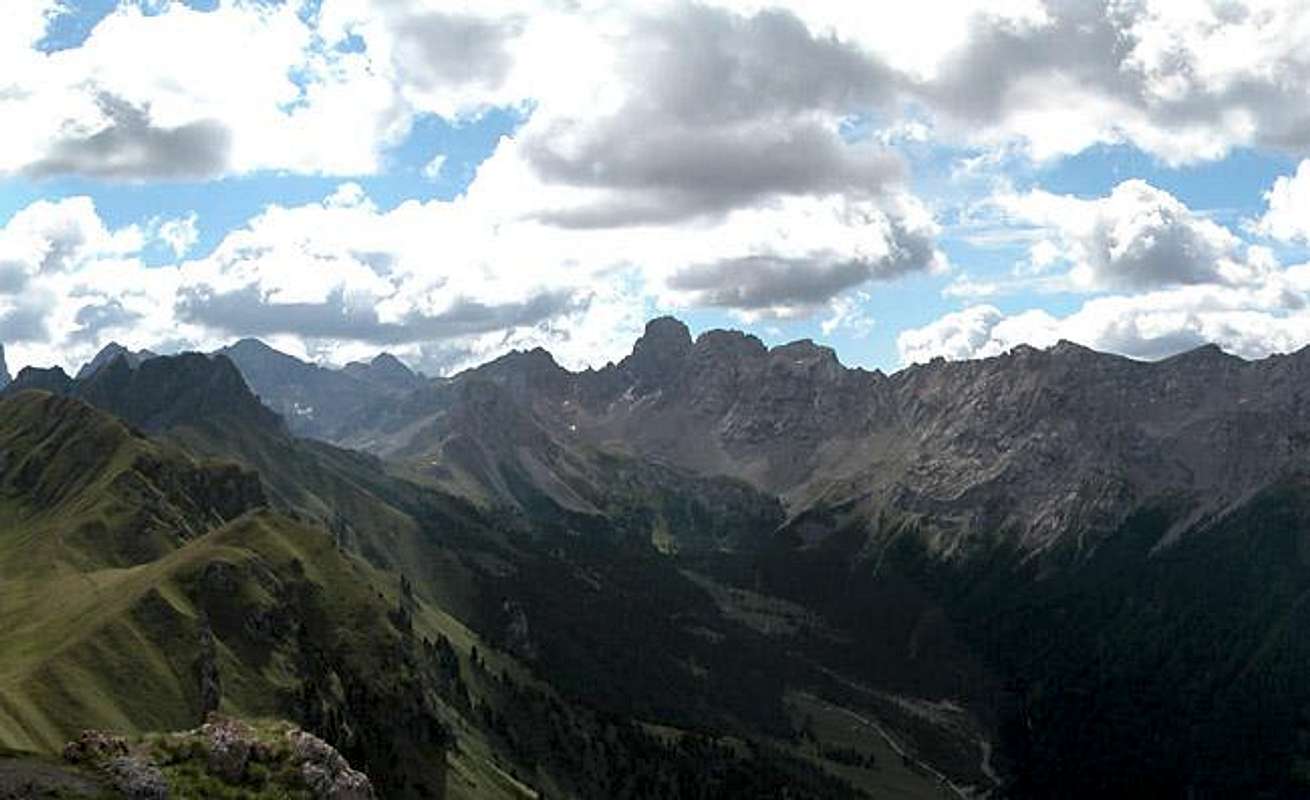
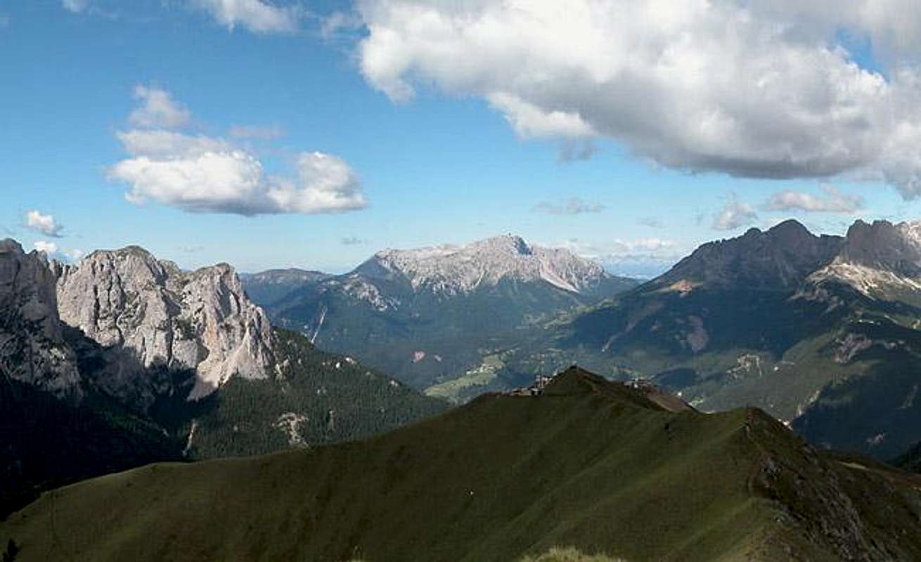
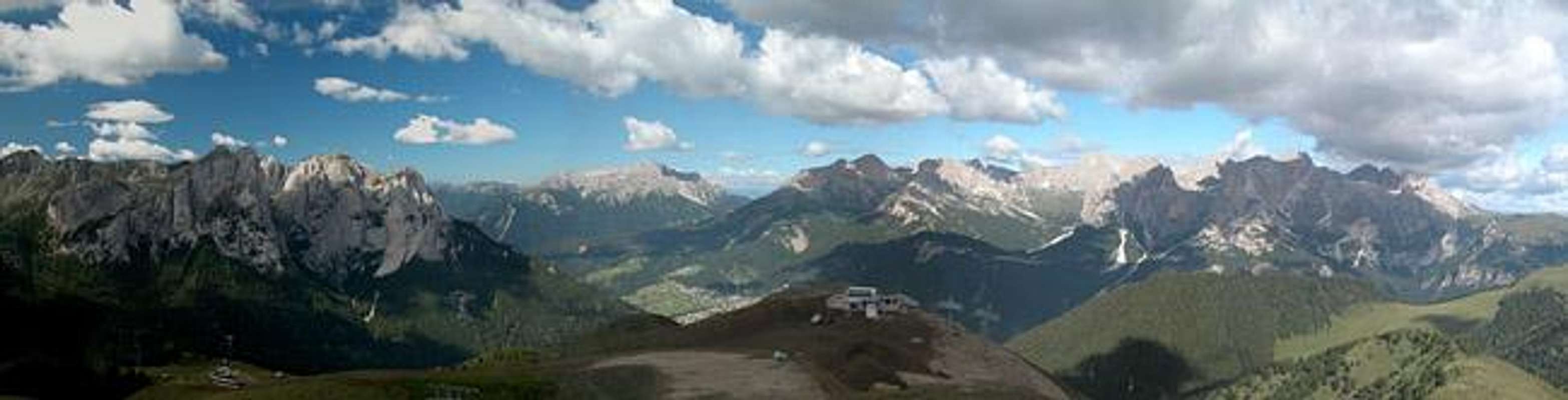
Finally, back to Sas de Adam: I chose it to represent the Colac - Buffaure Subgroup because it offers the best views all around. Su l'Aut might rival these views but during our hike weather was already deteriorating. All of the western Dolomites are on display as you can see from the 360° panorama on top. We were lucky to reach Sas de Adam very early before the crowds closed in on it and had to share the summit with two people only. Pure pleasure!
 |  |  |  |  |
360°Summit View
Sella di CiamolPlattkofelZahnkofelInnerkofler TurmGrohmannsp.Fünffingersp.L a n g k o f e l G r o u pPuez - Geisler/Odle GroupCol RodellaSass PordoiPiz BoèS e l l a G r o u pCrepa NeigraSu l'AutColacGran VernelMarmoladaSass PorcelSas de RocesSasso VernaleC. OmbrettolaC. CadineC. UomoP. de le ValateS. CostabellaC. CostabellaC. della CampagnaccaLastei GrandePala di CarpellaRizzoniC. MalinvernoP. VallacciaSas MorinSas da le UndescSas AutSas da le DodescV a l l a c c i a G r o u p L a t e m a r G r o u p RotwandMugoniC. CatinaccioC. ScalieretKesselkogelAntermoiakogelR o s e n g a r t e n / C a t i n a c c i o G r o u p
 |  |  |  |  |  |
Sentiero Lino Pederiva
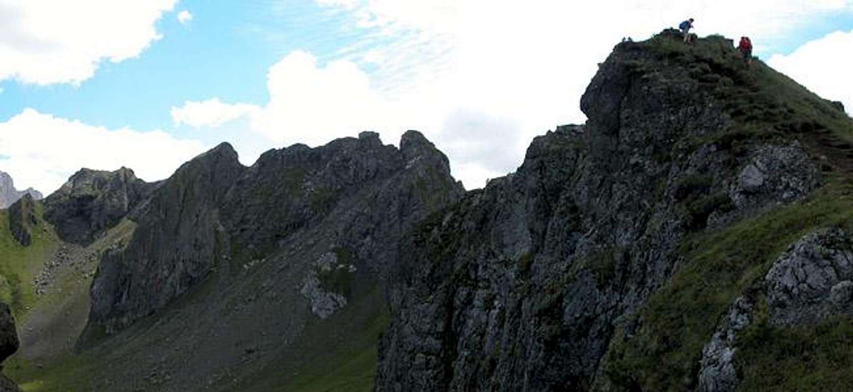
On Sentiero Lino Pederiva on the Roseal Ridge
Rather than putting up a route to Sas de Dama - the climb of which is absolutely straightforward - I would like to describe the Sentiero Attrezzato Lino Pederiva in this section. Sentiero Attrezzato means "equipped" trail - it is a hiking trail secured by cables. You will find these trails all over the Dolomites but beware - their difficulty differs a lot! Lino Pederiva (whoever he was) is a very easy trail. There are a couple of exposed sections in its eastern part which have been secured. The exposure is minimal however and I would say that the cables are there just to guide the eye ;-)
The trail starts from Sella Brunec from where it climbs directly to the Roseal Ridge. It follows the ridge right on top until it reaches the western walls of Sas de Roces. Up to here there is no protection but now, as the trail lowers into the south face of Sas de Roces you'll find several stretches equipped with firmly mounted steel cables. A short climb to Sasso Bianco leaves the "difficult" part and now you cross pastures towards Rifugio Passo di San Nicolò.
More difficult is the trail back across Forcia Neigra though this also wouldn't register as a ferrata. Directly east of Sass Bianco there is an intersection the left branch of which (trail no 613) leads northward to the black Torre Dantone. It (the trail) leads across the tower's western shoulder into a little pass. Between this pass and Forcia Neigra you have to climb another (unnamed) Sentiero Attrezato and here you certainly need the cables. Two or three big steps have to be negotiated and with the help of firm cabling this is far easier than without. From Forcia Neigra on the route gets to be a mere hike down into the Ciampac plain and back up to Sella Brunec.
 |  |  |  |  |
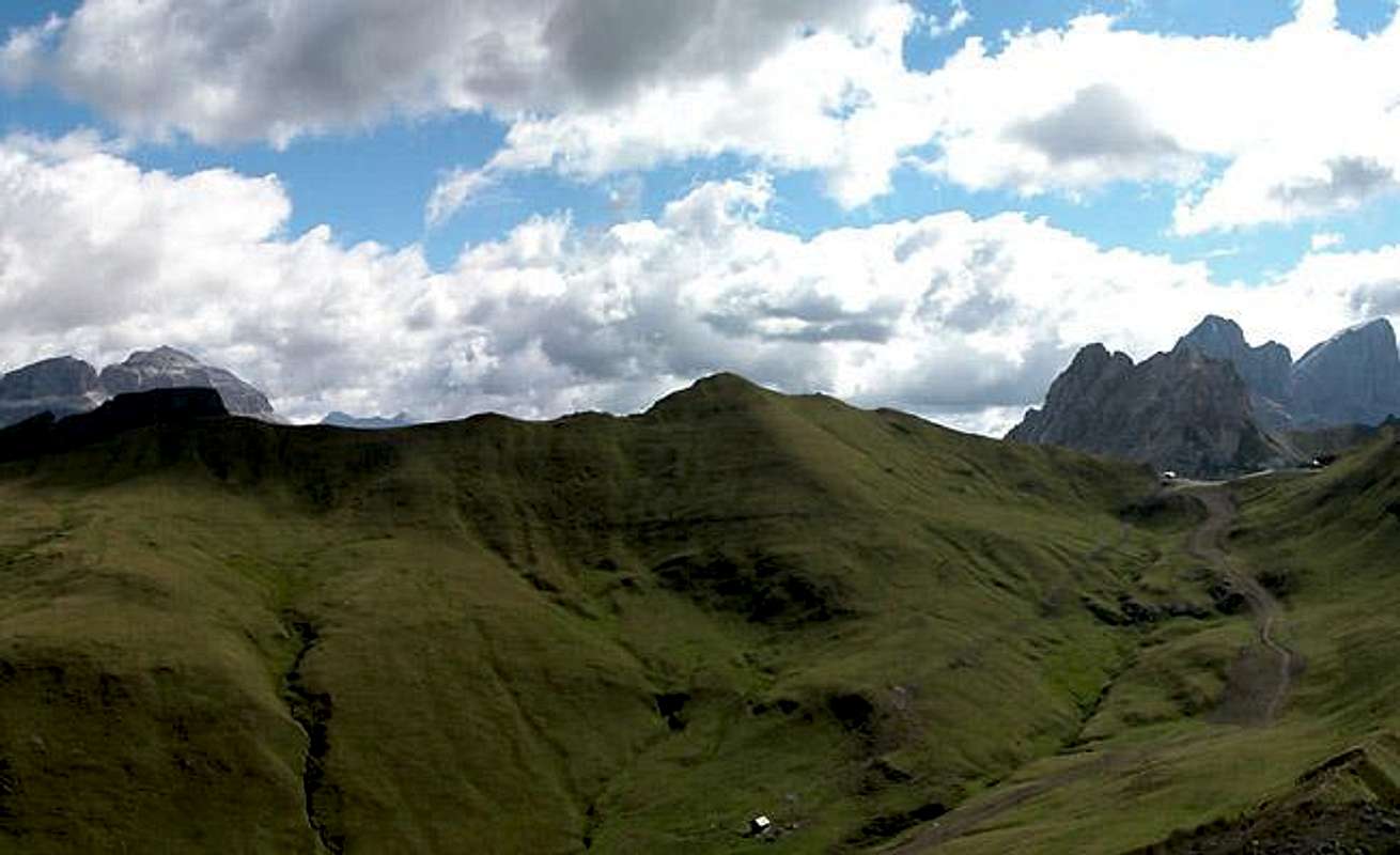
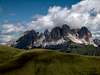
The summit views
View towards the east: Vallaccia, Latemar and Rosengarten / Catinaccio
There are few places where you can observe the western Dolomites as well as from the Buffaure Ridge. Padon comes to my mind and there might be another similar page in the future. On a fine day you can also see the Adamello and Presanella Groups to the west but my favourite is the northern view of the Puez Geisler Group.
 |  |  |  |  |
Getting There
There are two trailheads for Sas de Adam, both include cable-cars, cabin or chair lifts. Of course you can hike from the valleys below but I think it is a dubious experience when you get up to the summit huffing and puffing and find it crowded by the cable-car crowd. Moreover the hiking possibilities on the ridge will keep you busy for a day even if you start from one of the lifts.
Pozza di Fassa and Penia both are located in Val di Fassa. While you can find Pozza in the south of the valley, Penia is located to the north, east of the big bend At Campitello and Canazei. Both villages are connected by SS48 and SS641 (east of Canazei).
- From the North (Brenner / Brennero)
Follow motorway A22 down to Cornedo (north of Bozen / Bolzano). There turn east on SS241 (Dolomite Highway) across Karerpass / Passo Carezza to Vigo di Fassa. Turn north on SS48 to Pozza di Fassa where you need to turn east into Val di San Nicolò for the Buffaure trailhead. For Penia follow SS48 to Canazei and there turn east on SS641 direction Fedaia. After a couple of km you'll reach Penia and the bottom station of the Ciampac cable-car.
- From Verona
Take A22 north until the exit Ora / Auer. There turn east on SS48 direction Val di Fiemme which in the end will take you to Val di Fassa with Pozza and Penia (see above).
- From Venezia
Take motorway A27north up to its end at Belluno. From here follow SS51 north to Cortina d'Ampezzo where you turn west on SS48 which takes you to Livinallogo and accross Passo Pordoi to Canazei. Turn east on SS641 to Penia or follow SS48 to Pozza depending on your preferred trailhead.
A second route takes you from the end of the motorway through Belluno southwest on SS50. In Belluno turn onto SS203d which turns into SS203 to Alleghe North of Alleghe turn east on SS641 accross Fedaia Pass to Penia, Canazei and Pozza.
From Lienz (Austria)
Take E66 west to Toblach / Dobbiaco, where you turn south onto SS51, direction Cortina d'Ampezzo. Here you turn west again onto SS48 to Livinallongo, Canazei and Pozza. For Penia turn east onto SS641 at Canazei.
Red Tape
There is no red tape here. The slopes of Buffaure are used for skiing in winter and for cattle grazing in summer. Near the chair lift and cable-car stations you'll find a lot of construction going on so requesting special behaviour seems a bit out of place. Still respect nature and on the trails around Sas de Roces (Sentiero Pederiva) and Torre Dantone be careful not to dislocate any rocks. The trails are rather fragile.
When To Climb
The western part of the Group (Buffaure) can be climbed all year round. No matter what the weather is like you'll be able to reach Sas de Adam. The eastern part around Colac and Sas de Roces is best hiked in summer only. The season runs from late June through late September or early October.
Camping
Camping
- Marmolada
via Pareda
Canazei
Tel.: +39 0462.601660
Fax: +39 0462.601722 - Catinaccio
via Avisio 15
Pozza di Fassa
Tel.: +39 0462.763305
Fax: +39 0462.763501 - Soal
via Dolomiti 32
Pera di Fassa
Tel.: +39 0462.764519
Fax: +39 0462.764609 - Vidor
Località Vidor
Pozza di Fassa
Tel.: +39 0462.763247
Fax: +39 0462.764780
Accommodation
Mountain Conditions
Weather and avalanche conditions in Trentino: www.meteotrentino.it
Weather conditions Dolomites:www.dolomitimeteo.com
Maps 'n' Books
Books:
- Climbing
- Classic Dolomite Climbs: 102 High Quality Rock-Climbs Between the Uiaa Grades III and VII (also available on CD)
Anette Kohler, Norbert Memmel
Mountaineers Books
ISBN: 0 8988 6693 6
- Classic Dolomite Climbs: 102 High Quality Rock-Climbs Between the Uiaa Grades III and VII (also available on CD)
- Vie Ferrate
- Klettersteige Dolomiten
H. Höfler, P. Werner
Rother Verlag
ISBN: 3 7633 3096 8
- Hülslers Klettersteigführer
E.E.Hülsler
Bruckmann Verlag
ISBN: 3 7654 4161 9
- Klettersteige Dolomiten
- Hiking and Trecking
- Höhenwege in den Dolomiten
H. Dumler
Bruckmann Verlag
ISBN: 3 7654 3860 X
- Dolomiten
P. Fleischmann
Kompass Verlag
ISBN: 3 8705 1409 4
- Dolomiten 4
F. Hauleitner
Rother Verlag
ISBN: 3-7633-4061-0
- Die Marmolata. Königin der Dolomiten. Führungen durch ihr Reich
L. Visentini
Athesia
ISBN: 8 8701 4172 1
- Höhenwege in den Dolomiten
Maps:
- Val di Fassa, Marmolada, Gruppo di Sella
Kompass Map WK 686
ISBN: 3 8549 1768 6
Scale: 1:25000
- Sellagruppe / Gruppo di Sella
Kompass Map WK 59
ISBN: 3 8549 1066 5
Scale: 1:50000