
|
|
Route |
|---|---|
|
|
37.88810°N / 108.2557°W |
|
|
Steep scramble |
|
|
Half a day |
|
|
Scramble |
|
|
Introduction and Updates
Note from Chuck Haywood: We tried to access the NW ridge via the described road on Sept. 1st, 2005. The 4 wheel drive access road to the north-west ridge has been trenched about half way up (at 2.3 miles), and a no-tresspassing sign has been posted. We did not know if the road was still a legal easement to the national forest, and elected to turn around and drive back to the north ridge access road.Update #2 from Jaypkk (August 2007): The access road from the west is still barricaded at about 2.3 miles.
The following route is probably the easiest route on the mountain that has (or had??) public access, but the route seems to be closed now.
Approach
A 4wd vehicle is recommended, having only a car will add 8 miles round trip.From Norwood drive east on Highway 145 1.5 miles to 44Z Road. Turn right and follow the main road south. At 13.6 miles stay left on 44Z Road. At 16 miles bear left at the T, which is 31U road, and follow it south. At 17.7 miles take the 4wd road to the east (left). If you reach Acorn Ranch, you went too far. From the start of the 4wd road, obey the signs of no tresspassing and stay on trail. The road is accessible to the public, but you must not stop for the next four miles. The forest boundary is reached after four miles, and most cars can make it to this point. The road becomes FS 534. With a 4wd, take the first left and begin climbing. At 4.5 miles, stay left along FS 534. Stay right at the next fork, which is at 5 miles. Continue another .8 miles to a meadow and logged area. Park here.
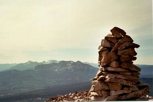 Summit of Lone Cone looking east.
Route Description
From the trailhead, head east cross-country towards saddle at the base of the NW ridge of Lone Cone. There's a maze of old logging roads here, just head in the general direction of the saddle using the logging roads, and cross-country travel. Stay just to the right of a bare rock ridge, and follow the forest edge. Make your way up to the saddle. From the saddle, climb up the NW ridge of Lone Cone, following it all the way to the summit. There is much boulder-hopping and the route is steep. Since this peak stands alone, you will be rewarded with some of the best long distance views in Colorado. You can also see parts of New Mexico and Utah. Be careful on the descent through the boulders.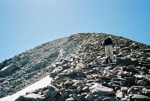 Nearing the summit. Just after the junction of the N and NW ridges.