

-
 9843 Hits
-
 74.92% Score
-
 5 Votes
|
|
Route |
|---|---|
|
|
40.72017°N / 110.82274°W |
|
|
Scrambling |
|
|
Summer, Fall |
|
|
Half a day |
|
|
Class 3 or 4 |
|
|
Overview
This is the standard route on Hayden Peak and the one just about every day climber will want to use. A fit climber can complete the route (RT) in just a few hours. With some fun scrambling, great views, easy access, and the strong likelihood of easily avoiding the thunderstorms that frequently sweep over the Uintas on summer afternoons, this route is an excellent way to attain the summit of what is probably the most challenging peak to climb in a day in the Hayden Pass area.
Since it's such a short climb (but quite steep), if weather permits, one can try the Hayden-East Hayden traverse to East Hayden Peak or take a few hours' break and later go for one of the scrambling options on nearby Reids Peak.
Getting There
From either Evanston (WY) or Kamas (UT), take the Mirror Lake Scenic Byway. This 54-mile road is the highest paved road in Utah and takes about 90-120 minutes to drive without stops. At Hayden Pass, more than 30 miles north of Kamas, find and park in the large, well-signed parking area for the Highline Trail, likely the busiest access point to the High Uintas Wilderness.Route Description
The original author of this page described a route that many users of this route page seem to have taken. However, I found a way that is more direct and seems easier. My route is described under Option 1; the original author's route is under Option 2. Some members have found some Class 5 options near the summit; see Option 3.
Distance to the summit is about 2 miles, with an elevation gain of about 2100'.

Showing the two variations for attaining the ridge crest itself

Showing the two variations for attaining the crest of the ridge itself
Option 1
From the trailhead, either strike out off-trail across a meadow and into forest in the direction of Hayden Peak or hike a short distance on the Highline Trail and then leave it, aiming for a rocky spur ridge visible through the trees ahead. If you do the latter, you may come across a decent use trail that leads to the talus at the base of the west side of the spur and Hayden's south ridge.
Your next objective is to climb up the talus (Class 2) to the prominent notch separating Hayden's south ridge from the long ridge leading to the summit of Mount Agassiz. By late summer, there probably will be no snow left in the couloir below the notch. Earlier in the summer, at least an ice axe might be necessary. You should be able to preview this part of the route from locations along the road, though. The couloir looks loose, and it is, but as it ascends and narrows, you can find pretty stable rock on the right side.
Once at the notch, head north (often there is a use trail skirting easy scrambling objectives) along the ridge to the summit area.
The way I found to the summit did not quite match the original description on this route page (see below). While the author worked north past the summit and then circled back, I found something more direct via a Class 4/5 chimney/corner. A much harder variation was nearby. Anyway, my way was more direct and put me a short distance southwest of the summit. Getting up that chimney/corner was the only technically challenging part of my route to Hayden's summit.
Bottom line: take some time up there near the summit and find the variation that works for you; Class 3-5 possibilities exist.
To regain the South Ridge below the true summit
Option 2
This is by MrWasatch, the original page author:
The route up Hayden climbs east directly to a prominent ridge rising from the valley. There are several small cliff bands that can easily be avoided down low. Once on this spur ridge the climbing is steep up to a 10-15 foot crack requiring difficult scrambling to get past. Once beyond this crack, it isn't far to the main south ridge of Hayden, which is almost entirely talus. Continue north up gentle talus and then contour around the west side of a sharp false peak. Re-ascend to the main ridge via a steep crack with good rock. Once back at the ridge, the route to Hayden's summit stays on the east side along steep rocks with some exposure, and we actually went north beyond the summit before circling back via the "easiest route." Loose rocks and exposure abound, not the place for beginners or people with a fear of heights.
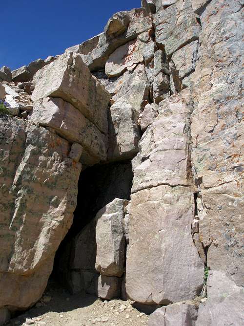
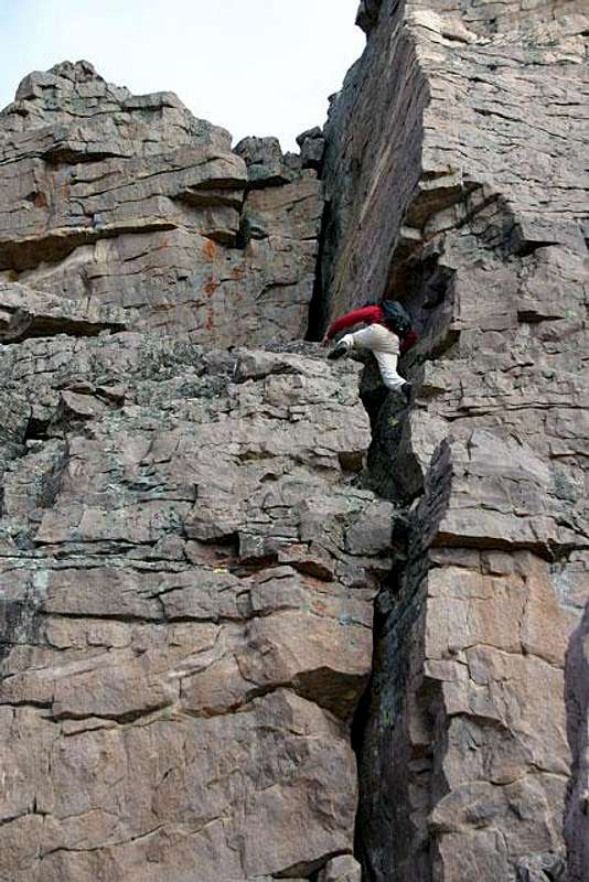
This is the 10-15 foot crack described as "requiring difficult scrambling to get past."
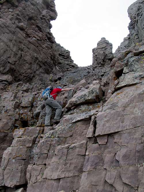
SP Member Mtybumpo ascending the first (and main) crux move to gain the South Ridge of Hayden Peak
Option 3
This is for those who want to turn this climb into a challenging Class 5 matter.
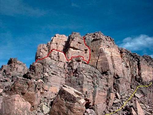
By Grandwazoo-- The route in RED is not the easiest way or the one described. This was a slight variation I took to reach the summit my second time to Hayden. The photo is taken while descending on the YELLOW route described as South Ridge.
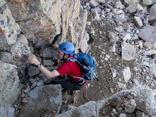
Working up the 5th class terrain described by Grandwazoo. Halfway up the second crack there is one 5.6 move that leads you to the top. Whatever courage I thought I had quickly evaporated with freezing winds and numb fingers. The standard route around the east side of the summit tower began to look like a lot more fun. October 8, 2005.
Essential Gear
Nothing special for most of the summer and early fall. In early summer, an ice axe and crampons might be advisable. Preview the route from the highway before deciding to haul the extra gear.