

-
 31701 Hits
-
 78.27% Score
-
 9 Votes
|
|
Route |
|---|---|
|
|
52.17630°N / 117.2347°W |
|
|
Mountaineering, Ice Climbing |
|
|
A long day |
|
|
AI 2, 45 degrees, 1400 m |
|
|
II |
|
|
Overview
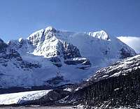 Skyladder on the right shoulder
Skyladder is a classic and highly recommended moderate ice climb. It is justifiably the most popular route on the mountain.
The difficulty depends on the amount of ice on the route, which can vary from
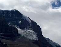 Skyladder melted out
Approach
From the climbers parking lot, walk along the paved road that leads to the bus parking lot. Pick up a faint trail that starts behind the left corner of the maintenance building. This trail can be a little tricky to follow, since it is pretty braided in spots. Try and maintain a direction towards the upper left of the glacier, where it meets the rock ridge that extends down from the summit.Once on the glacier, gain elevation onto the upper section, then pick the safest line to the base of the route. There are some very large crevasses.
Route Description
 Andromeda Routes
Cross the bergschrund (can be difficult) and climb up the ice face. The face is steeper (up to 45 degrees) at first and slowly decreases toward the top.
From the top of the face, continue along the ridge to the summit.
CLIMBING ON SKYLADDER:
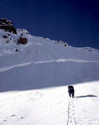 Approaching Bergschrund Approaching Bergschrund |
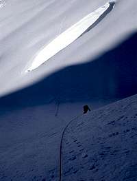 Low on Route Low on Route |
 High on Route High on Route |
Descent
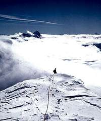 Descending the South Ridge
It is possible in very good conditions to descend Skyladder, but most parties probably would not choose this option.
It is also possible to descend the South Ridge to the Columbia Icefield and then down the Athabasca Glacier. This is the long way and has considerable crevasse danger.
Geoff Ruttan (former SP member and original submitter of this page) provided wrote the following descent description:
The most used descent from the summit is the East Ridge / AA col.
From the summit begin descending down east, towards Mt Athabasca. After descending approx. 150-200m cut onto a ridge that leads more to the north, towards the buses. In poor visibility it is very easy to miss this ridge.
Walk out onto the ridge. There are 3 rappels do to from here, but it is possible to down climb it. The first rappel is near the end of the ridge and goes down the right (SE) side of the ridge.
After rappelling, continue down climbing and traverse over to the col. It is a short climb up to the col.
Descend the ice face below the col via whatever means you feel comfortable. There is a piton rappel about 40m above the bergschrund. It can be found in the rock to the climbers left.
Essential Gear
Glacier GearOne or two ice tools or axes, depending on your comfort level
crampons
One rope is sufficient