|
|
Route |
|---|---|
|
|
40.79290°N / 110.3666°W |
|
|
Long backpack/scramble |
|
|
A few days |
|
|
Class 2 |
|
|
Approach
There are several possible routes to West Gunsight Peak, but by far the most popular route is from Henrys Fork.As per SP member Gradwazoo:
From exit 39 on I-80 head South towards Mountain View on route 414 for 6 miles. At the “Y” (@ the Bronze Elk) stay right on route 410 heading towards Robertson at about 6.8 miles on 410 the road makes a 90 degree right hand turn, at this point you will want to go straight (or left) leaving 410. The road turns and stays gravel for the duration of the drive to the trailhead. Continue straight on the gravel road after leaving 410 for 12.3± to another intersection at this point turn left, right would take you to China Meadows (7 miles). After taking the left continue for 7.7± miles to a hairpin turn, at this point continue straight (or right) off of the previous road. Follow this for 3 miles to the Henry’s Fork Trail head. The last 3 miles of the road are not maintained in the winter months, so your temporary trailhead will start 3 miles sooner.
Route Description
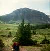
The Henrys Fork Trail is very well used and is easy to follow. From the trailhead, follow the trail south for two miles to a junction. Stay left on the main trail. After another 3.5 miles, you will reach Elkhorn Crossing, where there is a bridge, and another junction; this is the North Highline Trail.Continue on the trail to and then past Dollar Lake. This is not a recommended campsite, because it has been way over-used. Continue along the trail to Gunsight Pass. Just before the climb to the pass, there is a small lake and meadow that can be used as a campsite. It can get very cold here in summer, but this is one of the best campsites along the route.
From Gunsight Pass, you can climb Southwest over the boulders and reach a sloping plateau before climbing west to Anderson Pass, but the easiest (though longer) route to Anderson Pass is to follow the trail to the Southeast and into Painter Basin. Once the basin is reached, you can head due south (no trail, but easy) along the base of the ledge for a mile. You will then intersect the trail running west to Anderson Pass. Follow the trail west and towards Anderson Pass.
From the east side of Anderson Pass, and just before the final steep climb to the pass, leave the trail and head north. There is a track in places, because of people heading for the “shortcut notch” back to Henrys Fork to Kings Peak or vice versa. Note: This shortcut is not recommended after the snow melts. It has loose rock and erosion is a problem. Too many people using the route will create an unsightly scar on the mountain.
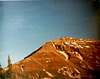
The notch is marked as 12,450 on the map. From the notch, climb up the ridge to the northeast. The ridge is easy, with only a few sections of boulder-hopping at the top. The summit is about 650 feet above the notch. Enjoy the fine views from the summit.
Round trip distance to the summit and back to the trailhead is 30 miles and takes 2.5 to 3 days for the average hiker.