|
|
Route |
|---|---|
|
|
49.12050°N / 20.13200°E |
|
|
Mountaineering, Scrambling |
|
|
Spring, Summer, Fall, Winter |
|
|
Most of a day |
|
|
Class 4 |
|
|
The page was created anew in December 2023.
Overview
Route Description
|
The starting point, or rather points, are located to the ENE of the summit on the red hiking trail between Skalnaté and Zelené tarns. If you are coming from Zelené pleso, you will leave the waymarked trail when you have ascended Sedlo pod Svišťovkou. For those coming from Skalnaté pleso the most convenient point seems to be the sharp bend in the trail about a hundred metres south of the saddle. 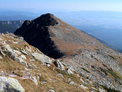
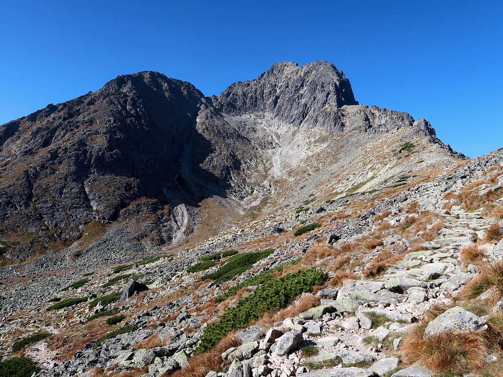
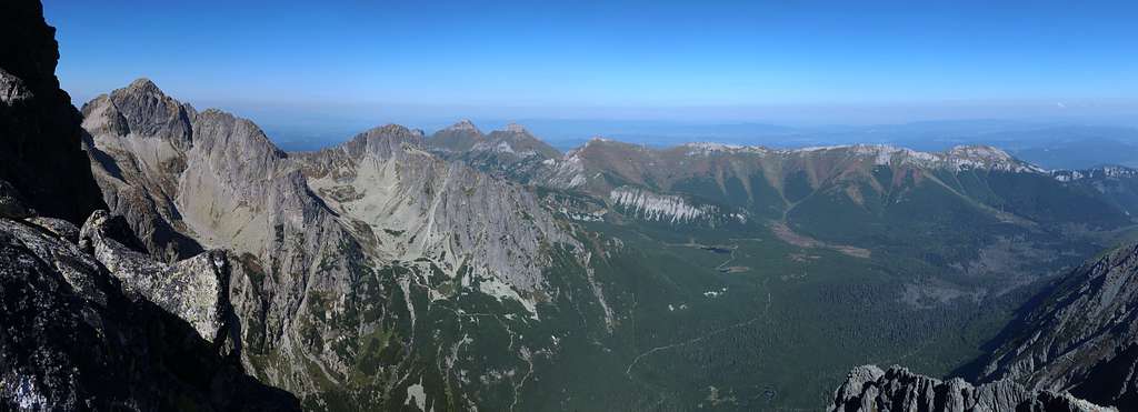
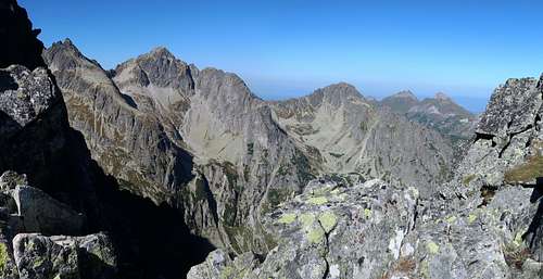
You can follow the crest of the ridge which runs northeast from Kežmarský štít and separates Huncovská kotlina from Dolina Zeleného plesa. If you do, there will be some scrambling along the way and also views of the uppermost parts of the valley of the Kežmarská Biela voda and the peaks surrounding it. The views will not be changing much though. 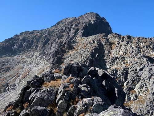
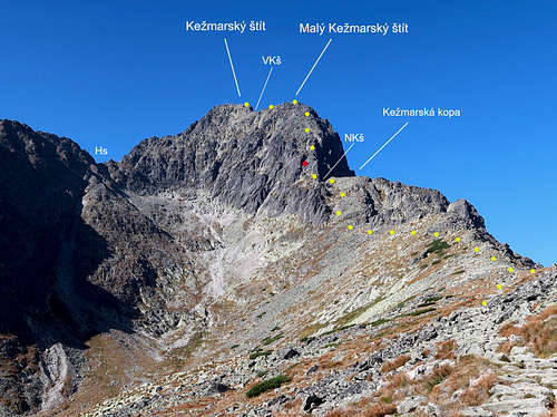
If you want to save a little time, you can keep to the side of the ridge away from its crest. There are pieces of a faint path, which will make your hike quicker but you do not really need to care about them. Your first goal is to get, very slowly gaining elevation, to the slope of Kežmarská kopa (2233m), whose horizontal ridge seen from the east looks like the footrest of Malý Kežmarský štít. An ascent of Kežmarská kopa will give you some boost in elevation. 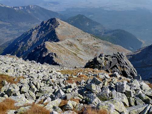
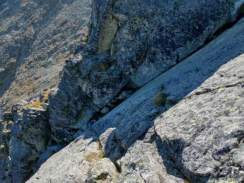
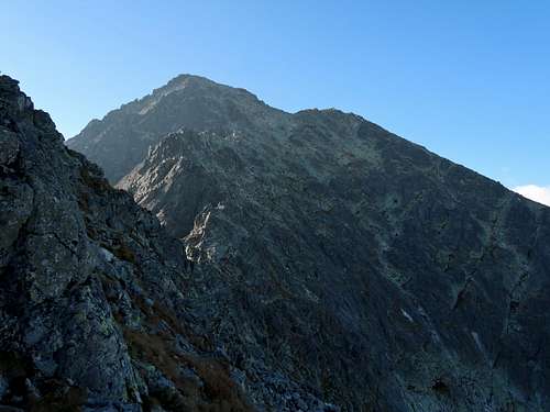
Having climbed Kežmarská kopa you find yourself near the crux of the route, where Malý Kežmarský štít rears up dramatically. You are separated from that place by a col named Nižná Kežmarská štrbina, where the ridge suddenly narrows. 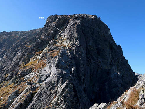
After passing the col, in a few minutes you are at the base of a sort of dihedral. A few metres of scrambling upwards and you are at the crux of the route, which is a steep cracked slab about ten metres long, or rather the first one-third of the slab, where the cracks providing you with holds are rather narrow. 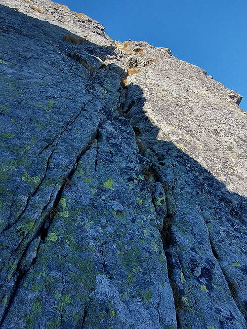
Above the crux there is just a bit of some easy scrambling, 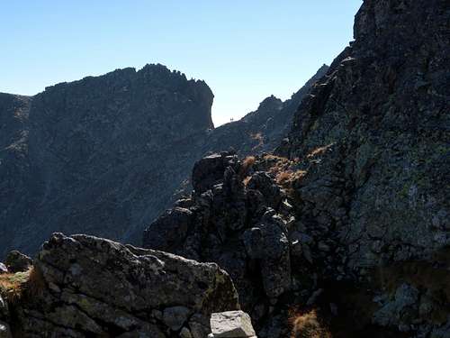
then the rest of the ascent of Malý Kežmarský štít is a walk up the broad ridge of the mountain covered mostly with countless blocks of granite. 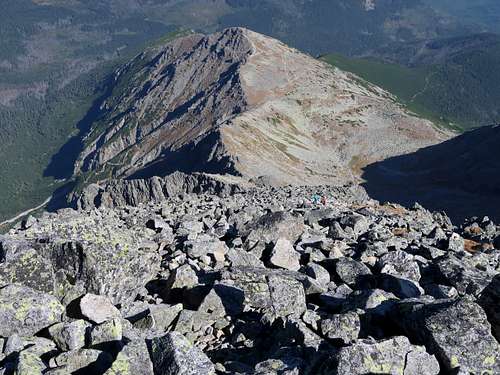
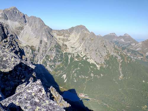
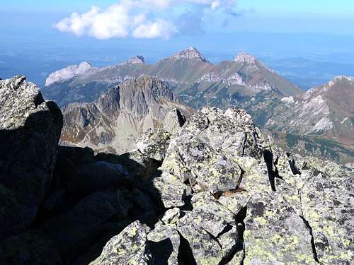
Views from the summit of Malý Kežmarský štít are similar to those from the summit of Kežmarský štít, except that the latter peak as well as Zelené pleso can be seen. 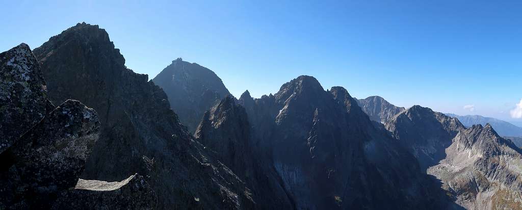

The last section of our route takes roughly twenty minutes. First you descend to Vyšná Kežmarská štrbina losing fifty metres of elevation, then you come across a fairly well-defined path running up on the left side of the crest. 
At the summit there are several metres of exposed YDS class 3 scramble. 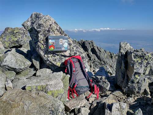
|
Essential Gear
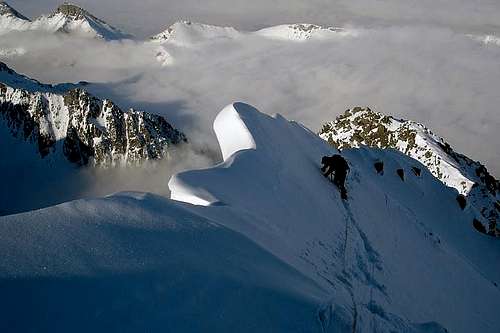
Good hiking boots or rather approach shoes. In winter conditions: a partner, crampons, ice-axes, rope.
Other Information
Please see the parent page.