
|
|
Mountain/Rock |
|---|---|
|
|
46.44410°N / 13.84286°E |
|
|
8192 ft / 2497 m |
|
|
Overview
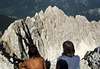
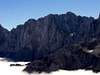
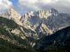
Geographical structure: Eastern Alps > Julian Alps > Martuljek group.From north, Martuljek group looks like a broad, slightly curved crest of wild, rugged peaks. This range starts on NE with Vrtaski vrh, 1898m, continues towards W-SW over Sleme, 2077m and reaches the sharp Kukova spica 2427m, with which a beautiful half circle of high mountains starts. Skrnatarica 2448m, Dovski kriz 2542m, Veliki Oltar, 2621m and from this one in a NW direction Velika Ponca, 2602m, Mala Ponca, 2502m, Spik 2472m, Frdamane police, 2284m, Rusica, 2074m. In front of this ridge is located a very hard approachable mountain called Siroka pec, 2497m. It is nice seen with its steep N face from Gozd Martuljek.
Siroka pec is the queen and the most powerful mountain of Martuljek group. Siroka pec doesn’t have the highest explicit summit. It is the mountain of many towers. There are around nine big towers and many smaller. There is no easy way to climb on the Siroka pec or any other tower of it. The easiest approach goes from the hidden basin behind the Siroka pec called Amfiteater. But before you climb in Amfiteater you must find the way that is not easy. The easiest route or normal route on Siroka pec from Amfiteater is estimated with UIAA III. But I suggest you that you are good in climbing more then UIAA III because you can go astray to harder places.
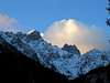
The normal route on Siroka pec goes over the south face above the basin Amfiteater but the famous is the powerful north face. This is the wall that you can lose in it. It is high around 700 meters and there are many overhangs, roofs, couloirs … Siroka pec was scaled over the famous north face first time in the year 1928. This was the first ascend on this summit too.
 ..
.. ..
.. ..
.. ..
..
The photos of Siroka pec on other pages.
So ascend on Siroka pec is only for very good climbers but if you want to reach the summit of Siroka pec over the north face you must be expert climber!
 |  |  |  |  |
Getting There
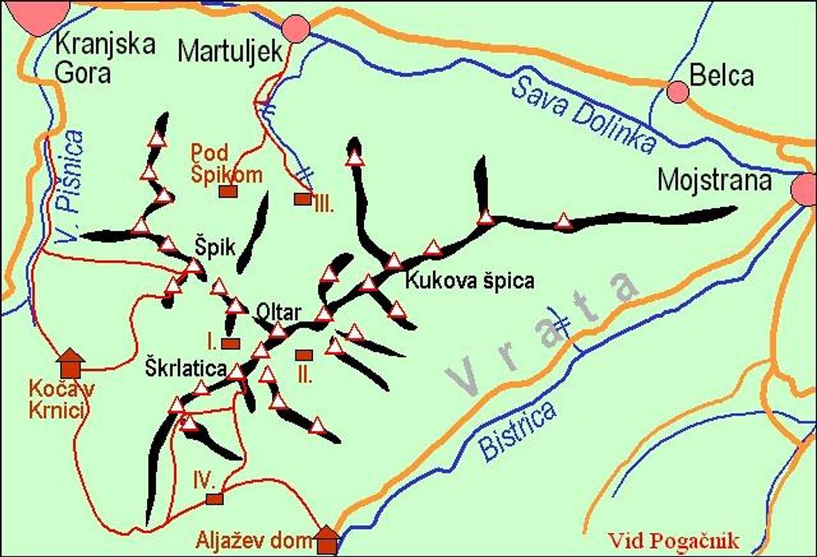
Martuljek group - main summits, access roads and marked paths.
The only logical starting point for climbing on Siroka pec is that you drive to village Gozd Martuljek where you follow the signpost for Bivak III (the Bivouac III) and walking route number 6. Here you can sleep and this is the starting point for ascends on the Siroka pec.
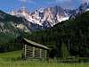
Gozd Martuljek
The village is named after one of the most beautiful mountain ranges in the Julian Alps - the Martuljek range. Its highest peak is Spik at 2,472 meters. There is a pachwork of poaring waterfalls under the Martuljek range inviting the romantic and artistic. From Gozd Martuljek is the best view on Martuljek group from the north.
For more information how to come here check the Julian Alps group page and the page of subgroup Martuljek group page.
Maps:
 |  |
Routes Overview
On Siroka pec there is no easy route. You must know that before you come in the basin Amfiteater below the south face of Siroka pec you have to climb around 30 meters high wall with difficulties UIAA III.The easiest approach goes on the second tower of Siroka pec from the east side. This is the climbing route UIAA II. The main summit is approachable from the basin Amfiteater over the south face with difficulties around UIAA III+.
Here are named some interesting possibilities for not very hard climbing in the face and ridges of Siroka pec.
North face
- Vzhodni steber. UIAA IV. 600m.
- Cihulova smer. UIAA VI, A2. 600m.
- Krivic-Cedilnik. UIAA VI, A2.
- Opium. UIAA V-VI. 400m.
There are many more climbing routes and if you want to know some more of them just inform me and I will help you! :-)
 |  |  |  |
Red Tape
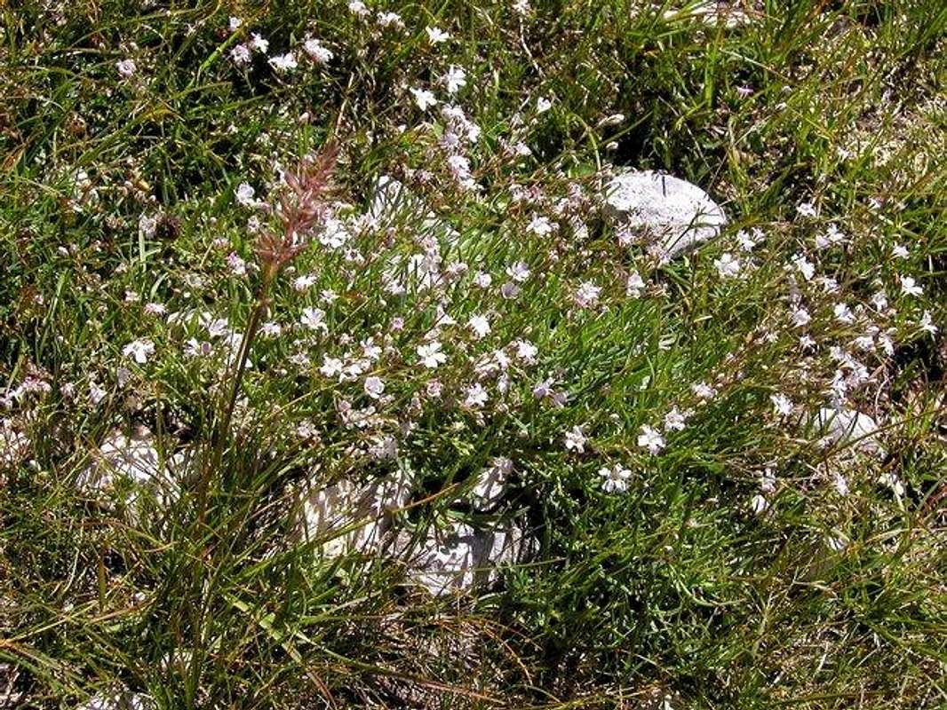
Nice flora in Martuljek group.
Siroka pec is located in Triglavski Narodni park.
When To Climb
The best time for climbing on Siroka pec is the time when the days are very long because all the climbing routes on Siroka pec are very long. So the best time is from June to September. And of course for experts Siroka pec is also approchable in Winter time.Camping
Camping inside the Triglav National Park is forbidden. Beside the mountain huts there are plenty of hotels and private apartments in the towns and villages, which surround the area. Here are few links where you can find info on accommodations closer and further away:Kranjska Gora
Mojstrana
Bled
In Sava valley there are many huts and hotels. In Kranjska Gora, for example hotels: Lek, Larix, Kompas and many family hotels.
Bivak III (1340m) is located on the start of the plateau Za Akom on the north side of the main Martuljek ridge. It is maintained by Mountaineering Club Jesenice. Address: Cesta zelezarjev 1, 4270 Jesenice; tel.: (04) 586-60-70.
Mountain Conditions
Mountain conditions in Julian Alps are well known, thanks to Kredarica (2515m) hut and meteo station, which is bellow the Triglav.You can observe current conditions and forecast for Kredarica on the Wunderground meteo site. Here is direct link to Wunderground - Kredarica page.
Some weather informatin can also be found here.