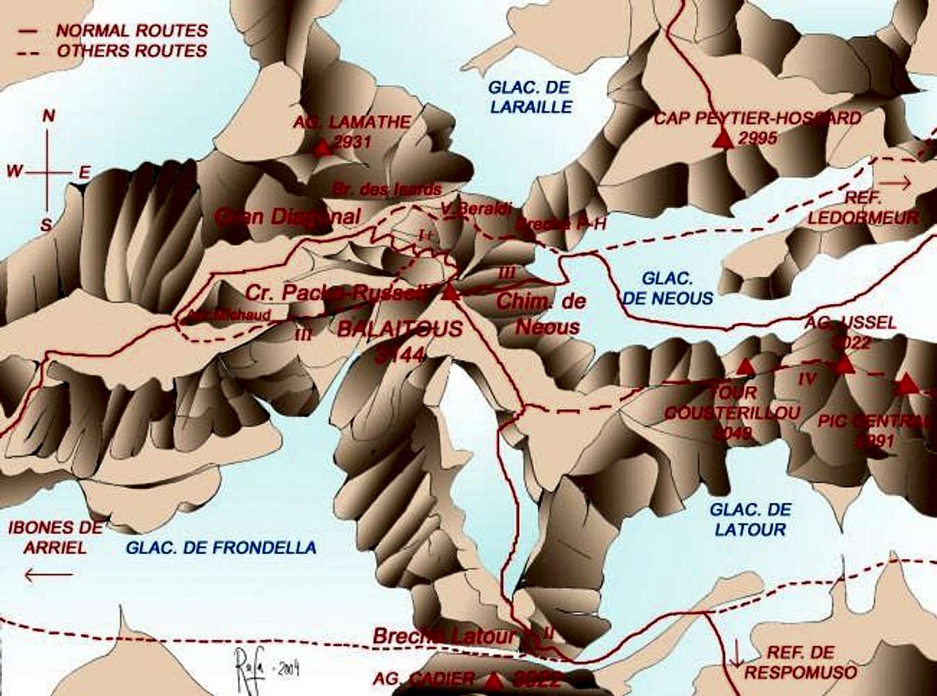
Sketh and map of the principal routes to acces to the summit of Balaitous realized with manual drawing with pencil in paper and colored with Photoshop. Based in books and maps of Miguel Angulo (Pirineos: 1000 ascensiones), maps of IGN of France and Spain, book and sketch of David Atela (100 cumbres del Pirineo Aragonés), map of Ed.Pirineo 1:40000 (#3-Valle de Tena), map of cuadernos pirenaicos Ed.Sua 1:35000 (#7-Valle de Tena) and many pictures.
The first climb is suposed for the cap P-H, glacier de Neous, brecha P-H and vira Beraldi. From vira Beraldi they get direct to the summit for a ridge grade III, not for the normal br. des Isards.


