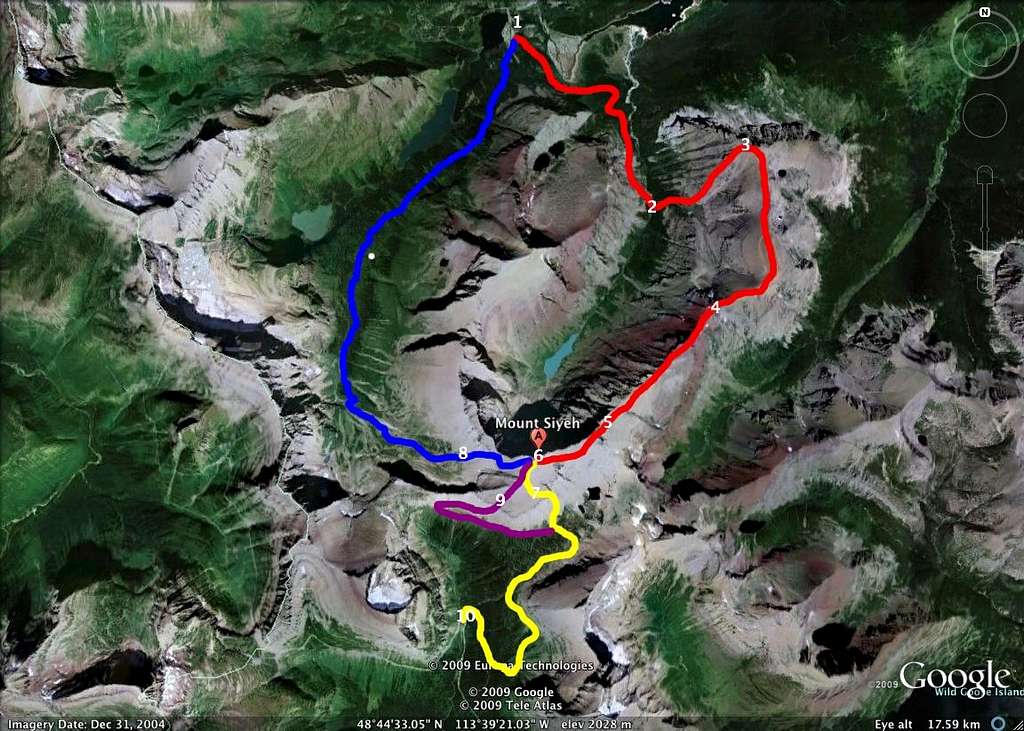
Sklyine Experience Route Diagram
ASCENT ROUTE - RED
1) Cracker Lake Trailhead, Many Glacier Hotel Parking Lot
2) Approximately 3.5 miles into the Cracker Lake Trail, a large bridge crosses Canyon Creek. Immediately after crossing the bridge, head off-trail to the left, following a drainage uphill to the east.
3) summit of Wynn Mountain (8,404 ft)
4) summit of Peak 9190
5) summit of Cracker Peak (9,833 ft)
6) summit of Mount Siyeh (10,014 ft)
DESCENT OPTIONS
7) YELLOW - south slope descent to Preston Park, Siyeh Pass Trail to Siyeh Bend on Going-to-the-Sun Road
8) BLUE - west couloir descent to Piegan Pass Trail and eventually Many Glacier
9) PURPLE - descent to Piegan Pass Trail, which eventually intersects Siyeh Pass Trail (yellow line) and continues downhill to Siyeh Bend on Going-to-the-Sun Road.
10) Siyeh Bend


