|
|
Trip Report |
|---|---|
|
|
44.30432°N / 73.86323°W |
|
|
Jul 13, 2018 |
|
|
Hiking |
|
|
Summer |
Video: https://youtu.be/4btG5lhzQuw Photos: https://photos.app.goo.gl/D7g6QFfarFgvXUpx6 Rico and Kevin's Report from the 2013 Attempt: https://www.summitpost.org/ste... Duration: 3:40 AM-7:00 PM, 15 hrs. 20 min. Temperature: 60-85F Length: Approx. 11 miles Total Elevation Gain: Approx. 5,500’ Benchmarks: Start: 3:40 AM, Slide: 6:05 AM, Kilburn: 9:00 AM, Sentinel: 12:30 PM, Stewart: 4:30 PM, Finish: 7:00 PM
General Route: Jackrabbit TrailàSlideàKilburnàRidge to xxx-àSentinelàStewartàWhiteface Ski Center entrance. Partners: God and some invisible moose Map: The accompanying map is an approximation of the route. My GPS does not track well, so I overlaid a line over a topo based on my route. None-the-less it provides context. Video: Sorry, I carried an old camera with low resolution. …and it turns the trees pinkish (sorry)!
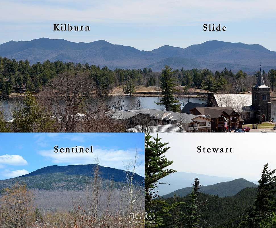
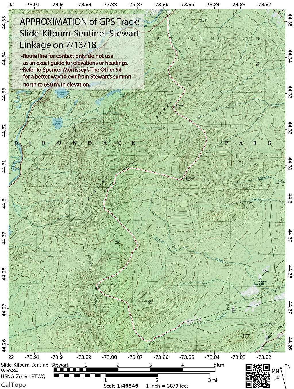
Strategy
While some think of bushwhacking as just walking (or thrashing) from point A to point B, this outing required more thought given its duration and the complexity of the terrain. As such, I prepared with the following in mind.
- Water management: Carry 2 liters, but increase to 4 between the Black/Slide col and Sentinel in case the rills along Kilburn’s ridge were dry. This was even more important since I was alone and temperatures were in the mid-80’s—heat-related illness was a concern. In the end, I’d consumed 6L.
- Pace: Push hard from the Jackrabbit Trail to Kilburn while the weather was cool. Push hard on the descents when possible.
- Use the Neil’s and Randomscooter’s beta (from Slide to Kilburn).
- Finesse my way through using gravity then bulldog my way through when all else fails.
- Consider all reasonable bailout options if needed: Obvious ones were North Notch to Holcomb Pond and Sentinel’s summit to the Bartlett Road.
- Don’t get hurt.
Background
For those unfamiliar with the four trailless peaks of the Adirondack 100 Highest list--Slide, Kilburn, Sentinel, and Stewart are notorious for difficult, skin-shredding bushwhacking. They're usually approached singly or, on occasion, as pairs. Spencer Morrissey's The Other 54 documents the general approaches--there is much hard-earned advice in its pages. Linking them as a foursome, however, is a test of one's endurance, navigational ability, mental fortitude, and pain threshold. I'm still deciding if I had fun or simply endured. My opinion may change when I can walk without a limp. I'm sure I'll look back with many fond memories...eventually.
The traverse has been the monkey on my back since 2013, perhaps earlier. I blame Neil Luckhurst for the initial inspiration. He’s meticulously explored the region for years. I believe Randomscooter provided valuable intel for some of Neil's ventures. This beta was priceless to me, so I thank both of them!
Rich McKenna and I tried the linkage May 4, 2013. We achieved Stewart and Sentinel in that order. I led us off Sentinel through a razor-sharp forest into the bowl between it and Kilburn. One of the “barbed wire trees” peeled a snowshoe from his pack (it was late spring) which contributed to the brutality of what followed. Blowdown and three feet of rotten snow greeted us on approach to Kilburn. We post-holed to our waist for ½ mile and tried to thrash our way up to Kilburn’s summit, but I was “empty” at that point. The days were shorter, and it was approaching evening, so we called it a day and bailed via the North Notch. We exited near Holcomb Pond after 18 hours of exhausting bushwhacking. That ended my interest for years.
Jaryn DeShane and I tried linking them again in 2017—the “short memory of an alpinist” dulled the most painful memories. We made great time up and over Stewart. We needed water and pulled it from Lewis Brook. I set my pack down, started fiddling with a Nalgene bottle, pulled my pack toward me, and felt a sting—then another. Jaryn remained still as I got swarmed and bolted downstream and away from the yellow jackets. He remained untouched while I ended up with about six stings.
As I was dealing with my “issue,” Jaryn (being a gentleman) walked upstream to get my pack and trekking pole. He triggered another attack when he touched the trekking pole. It was too near the hive. With a swelled eye and various other stings, he ran downstream cursing. We let the bees settle before I stalked my pack and retrieved it—he laughed since I was on my tip-toes trying to avoid creating any vibrations. Jaryn’s last words to me before I retrieved my pack were, “If you get swarmed and run this way, I’ll punch you in the face.” It took hours before I stopped laughing at his statement. It remains among my top 10 favourite hiking comments. The entire event signaled our retreat from the Sentinel Range.
I felt the urge to retry the linkage again a few weeks before this outing. A few days before I mentioned it to Neil, but he was busy. I then realized that it had been ages since I’ve hiked by myself for any length of time or toward a large goal. I wanted to spend some time alone in the woods and not on cliffs. I also wanted to get back to my roots—simply thrashing through the woods and navigating. What can I say, I love krummholz and forested challenges. This was the holy grail of bushwhacking to me…a personal call that I had to answer.
As the moment approached, I admit that I was apprehensive. On the other hand, I was excited to see how I’d perform, alone once again. The excitement lasted until I arrived at the trailhead. I nearly turned back as the uncertainties threatened to overtake my mind in the darkness. Mental fortitude had to build along with my pace. I knew I’d be bushwhacking up at least part of Slide in the dark and the last time I was near the area was in 2005 when I descended from South Notch. I’d never walked from Slide to Kilburn or summited Slide. I’d also never descended Sentinel’s NE flank.
Slide
I pushed the nagging questions aside and decided to simply see how fast I could climb Slide to get a feel for my stamina and capitalize on the cool morning temperatures (nearly 60F). I knew it was going to heat up by about 25 degrees. Darkness slowed me until I was at the col between Black Mtn. and Slide. Getting poked in the eye by a stray branch wouldn’t help my agenda. Navigation was easy since the woods were moderate and I could use the brook as a rail until the col. I checked the compass often and saw Black to my right as I neared the subtle col.
My spirits lifted as darkness gave way to the first hints of light. I filled four water bottles before striking W-NW toward Slide’s summit (just in case North Notch was dry). I hoped to be at the summit by 6:30 but beat that time by almost 30 minutes. Each early arrival widened the window of time that I could take to reach the next. The open forest and moderate grade for the first portion helped considerably. I arrived at 6:05 AM and decided to try Facebook Live…I rarely have a cell phone when I hike or climb (nor do I like using them), but I knew I could get a signal on the summits of the range and decided to “play.” I allowed myself 10 minutes’ rest to eat a muffin, hydrate and snap a few photos before the next segment…a walk into the unknown. I hoped to reach Kilburn’s summit in 4 hours, but that mountain has stymied me before, so I kept an open mind.
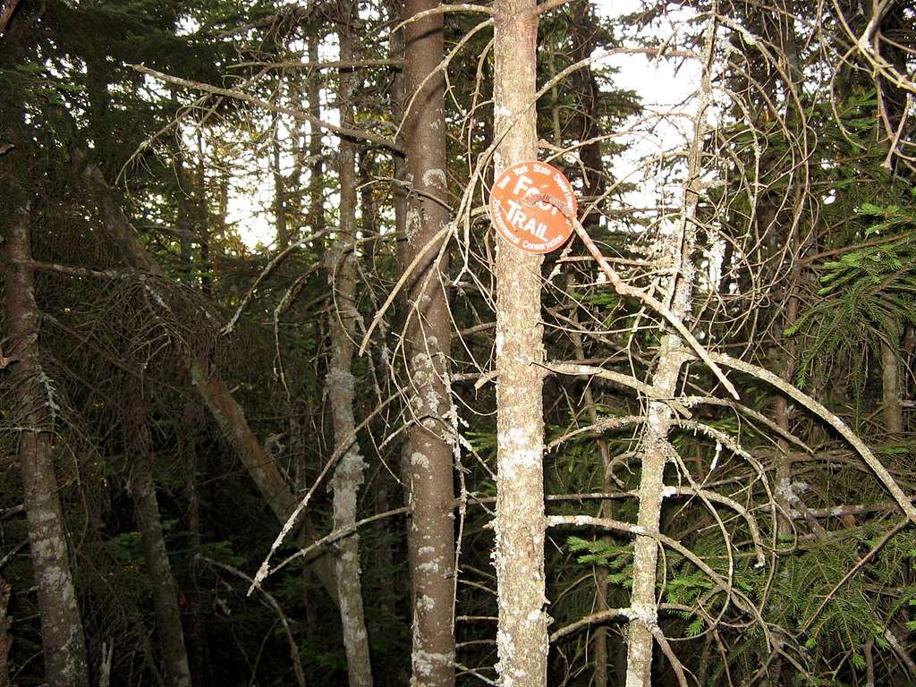
North Notch and Kilburn
On Neil Luckhurst’s advice, I pushed through the trees and dropped down the ledges of Slide’s northeastern aspect. I planned to navigate east around its NE summit and a small knob immediately south of North Notch. The forest was easily navigable in the drainage area and echoed with a mantra that I spoke aloud, “Kilburn is the only goal, Kilburn is the only goal…” It was one of many little mental tools I use when I’m out alone.
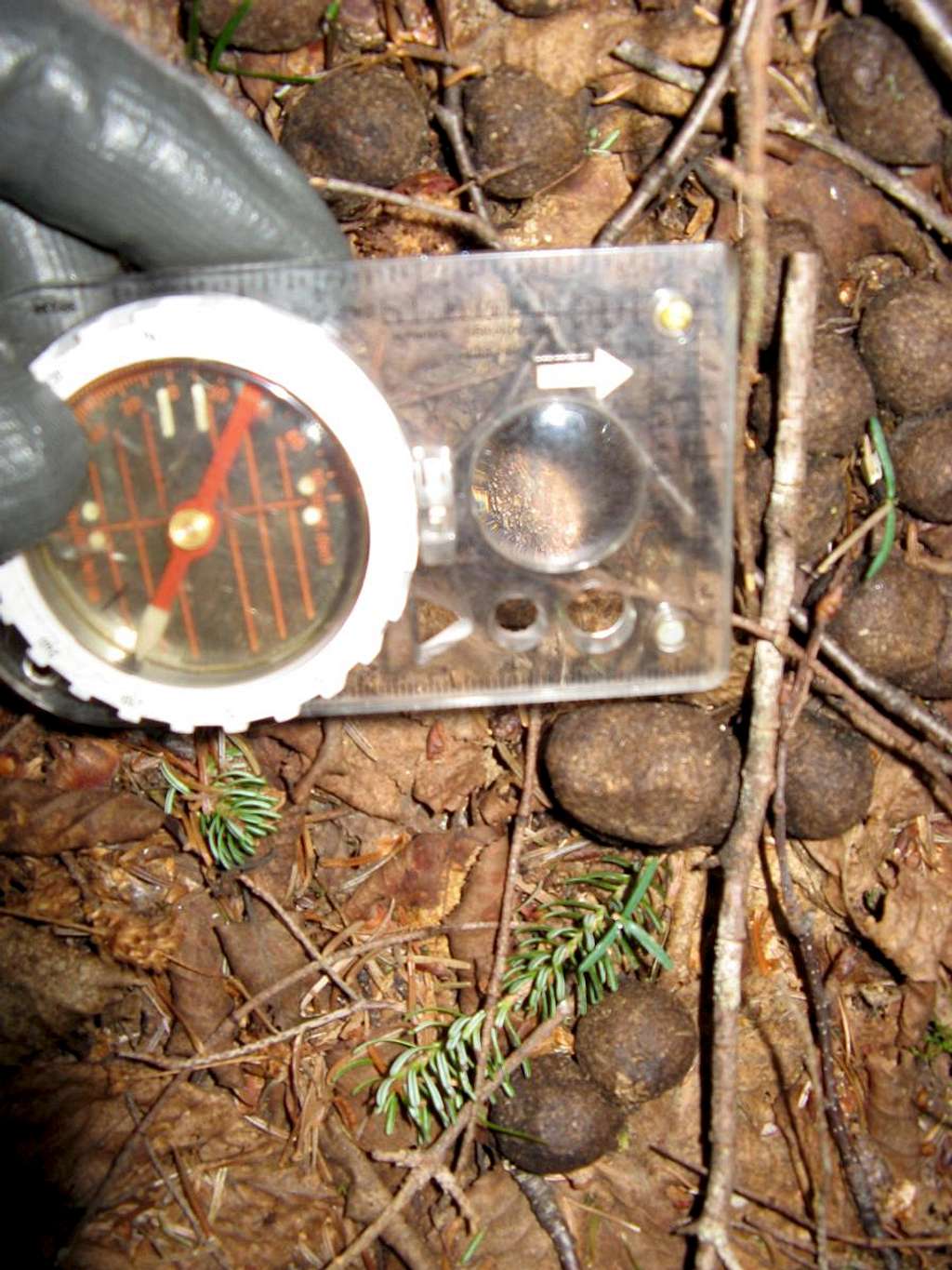
I ran across the first of many piles of moose scat after 20 minutes of bushwhacking. Some seemed fairly fresh, but if they were in the vicinity, they were invisible. It seemed that the path of least resistance was popular among four-legged mammals as well. This allowed me to push the limits of my pace. It wasn’t long before I saw the NE summit of Slide above to my left and then slightly behind me…I was making good progress and felt invigorated. In the back of my mind, however, I was concerned about thrashing my way up Kilburn. I eventually hooked north toward the notch and side-sloped the bump to its south. The terrain guided me off track, and I ended up lower than anticipated, something I figured out while replenishing a liter of water at Clifford Brook.
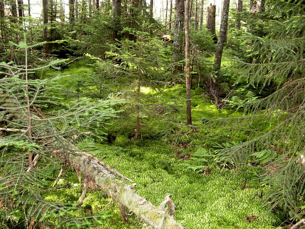
I readjusted the compass and climbed northwest. I couldn’t see Kilburn’s ridge, so kept telling myself to trust the compass (while occasionally checking my old Garmin GPS). I recognized the terrain from when Rich McKenna and I visited years ago. The sphagnum moss-covered forest floor and small meandering streams were a hindrance back then, but a welcome sight during this outing. It was soft underfoot and the forest was loosely knit. I knew that would soon change. A wall of evergreens answered that thought soon after.
This same wall greeted Rich and I after trying use line-of-sight navigation from Sentinel to Kilburn’s summit. The aforementioned snow sucked me of all energy. I tried to push my way up toward Kilburn’s summit and realized that I was “done.” The sun was getting low in the sky, and we probably wouldn’t have reached the summit until dark—hence our slow retreat via North Notch.
The trees didn’t seem quite as bad this time around. I was definitely fresher. Blowdown slowed progress, but not substantially. In fact, it served as a perch to survey the summit ridge. I spotted the indentation where the gash in the mountain lies—the distinct cut in the ridge that can be seen from Route 86 (READ MORE ABOUT THE GASH). Approaching the gash from the East was easier than the west—less talus and smaller cliffs. Gaining the ridge was steep, and the trees grew tighter (a taste of what was to come), but the ridge itself was a comfortable walk. Twenty minutes later, at 9 AM, found me on the summit proper in better time than I expected. This bode well, but the day was very young, and the worst was ahead.
Of all the summits, I like Kilburn’s view the best, not the summit, just the view. The many knobs of its ridgeline also intrigued me—what was on each? I planned to use this trip to satisfy some of that curiosity. The cool morning air was rapidly heating and getting more humid—just in time for the hardest push of the day. I needed to take a slightly longer break (15 minutes) to cool down but wanted to get going before the temperature rose any more. This was my primary concern—I hate the heat.
Sentinel and the Mile of Misery
I’d heard stories of the difficulties of Kilburn’s ridge. Thus I planned to follow it to see for myself—until it became unnavigable or another, seemingly better, option arose. I felt the first “ping” in my knee as I committed. It wasn’t anything to worry about, but it was a warning to lessen my pace.
Interesting ledges, beautiful moss, and manageable tree density made progress “easy” for just over ½ mile (or three knobs). I felt thrilled at my progress and hoped to reach Sentinel in 4-5 hours. I left the ridge and bushwhacked east below the fourth knob marked 1179m on the topo. I again employed my mantra replacing it with the next mountain and an additional phrase, “Sentinel is the only goal, Sentinel is the only goal…I love bushwhacking, I looooove bushwhacking.”
The strategy of finessing my way through the trees on the ridge changed to bulldogging my way across the slope below the ridgeline. It was generally miserable with intermittent zones of “this really sucks” thrown in to lift my spirits. Rotten deadfall, a few drainages, and dense scratchy balsams led to the drainage of the Kilburn/Sentinel ridge. The bushwhacking was easier here—the calm before the storm. It was 11:00 AM when I entered the wooden ring of pain and misery that guards this aspect of Sentinel.
Sentinels of Sentinel: This only took 20 minutes to get through, the difficult stuff was during the preceding hour.
It always stuns me that trees can grow so tightly knit and survive. I couldn’t even see my feet. It also stunned me that deerflies could torment me so tenaciously in the undergrowth. I was heading east which may have prolonged this particular section (as opposed to descending southeast then up). It took over an hour and a half of crawling, pulling, and pushing to reach the summit. My wrists were being sanded free of skin by the balsam bark even with gloves and a long-sleeved shirt. The final few hundred linear feet was through dead trees leaning every which way. I expected that the ordeal would be heinous, but memories didn’t measure up to the reality of the moment. I reached the summit cone at 12:30 PM. The problem was that I couldn’t find the summit proper and the “Sentinel” sign. I was overheated to add insult to injury. Patience paid off, and I settled down in the shade of a balsam near the broken sign. Whiteface stood in the distance.
My immediate concern turned from navigating to cooling myself down. It was in the mid-eighties, and the fight for the summit overheated me. The long-sleeved bushwhacking shirt, protective gloves, and hat trapped the heat. I poured water over my head, soaked my shirt to use evaporative cooling, took advantage of what little wind there was, and drank enough water to satiate my thirst.
Some twenty minutes later, I cooled down enough to eat and think more rationally. I was three summits into the linkage and had plenty of time to finish the quest having beaten my allotted time to each peak. Just one more major push and I wasn’t sure how to go about it, so I rolled the dice.
Stewart
The northeastern ridge of Sentinel has rough terrain on its top; hobbling krummholz up high and tightly woven growth as it trends NE. Thus I dropped NNE of the summit to avoid the ridge altogether. Tight growth on a steep slope with a few ledges helped the elevation fall away quickly. I stepped carefully to avoid injuring my knees though deliberate footwork was easier thought than done. The time seemed to creep by as I waited for the terrain to ease.
It finally did, and a couple of minor drainage streams made the going easier until I crossed the main brook to follow along its western side. I started contouring up at 2,800’ in elevation and eventually crossed the ridge at 3,150’. My other choice was to follow the brook all the way down then climb Stewart from a more easterly direction. The latter choice would cost me in elevation. Once over the ridge, it was a mere 10 minutes’ descent (with a cliff thrown in) to Lewis Brook where I to refilled two liters of water before attacking Stewart (or vise versa).
My apprehension grew as I approached the brook at 2:30 PM. I was near where Jaryn and I got swarmed last year. I knew this was no different than any other brook, but the thought plagued me. It disappeared as I pumped water and no bees arrived. I did, however, have to cool down again. The heat was wearing on me.
Until this time, I took no significant breaks except at the summits. Any breaks in between were only long enough to take in water. Given the early hour and how I felt, I decided to slow my pace and take more breaks. I crossed the small bulge of land above the brook confluence and marched up Stewart’s lower flank. It didn’t take long before I needed my first break—this ascent was going to take some time, and it was anything but smooth.
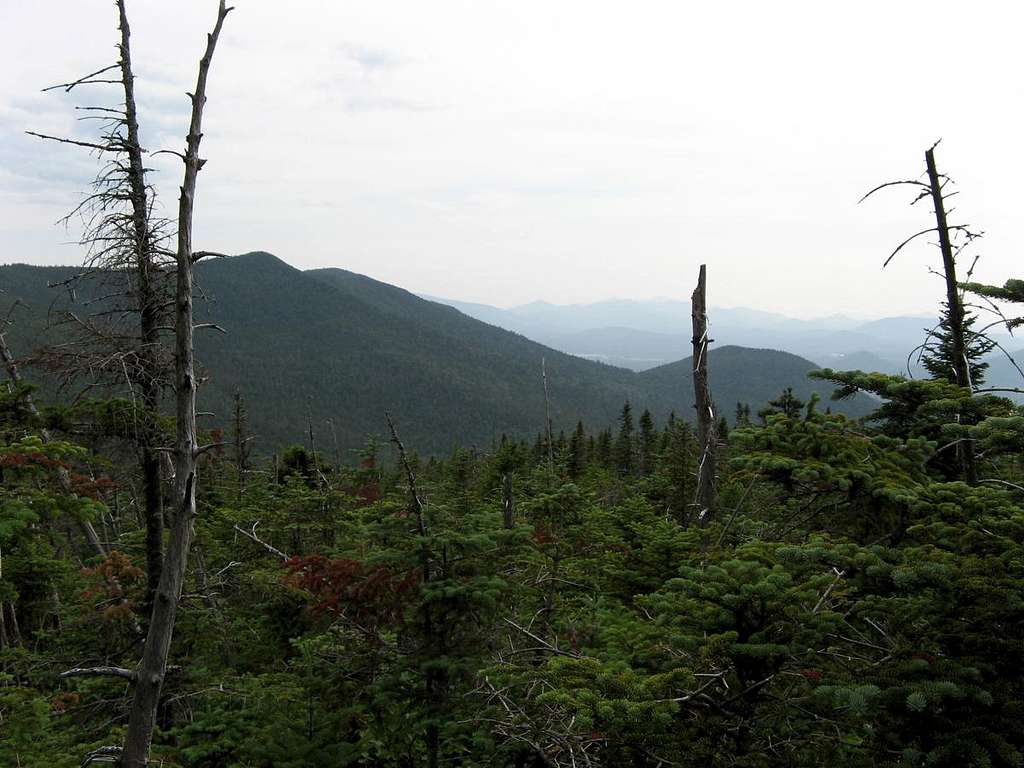
After refueling and resting again, I found the first of several large cliffs, the largest being around 75’ high. I’d tracked too far to the left. I scrambled up a couple of gullies and contoured to the right along the base of the largest before reaching more agreeable ground 300’ below the summit. It wasn’t as steep though blowdown and tight growth slowed progress. I was exhausted and elated—so near to the final objective. I recognized the terrain having been up here a couple of times over the years. It was around 4:15 PM when I intersected the herdpath and 4:30 when I hit the summit. I trekked south to take a photo from the best overlook.
Exiting Mishaps
My exit plan was to trek back over the innocuous bumps and drop down to the north via twin gullies. I only later looked at Spencer’s book and realized I should have stayed out of the gullies to their left. In a series of late-day bonehead maneuvers, I dropped down on the wrong side of the ridge. In my tired state, I decided that the compass was wrong (dumb) and I was indeed going north not northeast. I eventually figured out that I was slightly east of Stewart’s NE summit and needed to readjust.
This involved climbing over the col which placed me on the flank of the NE summit and in the middle of a horrendous forest of krummholz. I “only” needed to descend a series of ledges in the cripplebrush to attain the drainages. That was another mistake of sorts. The drainages led down, but over rough terrain comprised of talus covered with duff and blowdown. I eventually struck south to get out of them and limped my way toward the hardwoods below. Both knees were sore. I was ready for the day to end.
The grassy glades and an old beaver pond at the end of the stream were a welcome sight. The spongy moss underfoot felt good. I trekked NE through a beach forest behind a small knob and located the stream that led north to Route 86 where my father was waiting to pick me up. Progress was slow over the last ¾ mile through the forest was easy terrain. I was simply that tired and counted it a blessing that I did not try to add Pitchoff into the mix (yes, I considered it while planning the trip).
I passed a defunct steel structure on the ridge and reached the road at 7:00 PM. It had taken less than 2.5 hours to descend, but it felt like more. I arrived at the entrance to Whiteface where my father was parked with the knees and pockets of my pants torn, holes in my shirt and a thousand pine needles stuck to my back. He laughed while I limped over to the car. This seemed like a fitting ending to such a venture.
THE PICS BELOW PROVE IT WAS A GOOD DAY, GOD BLESS.

