
-
 8396 Hits
-
 85.36% Score
-
 20 Votes
|
|
Mountain/Rock |
|---|---|
|
|
46.73630°N / 12.79150°E |
|
|
7286 ft / 2221 m |
|
|
Overview
Geographical Classification: Eastern Alps > Gailtal Alps > Lienz Dolomites > Soleck
Soleck - one of the most frustrating experiences I have had in my climbing career!
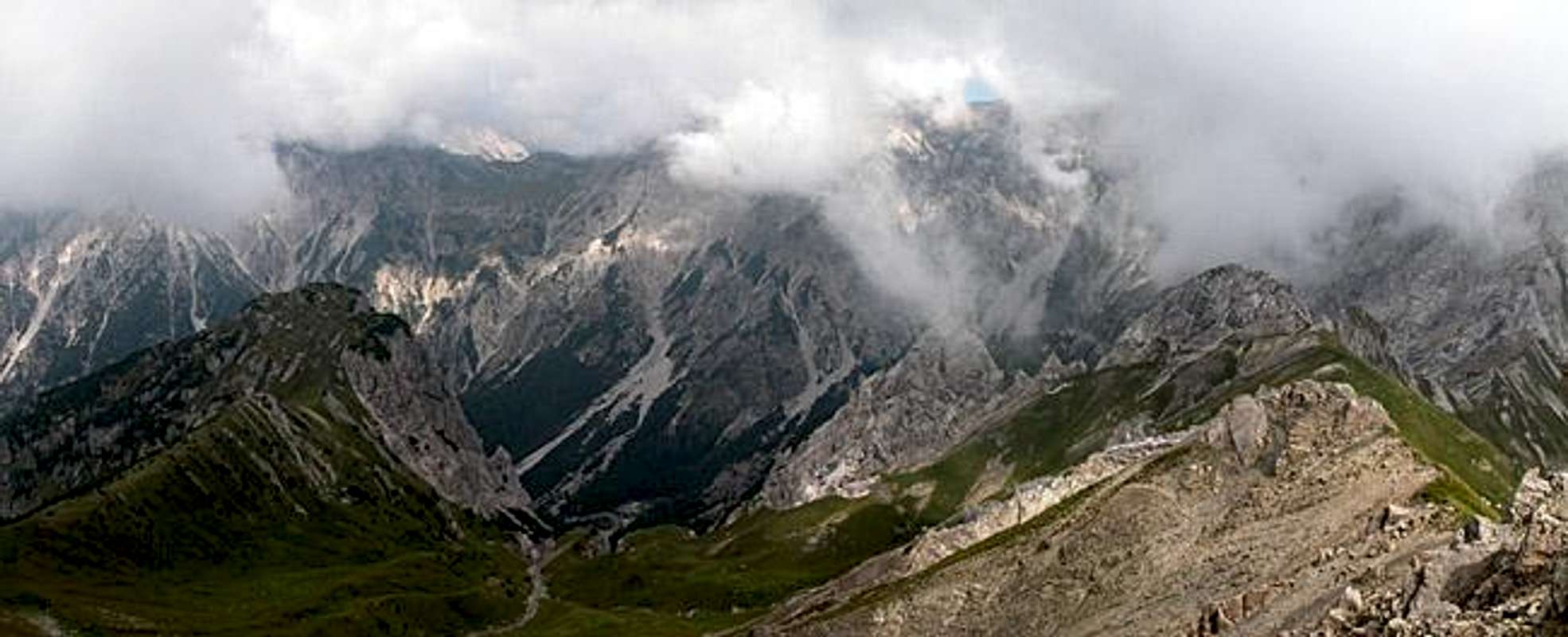
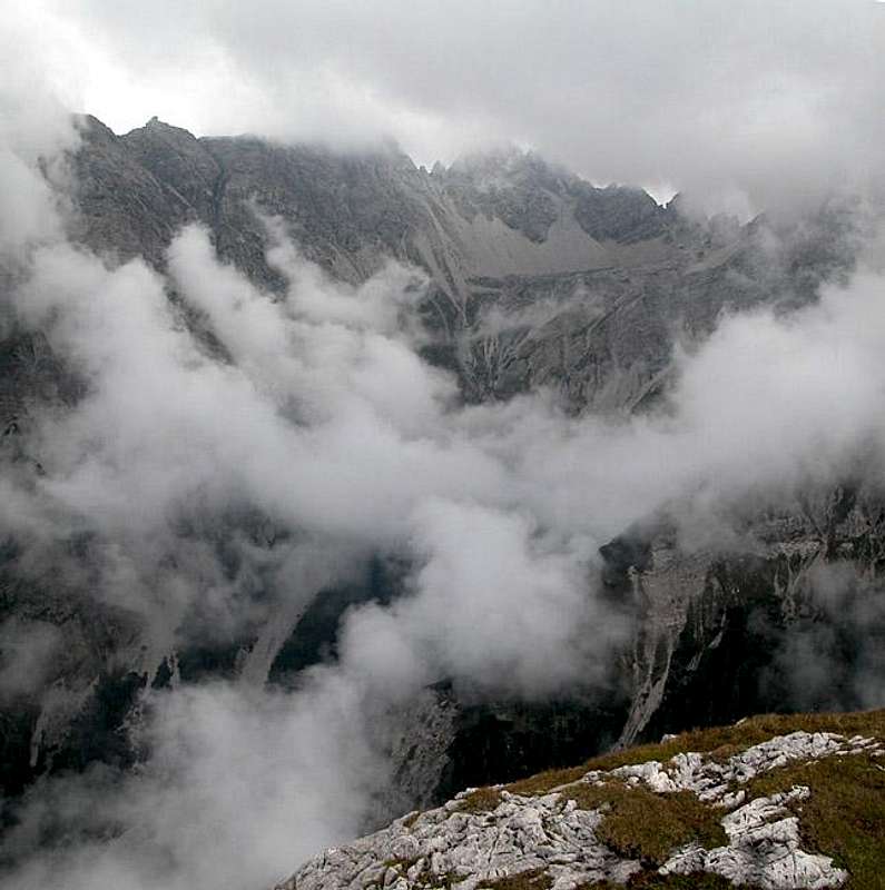
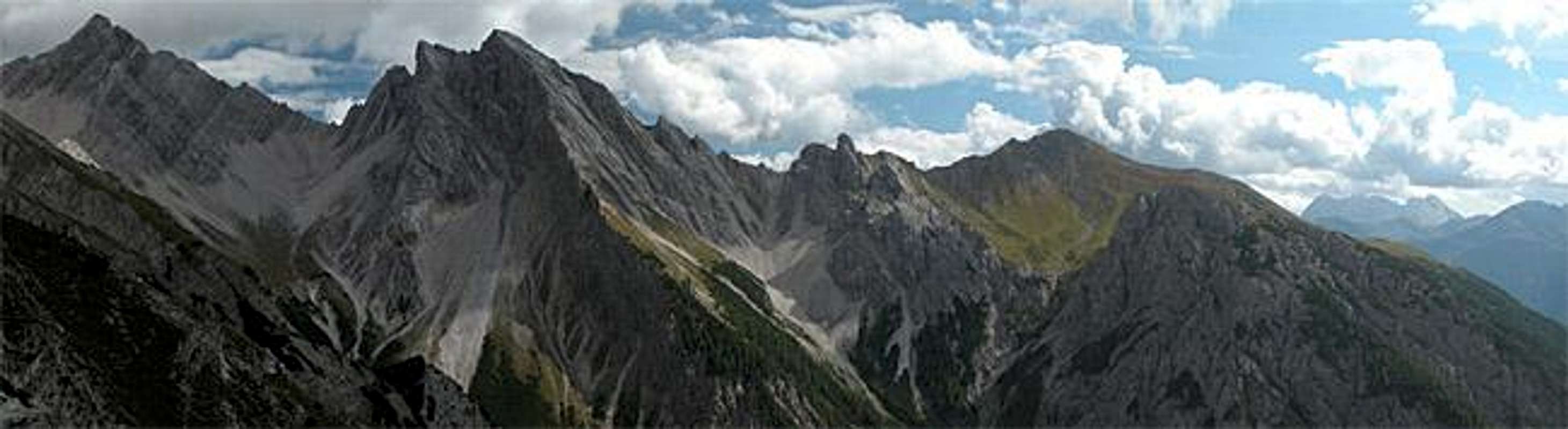
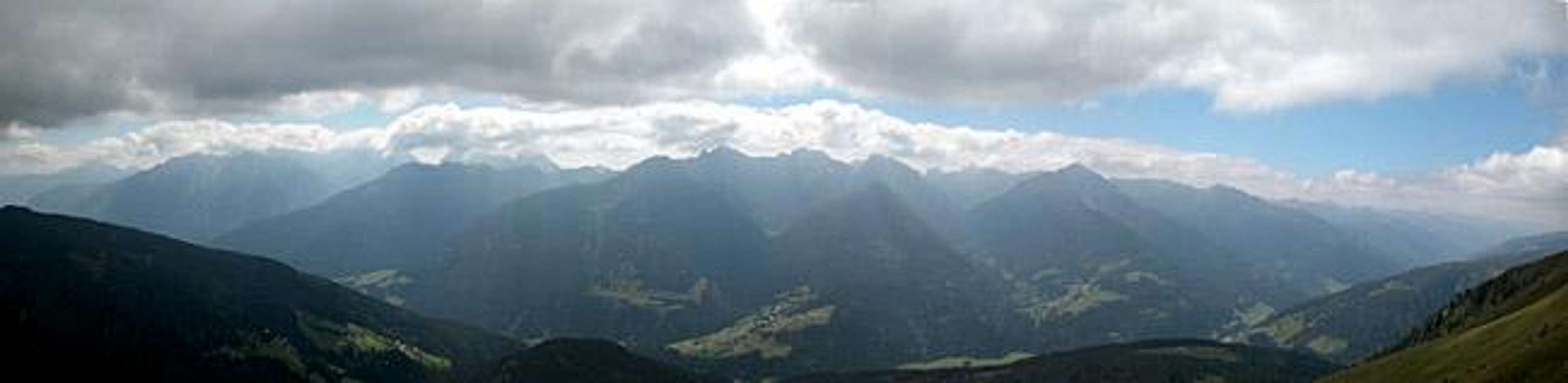
Soleck is a mountain to the south of the Lienz Dolomites separated by the main ridge (Simonskopf through Wilde Sender) only by the deep gorge of the Wildensenderbach Valley. This valley turns around Soleck in a 270° fashion only to end in the Karlahn Cirque at the base of Riebenkofel. Soleck itself has vertical north and west faces of about 700m height. In normal weather you can get a perfect view from the summit towards the Lienz Dolomites Main Ridge.
In all this Soleck is very much comparable to Croz dell'Altissimo in the Brenta Dolomites, one of my best climbing experiences.
So why the fuss?
Imagine you start on an almost perfect day - you want to tag three summits - let's say Soleck, Riebenkofel and Böses Weibele. You head for the first through dense forest still with sunny weather, traverse the southern slopes with beautiful limestone walls cropping out of the meadows and head for a little pass between Soleck and Riebenkofel. You reach that pass and - wow - there is the Lienz Dolomites southern Main Ridge at your fingertips. But before you have snatched the camera out of its pocket a multitude of thick clouds ooze through the valley to obscure the view! You go on to tag the second summit - still clouds - you have a freezing lunch sitting down among the sheep droppings. You decide to leave out the third mountain and head back to your car. And as you reach the car the sun comes peeping out of the clouds, the clouds disappear and everything is coloured white, green and blue! Aargh!
Actually I hold a grudge against this mountain but to be fair, I suppose I have to put up some specifics too. The actual height of Soleck is some kind of mystery to me - my maps state 2221m, my GPS measured 2216m and the sign near the summit cross states 2231m. Soleck is a rather popular mountain. Many of the tourists, who come to the Tuffbad Spa resort will do the Soleck climb for its shortness and for the views. The trail is a steep scramble however, much of the time leading through dense pine forests. As stated above, once you reach the timber line things get beautiful. The south face of Soleck is a steep meadow and here and there vertical 20m high walls pop up, several of them with bizarre rock formations. The summit itself is a little plateau which to the north and west quickly drops away into the Wildensenderbach Valley abyss.
 |  |  |  |
Getting There
The best trailhead for ascending Soleck is at Tuffbad located to the north of the Lesachtal Valley and can be reached from St. Lorenzen.
How to get to Lesachtal
From the West (Brenner Motorway A22)
Leave the Brenner Motorway near Brixen / Bressanone and follow SS49 to the east through Pustertal / Val Pusteria. To the east of Innichen / San Candido you cross the Austrian-Italian border and follow the road (now B100) to Tassenbach. Turn right (south-east) here onto B111, which you follow to St. Lorenzen
From the North
There are two possible roads:
- From Kitzbühel over B108 through the Felbertauern Tunnel to Lienz, then southeast to Oberdrauburg and Kötschach-Mauthen (B110), where you turn on to B111 west into Lesachtal.
- From Salzburg along motorway A10 to Spittal. Turn west on B100 to Oberdrauburg, there south to Kötschach-Mauthen were you turn east on B111.
From the South (Udine)
Take Motorway A23 to the exit Camia Tolmezzo. Follow SS52 north to Tolmezzo where you turn onto SS52 bis. This leads to Plöckenpass, where it crosses the Austro-Italian border. In Austria the road turns into B100 and at Kötschach-Mauthen you have to turn east on B111 into Lesachtal Valley.
 |  |  |  |
Red Tape
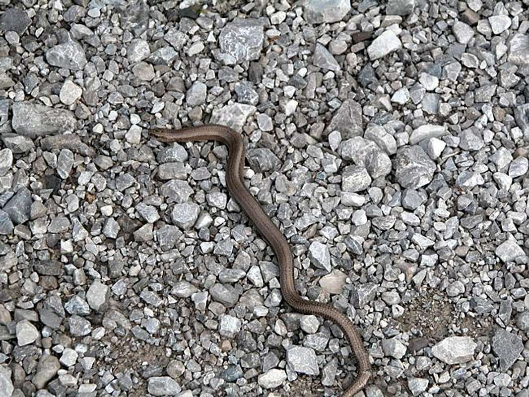
There's no red tape here. There are many sheep as can be seen by their droppings on the summits so be careful when hiking with dogs.
When To Climb
Soleck is an all year mountain. The normal hiking season is May through late September but you can climb it as a ski tour together with Riebenkofel.
 |  |  |
Accommodation
There are no large campgrounds in the area - the nearest one is at Kötschach-Mauthen. In most of the villages, however, you will find an inn or a hotel, where you can camp on the surrounding meadows for a small fee.
If you are looking for hotel rooms or apartments follow one of the links below.
Official sites:Accommodation sites:
- Lesachtal lodging (tiscover.at)
- Kötschach Mauthen lodging (tiscover.at)
- Lienz Dolomites lodging (tiscover.at)
- Hochpustertal lodging (tiscover.at)
Weather Conditions
Locals will tell you that often the days start out foggy but that around noon the sun starts coming through. With our ascent things seemed different.
For up to date weather information follow one the links below.
Maps 'n' Books
Maps
I have been using a map by Kompass Verlag, which is very good for the hiking trails though it does not show ALL the relevant summits of the area.
- Lienzer Dolomiten / Lesachtal
1:50000
Kompass Map WK47
Kompass Verlag
ISBN: 3-85491-053-3
Books
You’ll probably not be able to find anything on the Lienz Dolomites in a language other than German. The books I used are (both describe the ascents of Riebenkofel ):
- Hiking and Trekking
Osttirol Süd
W. Mair
Rother Verlag
ISBN: 3-7633-4132-3 - German
ISBN: 3-7633-4307-5 - Italian
Good descriptions with maps covering: Defregger Berge, Villgrater Berge, Carnic Alps, Lienz Dolomites
- Gailtal – Lesachtal – Karnischer Höhenweg
Kompass Wanderbuch 982
Kompass Verlag
ISBN: 3-85491-500-4
Good Descriptions with maps and elevation profiles covering: Carnic Alps, Southern Lienz Dolomites, Gailtal Alps