
|
|
Route |
|---|---|
|
|
40.20280°N / 105.6772°W |
|
|
Hike/some minor scrambling |
|
|
A long day |
|
|
Class 2 |
|
|
Approach
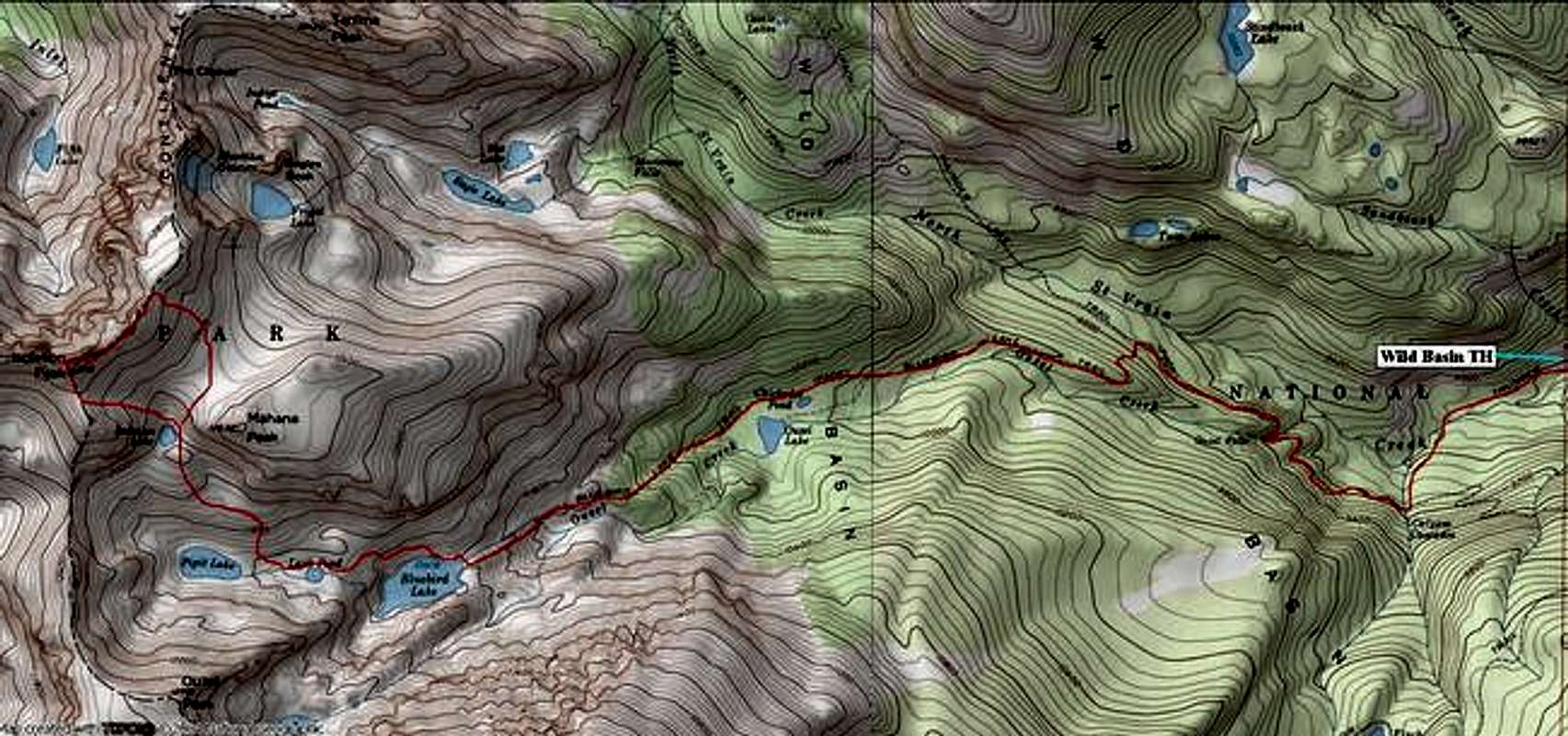
RT -17 miles and 5,000-ft
First, car camping is not allowed at the Wild Basin TH, and the parking area is patrolled during the night. Remember, there is a Ranger Station just down the road-see “Camping”. Also, Wild Basin is so enormous that the trail signing can be confusing. Just remember this: any signing gets you to the very next objective. Meaning, early on in the hike, you will not get a sign for Bluebird Lake. The sign may say, “Calypso Cascades .08 miles.” Just know that Calypso Cascades is on the way to Bluebird Lake. It really helps to know the landmarks on the way to Bluebird Lake. Bring a map
From the huge parking area begin your long day by locating the Wild Basin TH at 8,480-ft. The trail here is huge and accommodating to say the least. Quickly pass Copeland Falls and continue 1.5 miles to a trail junction. This junction is not marked on the USGS Topo map. This junction is signed. Go south and take the “Calypso Cascades & Ouzel Falls” Trail. Continue 1.7 miles on this trail past Calypso Cascades and Ouzel Falls to another signed trail junction in the trees. Do not miss this junction. Take the “Ouzel Lake & Bluebird Lake” Trail, and begin a quick ascent up through more trees. Soon the views will open up. Continue another 2.75 miles to Bluebird Lake. It is around 6 miles from the TH to Bluebird Lake.
Route Description
At Bluebird Lake, quickly cross Ouzel Creek to you’re right and locate a faint trail that escorts you around to the north end of the lake. Leave the trail and begin an easy bushwhack up the steepening slopes north of the lake. Make Lark Pond your next objective in this trailless environment. From Lark Pond, pick a spot to ascend the south slopes of Mahana Peak. From here, Isolation Peak is not easy to discern, so locate a landmark of two enormous rock towers to the west. Those towers are part of Isolation Peak’s south ridge. Your next objective is Isolation Lake, which is to the right of those two rock towers.
From Isolation Lake, locate the steep slope directly west and ascend loose and dirty talus to the ridge crest of the south ridge. Ascend the south ridge to the summit.
It is possible to explore Isolation Peak’s north ridge and descend the east slopes to a giant tundra-covered saddle between it and Mahana Peak. From here it is an easy descent back to Isolation Lake.