
Viewing: 1-2 of 2

kilimanjaro1 - Aug 17, 2005 11:15 am - Hasn't voted
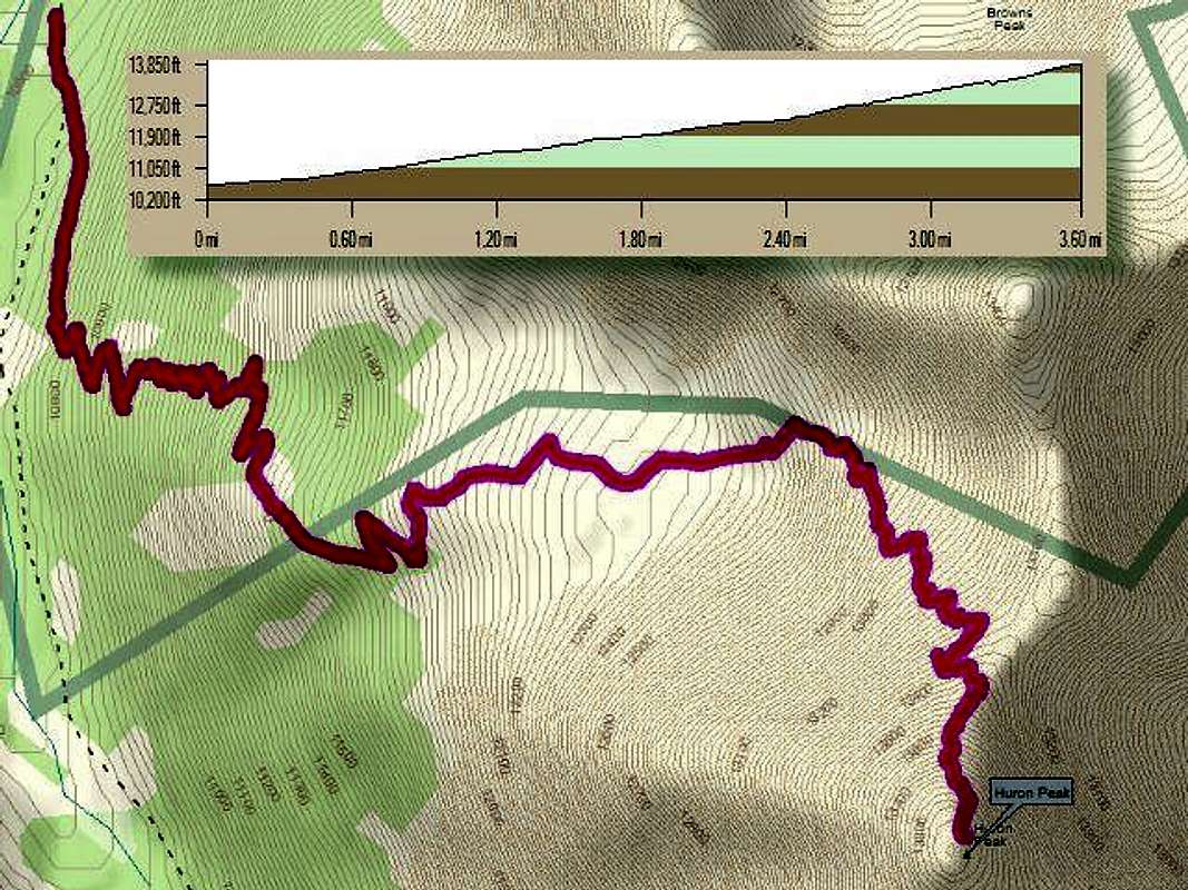
GPSDoes your GPS automatically make that track line or did you enter numerous waypoints? What program/software are you using to come up with this to superimpose your track on the map? Or is the map not YOUR actual track, but rather just the planned route? I have loaned out my Roach book, but I think I still have the Huron map at home. I will check it out tonight. Thanks!

dunking_deutschman - Oct 1, 2005 3:59 pm - Hasn't voted
3.5 miles?Wow, I was under the impression that is was 2.5 miles (or even less according to some sources) from traihead to summit. It did seem longer than that...
Please GPS Longs, I swear to you it is longer than 7.5 miles! : )
Viewing: 1-2 of 2


Comments
Post a Comment