
|
|
Route |
|---|---|
|
|
48.96980°N / 121.2406°W |
|
|
Scramble |
|
|
Half a day |
|
|
Class 3 with steep snow |
|
|
Overview
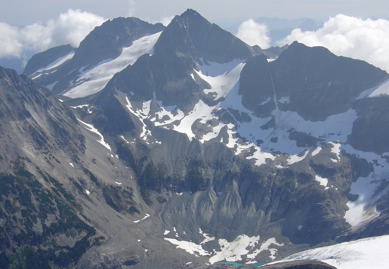
This is the least technical route from the Depot Creek side. It is basically only done from that side (the west side up from Ouzel Lake). This route can be used for the descent back to the lake after doing the Silver Glacier Route. The key is finding the correct notch in the ridgeline.See this picture for a good overview of the entire route.
Getting There
To get to Ouzel Lake (good camping), see the Depot Creek Approach on the Main Page. Apart from the drive to the trailhead, you will need 5-6 hours to get to the lake from the car. The lake is at an elevation of 5,700 ft and is generally snow-free in July.
Route to Notch
From the north end of the lake, climb NE up the obvious wide gully toward the Custer-Spickard saddle. You will not be going all the way to the saddle. Climb up this gully for about 1,000 vertical until a break in the gully wall on the right appears (approximately 6,700 ft but there is possibly another break lower). Turn south and SSE leaving the gully through the break and hike across heather benches toward the toe of the small glacier/snowfield in Spickard's western cirque. Cross through a slabby area with streamcourse. Stay to the right side of the basin toward the rockwall below Solitude Peak's 8,160+ ft northern crag. A steep snow swale climbs up and east below this crag to the 8,000-ft notch. This notch is about 1.2 miles of climbing from the lake. |
Notch to Summit
Turn left at the notch and begin climbing toward the summit. You will probably need to swing out on the south slope at times to avoid minor cliffs. Albeit, some can be climbed through. From the notch it is not at all evident where or how far the summit is. My friend Sergio Verdina reported exasperation at cresting a rise thinking he was nearly there only to see he wasn't. The ridge goes on longer than one might think given the short distance on the map from notch to summit.The rock is bouldery and loose in places but not really all that difficult. Class 3 max. The crux will probably be the steep snow swale leading up to the notch. Take ice axe and aluminum crampons for this.
Essential Gear
For this route a rope will probably not be necessary. Although, it is possible a moat could form on exit to the notch. It probably won't be a problem.However, lightweight crampons and an ice axe are mandatory year-round.