Comments
No comments posted yet.
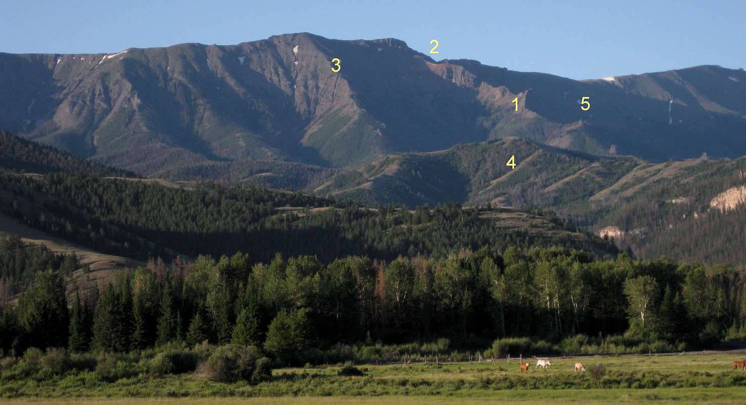
This view is from the road through Sunlight Basin. After reading the key, please click on this picture or click on "Orig" to view it in better detail.
In August 2011, I ascended via the spur with the 1, 2, and 5 marked on it.
1. At this point, to avoid the big cliff, I traversed to the left, which involved a lot of loose, steep sidehilling and a lot of Class 3 scrambling on very slippery, loose terrain.
2. Ultimately, I worked my way to and above the snowbank seen below the number. Then I crossed the ridge and found a sheep trail that led me most of the way to a final steep scramble to gain the main ridge above. From there, I headed south (right as in this view) to reach Dead Indian Peak.
3. The spur I descended in August 2011. Up high, it is easy going and free of the kinds of obstacles I faced on the ascent spur. However, the spur ends before it reaches Gravelbar Creek, and then there is a steep, dense bushwhack for about 1.5 mi. Not recommended.
4. Gravelbar Creek is behind this ridge.
5. A tricky section of pinnacles and outcrops (below the number). I was able to find a Class 4/5 chimney getting me down to the other side. My climbing partner traversed left and below, having to lose and regain a notable amount of elevation. Returning, he found that bypassing on the other side (right as in this view) is better.
Absaroka Range, WY-- August 2011


