-
 24723 Hits
-
 74.92% Score
-
 5 Votes
|
|
Route |
|---|---|
|
|
45.88989°N / 114.29685°W |
|
|
Hiking, Mixed, Scrambling, Skiing |
|
|
Spring, Summer, Fall, Winter |
|
|
Most of a day |
|
|
Moderate - Class 1 and 2 |
|
|
Overview
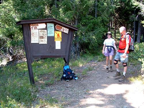
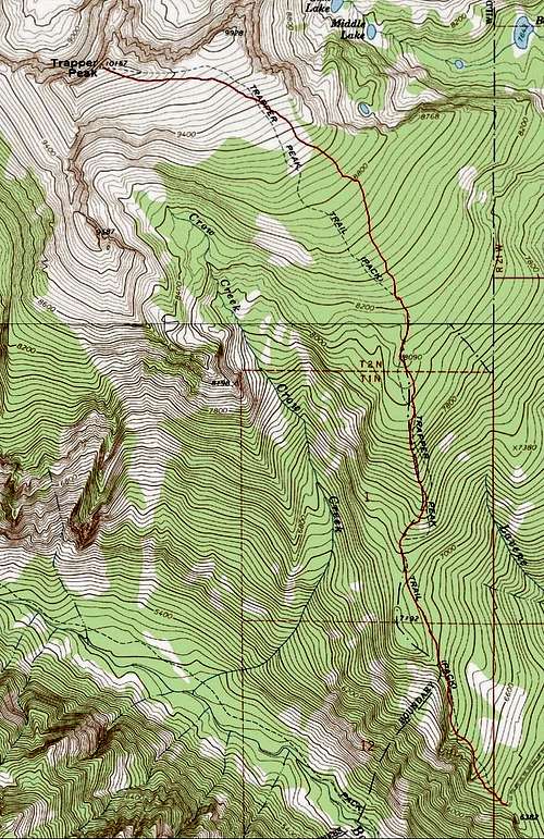
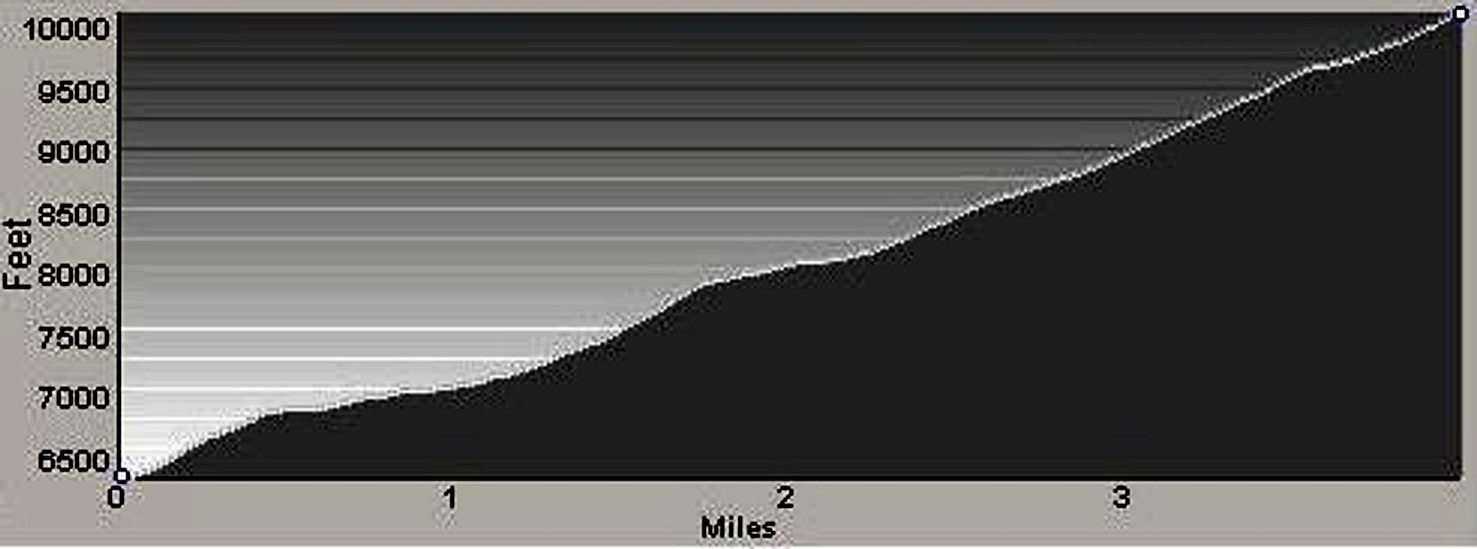
Route Type – Hike Class Level – Class 2 Elevation – 10,157’ Elevation Gain – 3,794’ Distance – 4.2 miles (one way) Length of time required to complete route – one day Trapper Peak, owning the highest summit in the Bitterroot Mountains, is often climbed by peak baggers. Reaching the summit using this, the Standard Route (trail 133), is very straight forward and not difficult - a Class 2 hike - and most who make the attempt, succeed. The wind-swept plateau near the summit is also visited by hardy backcountry skiers who wish to experience high-altitude skiing far from the crowds. Reaching this area is certainly more difficult when winter conditions exist, but according to those who have done it, well worth the effort. Getting ThereTrapper Peak's Standard TrailheadContinue on the West Fork Road to a point just past the 11 mile marker then turn right (north) onto FR 5630-A at Laverne Creek. There is a sign at the turnoff for Trapper Peak Trailhead. In about .6 mile, stay left at the first junction (signed) as you continue on switchbacks for 6.5 miles to the signed trailhead (trail 133). There are no restroom facilities, but there are spaces for parking several vehicles. Trapper's summit is up the trail about 4.2 miles and 3,800' of gain away. Route Description
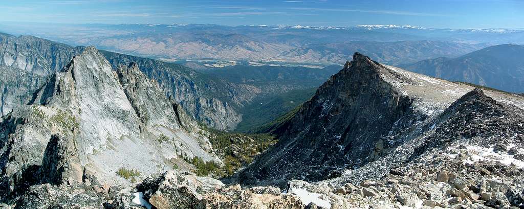
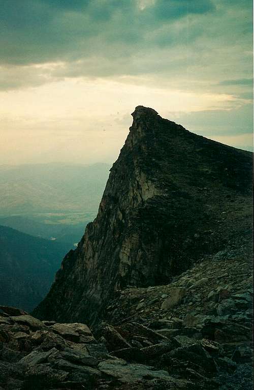
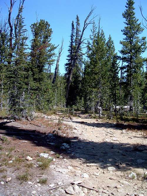
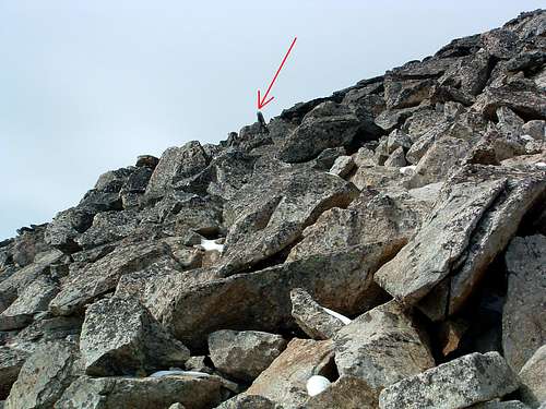
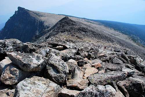
However it was during descent that many beginning hikers ran into problems by not being able to rediscover the path from the plateau which led back to the trailhead. Fortunately, over the past few years, a series of cairns has been built and one trail has become clear enough so that it can easily be followed back and forth between tree-line and the boulders just below and surrounding the summit. From the trailhead, hike north-northwest up the very clearly defined trail through the open forest. The trail stays fairly close to the crest of a long ridge as it proceeds toward Trapper's summit plateau. The land along the trail slopes gently down to the right (east) and more precipitously to the left (west) into Boulder Creek Canyon. In several places the trail is close enough to edge (on the left) that some excellent views back the Boulder Creek Drainage are available without leaving the trail. At around .4 miles from the trailhead (45.85103 N / 114.26851 W, 6,850' elevation), the track turns more directly to the north as it meanders left and right of due north for the next 2.5 miles. Near 8,800' (45.88306 N / 114.27655 N), the route turns to the northeast through the ever-thinning mixed forest of Whitebark Pine and Larch as it proceeds toward tree-line at 9,200'. Tree-line is about .75 mile from the summit. From tree-line to the base of the boulders near the summit the trail is quite clear (made so by the boots of many hikers) and well marked with cairns. Follow the track upward to the west-northwest and the saddle just west of Point 9928 (East Trapper). Just before reaching the actual saddle, follow the trail as it turns almost due west. As you proceed, there is a boulder pile which at first appears to be the summit. It is not! To keep your wanderings to a minimum and lessen the amount of up and down climbing required to reach the summit, do the following. Once you're close to the boulder pile, begin looking for, what I call "a signpost rock" part way up the left (south) side of the pile. (Stay on the existing track as you look for it. It’s visible from a long distance away.) Then, as the trail "on the ground" grows more indistinct (and a bit braided) near the base of the boulders, head directly for the signpost rock. This line is almost directly toward the summit and much shorter than if you try to follow scattered cairns which have been placed on the boulders. (Following those cairns will take you too far right and cause you to climb directly over the top of the pile - totally unnecessary.) Once you’ve reached the signpost rock, the summit is easily visible. Pick your own line forward, down a bit, then up the last pile of talus and boulders, and onto the summit. Essential GearSturdy footwear, to help support your ankles as you cross the talus and boulders just below the summit, is a good idea.There is no water available along the route, so be sure to carry plenty of liquid, especially on those hot summer days, when it can get scorching hot above tree line. When To GoThe summit of Trapper Peak is visited during every month of the year, though it happens most often when there is little or no snow on the ground.Any time there is snow on the road to the trailhead, this route will be lengthened considerably. That doesn't mean it's not doable, just that it will require more time and energy to reach and return from the summit. Route StatisticsAdditional Pictures
|


